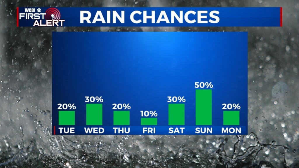
Mainly dry week with several shots of cold air
COLUMBUS, Mississippi (WCBI) – Monday will likely be the warmest day of the next seven. Multiple cold fronts are slated to bring more cold air in the next week.
MONDAY: Mostly sunny and mild with highs in the upper 50s to potentially lower 60s. High clouds will stream in late in the day, but overall a pleasant start to the week is expected.
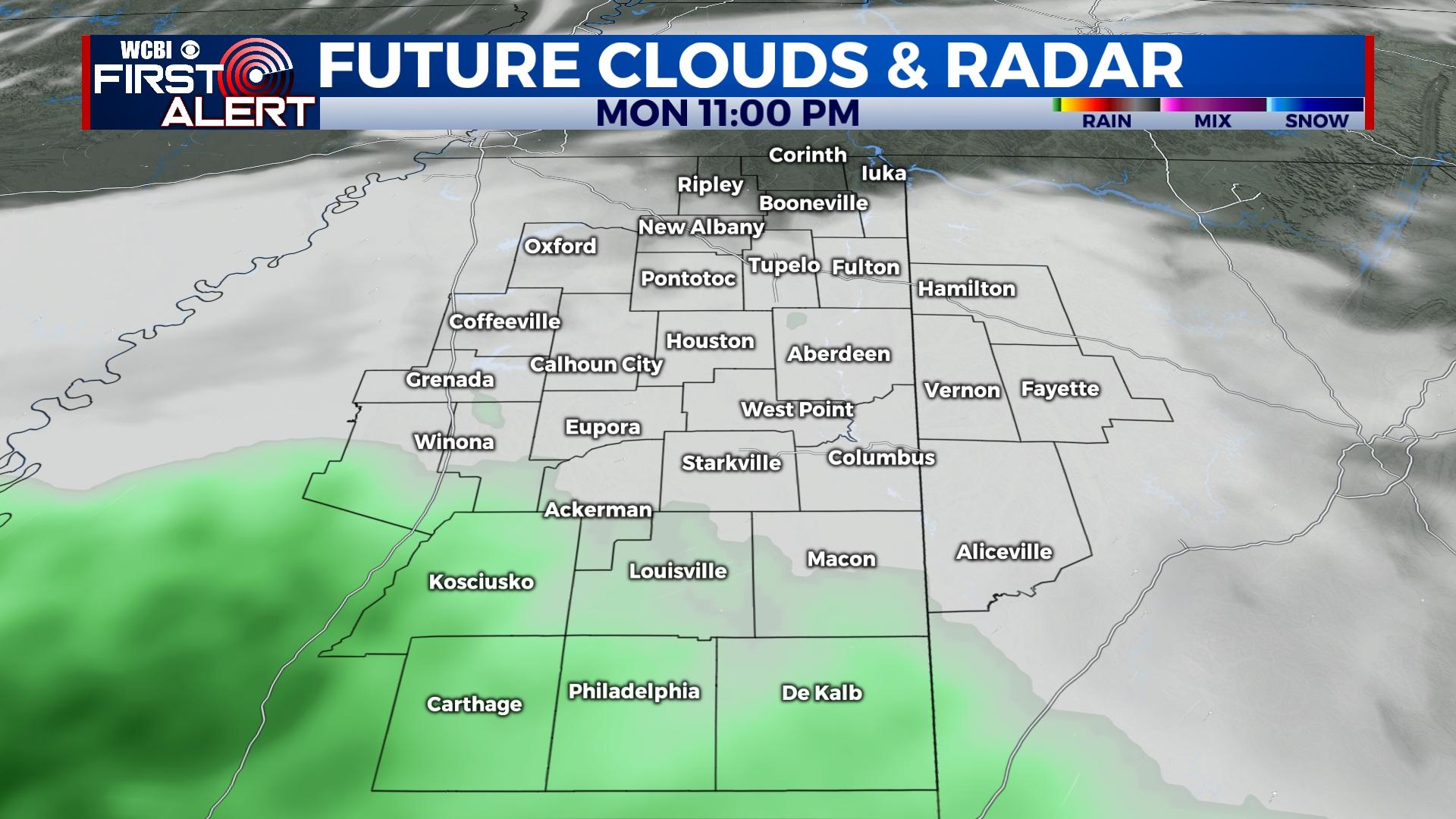
MONDAY NIGHT: Clouds will continue to thicken up as a disturbance approaches from the southwest. The track of this system is largely south of the region, so most of the rain will be confined to the Gulf Coast. Still, a few showers could move as far north as US 82 overnight, but most places stay dry.
TUESDAY: As Monday night’s system moves east and away, colder air once again returns to the Twin States. Highs may reach the upper 40s, but increasingly northerly winds behind a cold front will quickly bring temperatures down in the evening. Overnight lows will drop into the 20s.
MIDWEEK: Another brief warm-up is expected through Thursday before another front brings more cold air to the end the week. At this time, this front should not bring any rain as well.
WEEKEND: Similar to this past weekend, expect very cold mornings but sunny, tolerable days in the afternoon.


Leave a Reply