Mid-week recovery before end of week rain
COLUMBUS, Mississippi (WCBI) – Nice conditions continue for the the middle of the week. The last few days of the work week will have extra moisture, cloud coverage, and chance for rain. Nice weekend after though!
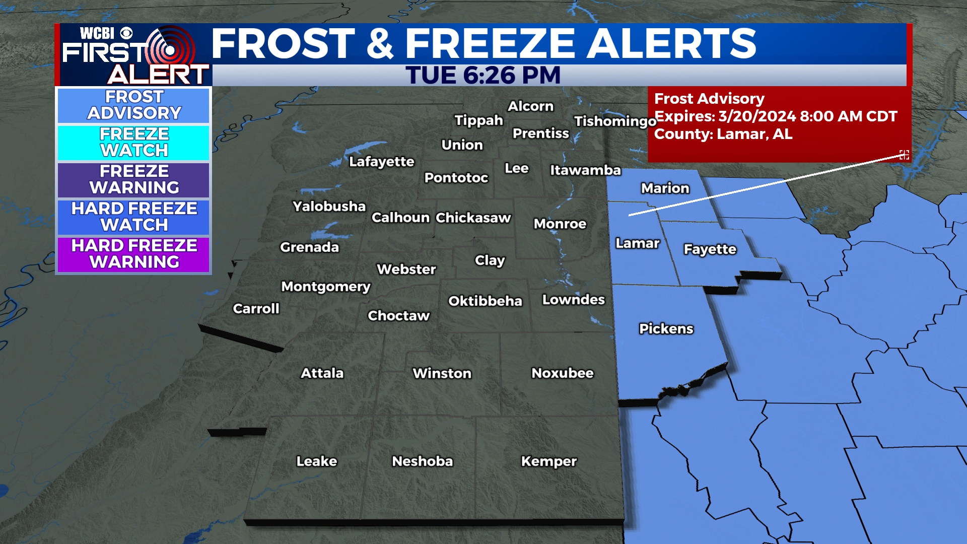
TUESDAY NIGHT: Mostly clear sky and chilly temperatures, as lows tonight fall into the middle 30s. Patchy frost is possible, but another freeze is not currently expected. Kind of cold for our first night of Spring.
**Lamar and Pickens Counties continue under a Frost Advisory until 8am Wednesday morning. **
WEDNESDAY: Spring has arrived! The winds will continue shifting, coming in from the SW. This will allow for extra moisture to fill in with cloud coverage by Wednesday afternoon. High temperatures will be back in the lower 70s. Low temperatures overnight will continue being chilly, in the middle 40s.
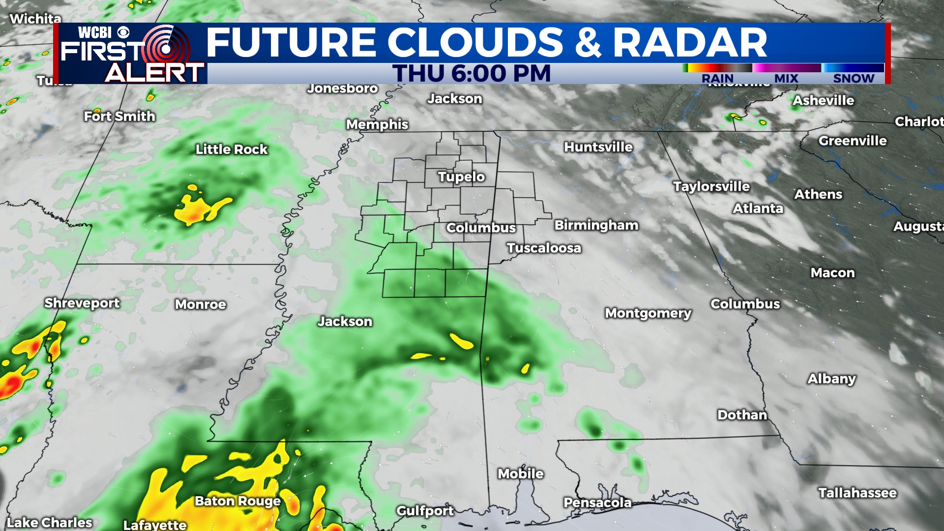
THURS/FRI: Clouds become more widespread Thursday, ahead of an area of low pressure sliding across the Gulf Coast. A few showers are possible Thursday afternoon and evening, but slightly better rain chances exist on Friday. We still expect the heaviest, most consistent rains to stay closer to the coast…but we’ll monitor any northward trends!