Mild and dry week ends with rapid warmup to start next
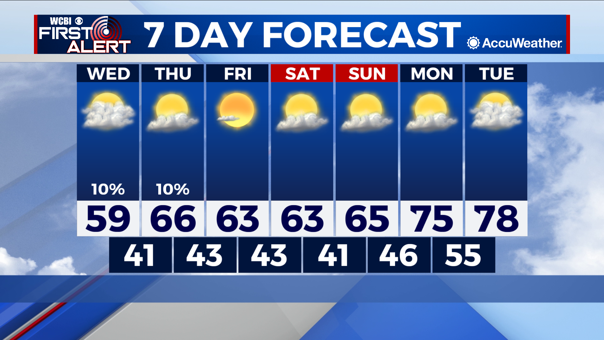
COLUMBUS – SUMMARY: Tuesday’s cold front leaves us with cooler temperatures than have been typical over the past few days. Highs start out close to 60, but end up in the upper 70s by the beginning of next week. Lows follow a slightly different path and remain in the 40s throughout much of the next 7 days. No major rain chances are expected over the next week.
WEDNESDAY: The coolest day of the week, Wednesday offers up highs close to and potentially breaking 60. Lows will sit in the low 40s for what will be a cool night outside. Rain chances take a drastic dip, with only the possibility for a few isolated showers.
THURSDAY: Some slight temperature improvement is seen Thursday with highs in the upper 60s in the afternoon. Lows do not make as great of a jump and remain in the lower 40s. The chance for the odd shower is present once again, but also presents the last rain chance of any kind for the rest of the week.
REST OF THE WEEK: Highs will hover around the mid to low 60s range throughout the rest of the week, before a rapid warmup into the upper 70s occurs early next week. Lows will similarly hover in the low 40s, before warming up into the mid 50s early next week. Rain chances remain non-existent throughout the rest of the week to this point.