Mild & stormy pattern
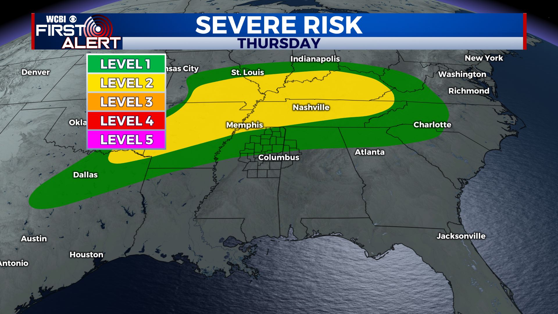
SUMMARY: Daily chances of showers and storms continue for at least the next week. A few more strong to severe storms may occur Thursday evening/night. Above average temperatures look to continue for the most part through next week.
WEDNESDAY NIGHT: Partly to mostly cloudy with lingering showers and storms possible. Lows near 60.
THURSDAY: A few early day showers may occur with clearing skies during the afternoon. Look for highs well into the 70s and some spots could get into the low 80s. Winds SW 10-15 mph.

THURSDAY NIGHT: Mostly cloudy. Areas of showers and storms are likely. Some strong to severe storms are possible. Wind and hail would be the primary threats once again if storms manage to stay strong as the enter north MS. Lows near 60.
FRIDAY: Mostly cloudy with areas of rain or showers. Highs in the mid 60s.
SATURDAY: Variably cloudy with a chance of a few storms. Highs in the mid 70s.
SUNDAY: Mostly cloudy with rain and showers likely. Highs in the low 70s.
NEXT WEEK: Daily opportunities for rain and storms. Highs in the mid to upper 70s. Lows around 60.
Follow @WCBIWEATHER on Facebook, Twitter, Instagram, and the WCBI News App


Leave a Reply