Mild temperatures hold steady despite midweek cold front
COLUMBUS – SUMMARY: Highs remain in the 60s throughout most of next week despite a cold front next Wednesday. Wednesday also provides our one big rain chance of the week. A cold front next Saturday returns us to normalcy.
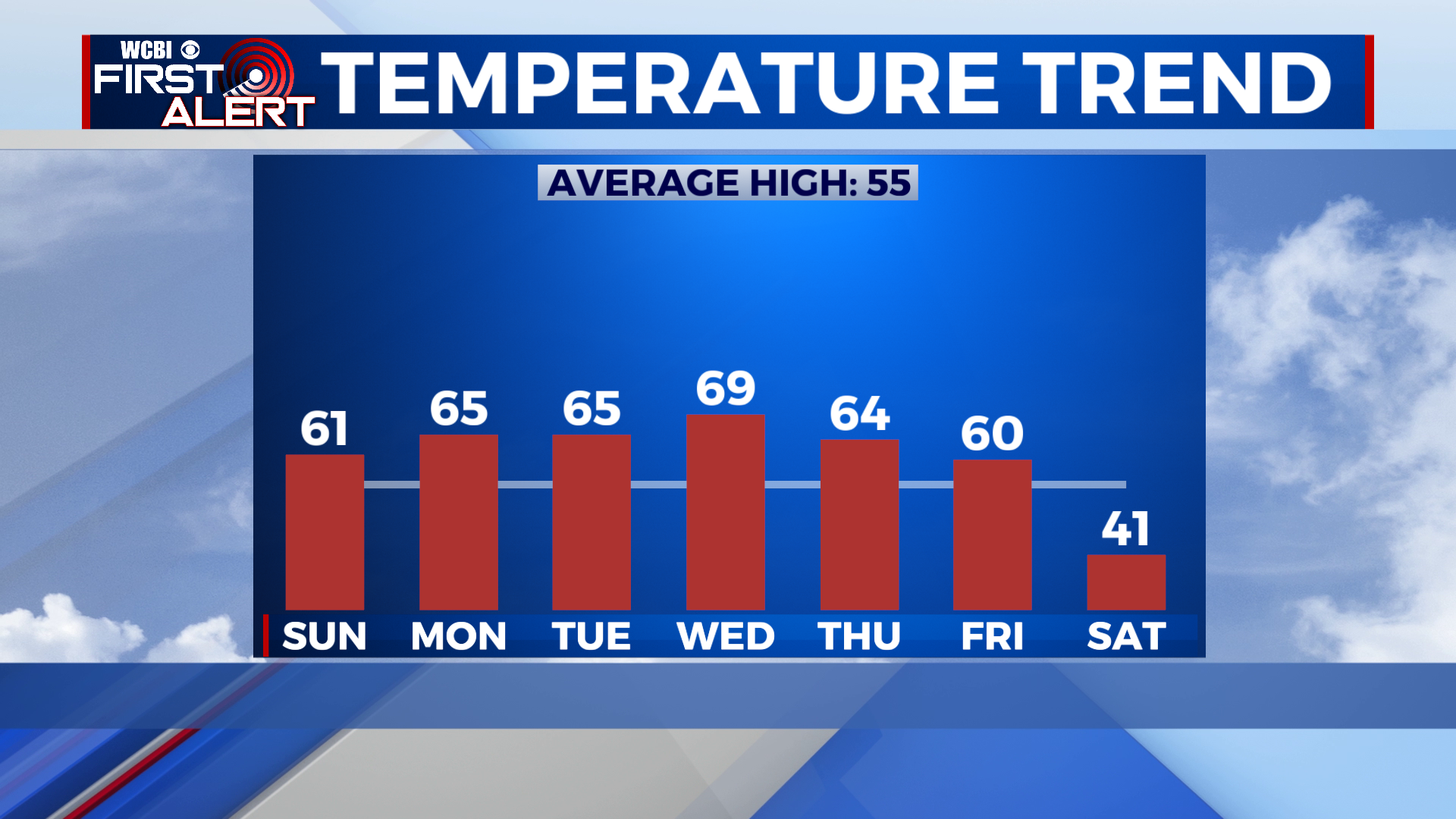
SUNDAY: Highs top out in the low 60s as a mix of sun and clouds prevails across the region. Lows bottom out around 40 overnight. No rain is expected Sunday.
NEXT WEEK: Afternoon temperatures will slowly climb into the upper 60s by Wednesday afternoon, amid high pressure generated by a broad ridge across the eastern United States. Lows will fluctuate between the 40s and 50s throughout much of the week. A weak cold front overnight Wednesday will bring rain and storms back to the region as the week’s only rain chance. The cooling effect of the front will remain minimal however as highs remain into the 60s until next Saturday. A much stronger cold front Saturday finally takes us down a notch by putting highs in the 40s and lows in the 30s.


