Monday Night Snow Possible, Sunny Tuesday
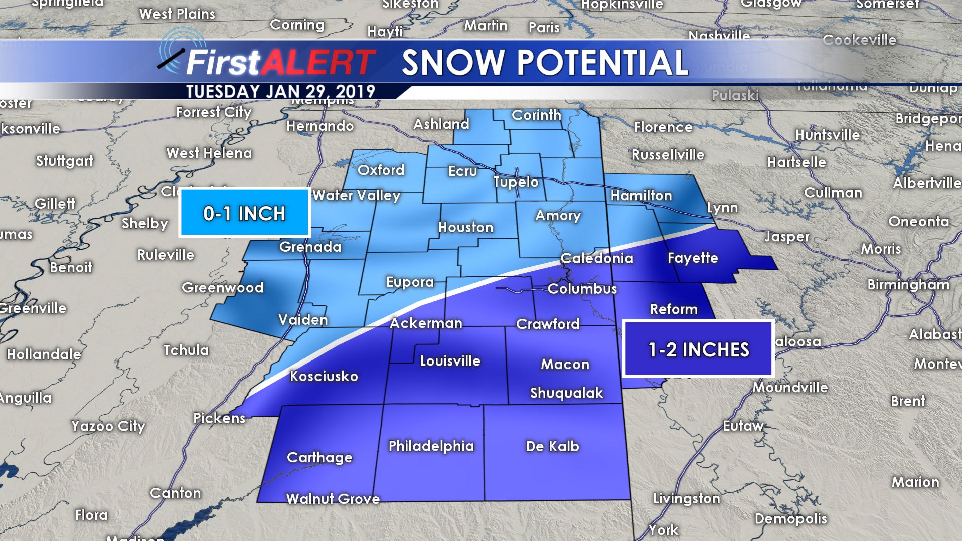
MONDAY NIGHT: Rain will develop and switch to snow from NW to SE. The best chance of over 1″ now look to be from the Golden Triangle area and to the south and east. Lighter amounts are possible farther north and west. Temperatures are going to fall below freezing by sunrise and that could lead to some icy spots, especially on elevated surfaces like bridges. Winds pick up from the NW between 10 and 20 mph. Wind chill values will plummet into the 20s and 10s.
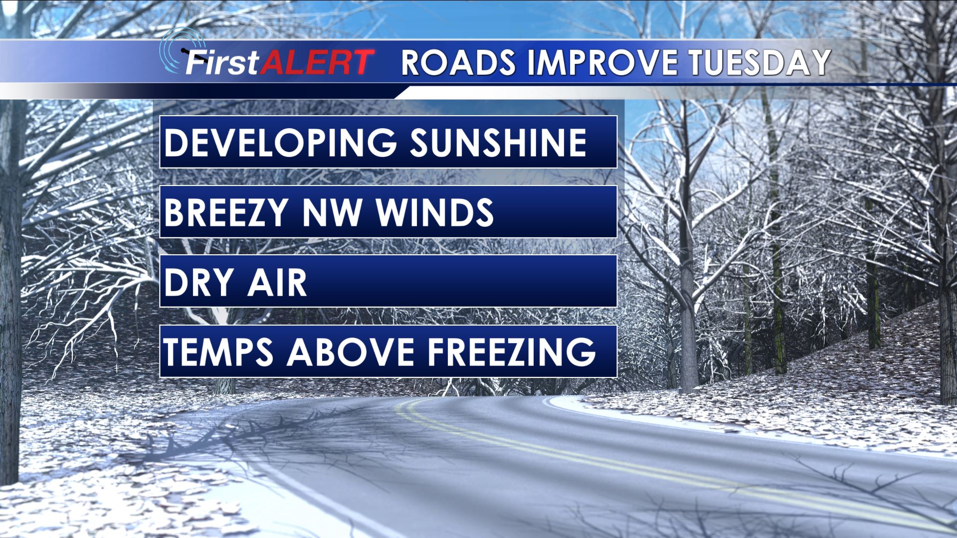
TUESDAY: The precipitation is expected to be done by 7 a.m. with clouds rapidly clearing thereafter. It may take until noon to get air temperatures back above freezing but it is likely that we’ll all get above freezing during the day. We do expect highs in the 30s but blustery NW winds between 10 and 20 mph will keep the wind chill in the 20s and 10s all day long. The combination of sunshine, dry air, breezy winds, and temperatures a little bit above freezing is expected to remove a lot of the moisture off the roads during the course of the day.
TUESDAY NIGHT: Variably cloudy and cold. Any lingering moisture will ice up so just be careful if you encounter any if you’ll be out and about but issues should be rather isolated. Lows around 20.
WEDNESDAY: Lots of sunshine mixed with some clouds. Highs the 30s to lower 40s. Lows Wednesday night will be in the 20s.
THURSDAY: A mix of sun and clouds with highs getting up to around 50.
FRIDAY-SATURDAY: Partly to mostly cloudy with a slight chance of a few showers. We’re keeping the rain chance to 20% right now. Highs look to be in the mid to upper 50s.
SUNDAY-MONDAY: Partly to mostly cloudy skies look to continue. The chance of showers will continue as well. Highs moderate back into the 60s.


Leave a Reply