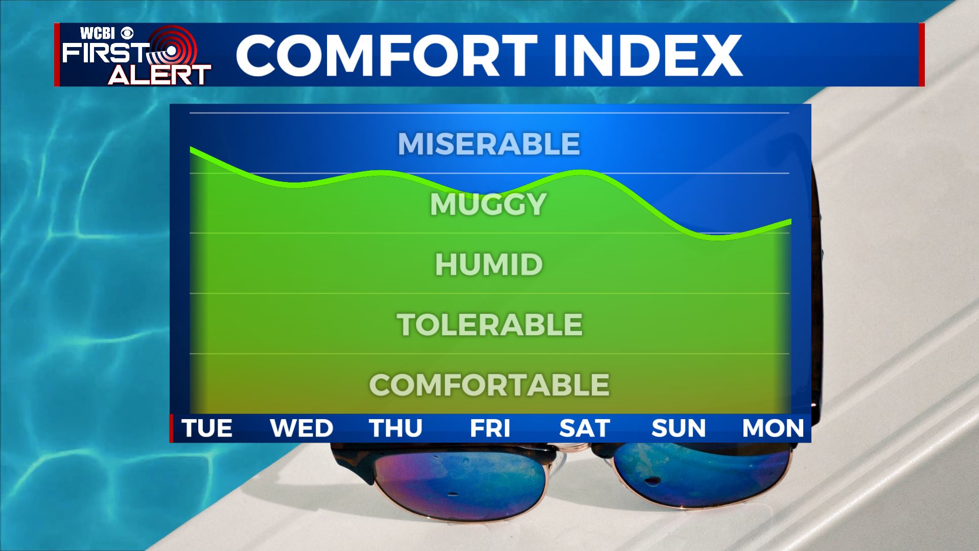
The month of June ending on a muggy note
SUMMARY: Staying very much like summer with the muggy conditions and daily pop-up afternoon storms as we end the month of June this Tuesday and head into July. Heat indices will make it feel like near 100 degrees at times during the day thanks to the hot & humid conditions with highs in the 90s. There will also be scattered afternoon storms. No major weather systems are expected but any storm this time of year may have some gusty winds, heavy rain, lightning and some small hail.
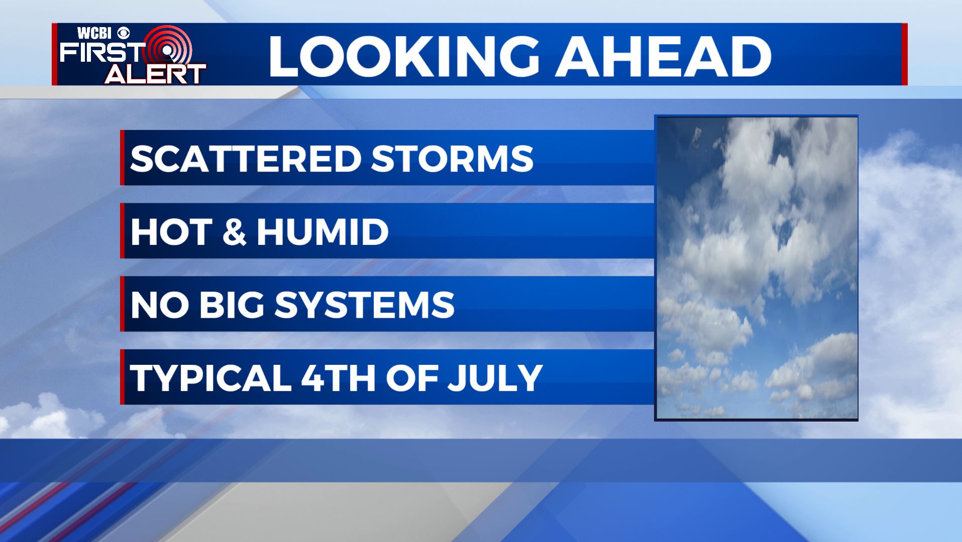
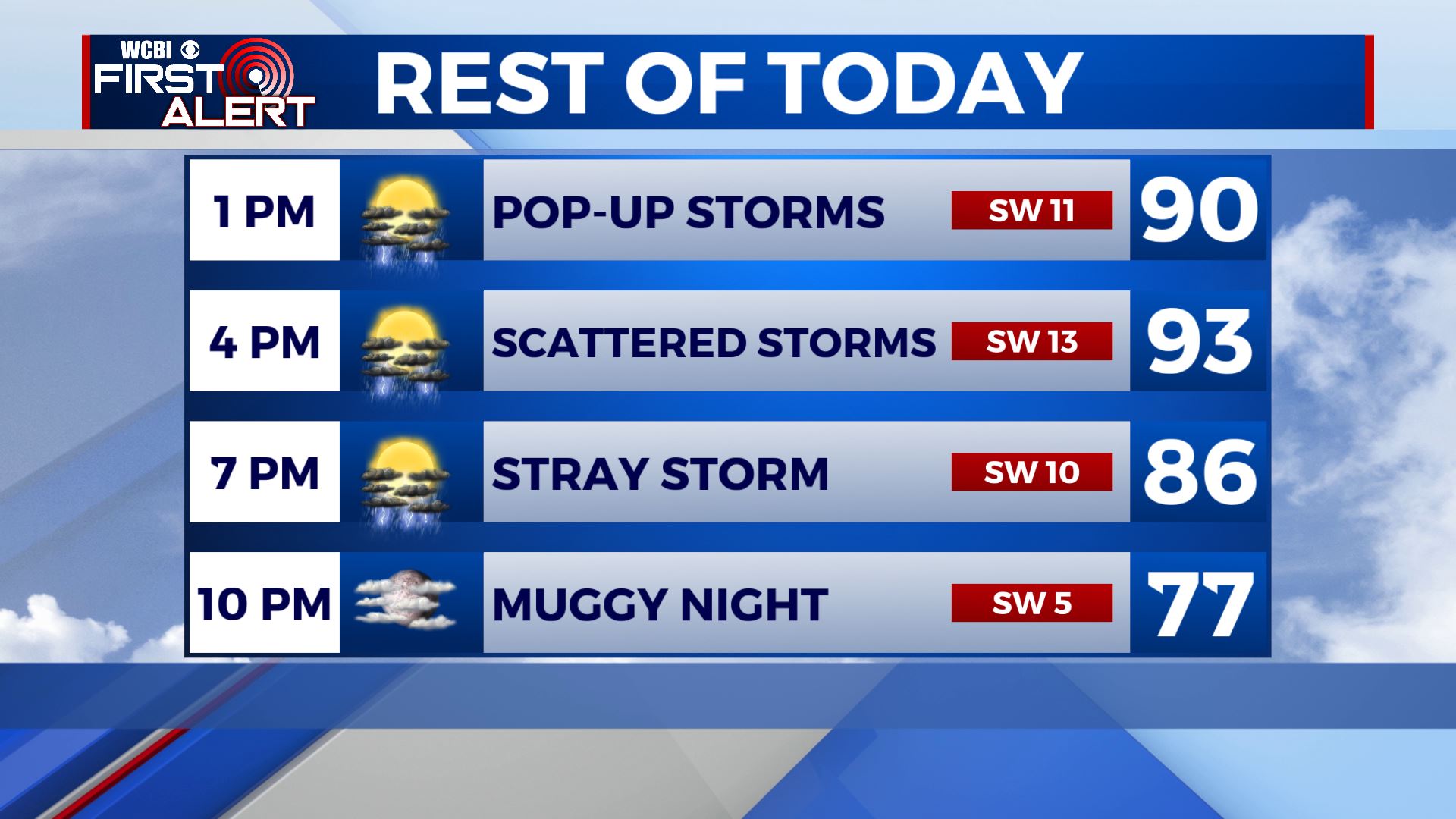
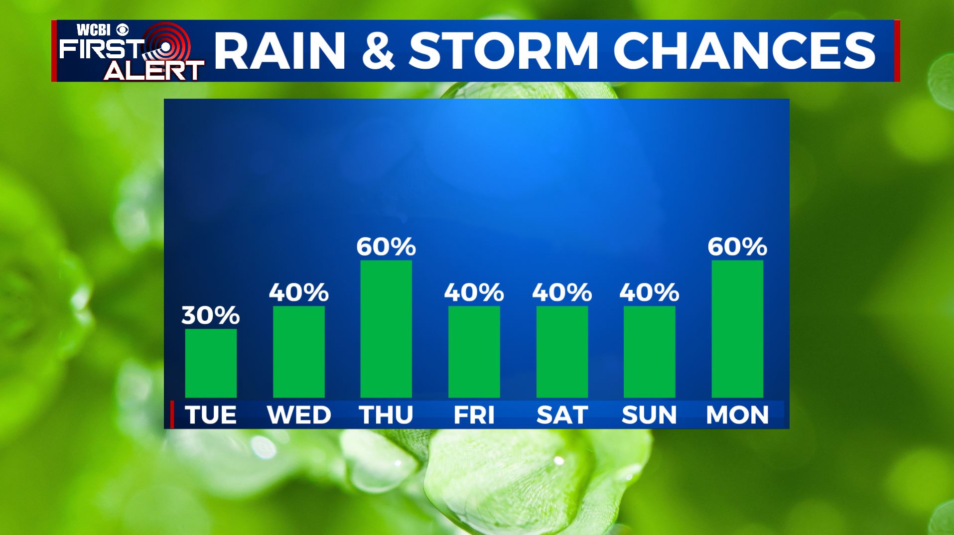
TUESDAY: We’re waking up to a few stray showers this Tuesday morning. We’ll have another day of hot & humid conditions followed by afternoon pop-up scattered showers & storms. Highs in the lower 90s with SW winds at 10-15 mph.
TUESDAY NIGHT: Showers & storms should come to an end once the sun sets early evening. Partly cloudy skies. Overnight lows will be in the mid 70s.
WEDNESDAY-THURSDAY: Staying hot and humid. Highs remaining in the lower 90s with heat indices making it feel like the lower 100s at times. Better chances of showers and storms for the second half of the week, so keep the umbrella nearby. Some storms could produce small hail or gusty winds, but widespread severe weather is not expected. Overnight lows in the low 70s.
FRIDAY-SUNDAY: The long Fourth of July holiday weekend looks to feature typical summertime weather. Highs stay in the low to mid 90s with lows in the low 70s. Chances of a pop-up shower or storm in the afternoon hours, but not looking to be a complete washout so any outdoor weekend plans will be a go. But you may want to have a backup indoor plan just in case.
Stay connected with @WCBIWEATHER on Facebook, Twitter, Instagram, and the WCBI News App


Leave a Reply