Mostly Cloudy Friday, Cold Front Arrives Saturday
COLUMBUS, Mississippi (WCBI) – Rain and storms are in the forecast for the next two days. After that, we’ll enter a drier and more comfortable weather pattern.
TONIGHT: Broken cloud cover with a few showers lingering overnight. Chance of rain: 20%. Lows in the mid-60s.
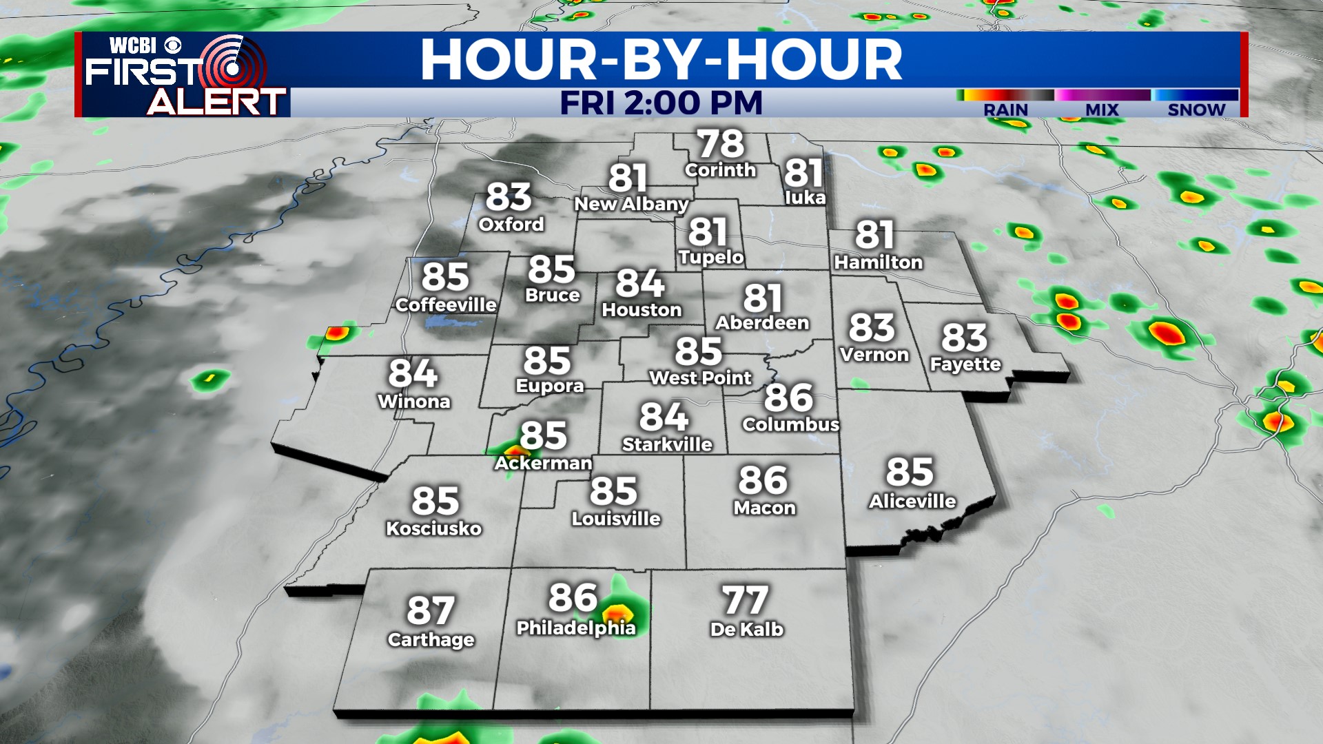
FRIDAY: Skies become cloudy as our next front approaches from the west. Highs will range from the low-to-mid 80s, depending on how much sun you get. A random shower or storm may develop in the afternoon, but overall, rainfall coverage will be less than the past couple of days. The cloud cover is going to help keep us more stable. Chance of rain: 20%.
FRIDAY NIGHT: Lows in the mid-to-upper 60s once again. The cold front will begin to move through Mississippi overnight, so showers and storms are likely Friday night ahead of the front. Chance of rain: 50%.
THIS WEEKEND: Rain and possibly a few thunderstorms will move through Saturday morning. Chance of rain: 50%. Once the front clears our area, rain and storms will begin to move out. Saturday afternoon looks mainly dry but cloudy. Humidity begins to drop on Sunday.
NEXT WEEK: Less-humid! Drier air will be in place, so we aren’t expecting much rain. Temperatures stay right around average for this time of year, in the low-to-mid 80s. A lot of sunshine, too!


