Mostly Dry Thursday, Then Storm Chance Friday
COLUMBUS, Mississippi (WCBI) – One more day of mostly dry weather, then storm chances return on Friday. A break from the heat is coming, too!
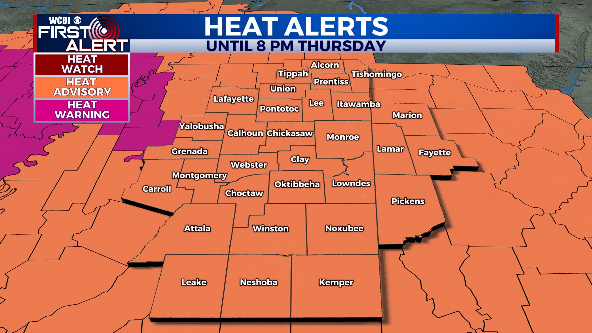
THURSDAY: Very hot with a mix of sun and clouds. A Heat Advisory is in effect until 8pm. High near 96°. Heat index values will range between 100 and 110°! Most of us will be dry today, but an isolated shower or storm may clip extreme northeastern Mississippi later this afternoon/evening.
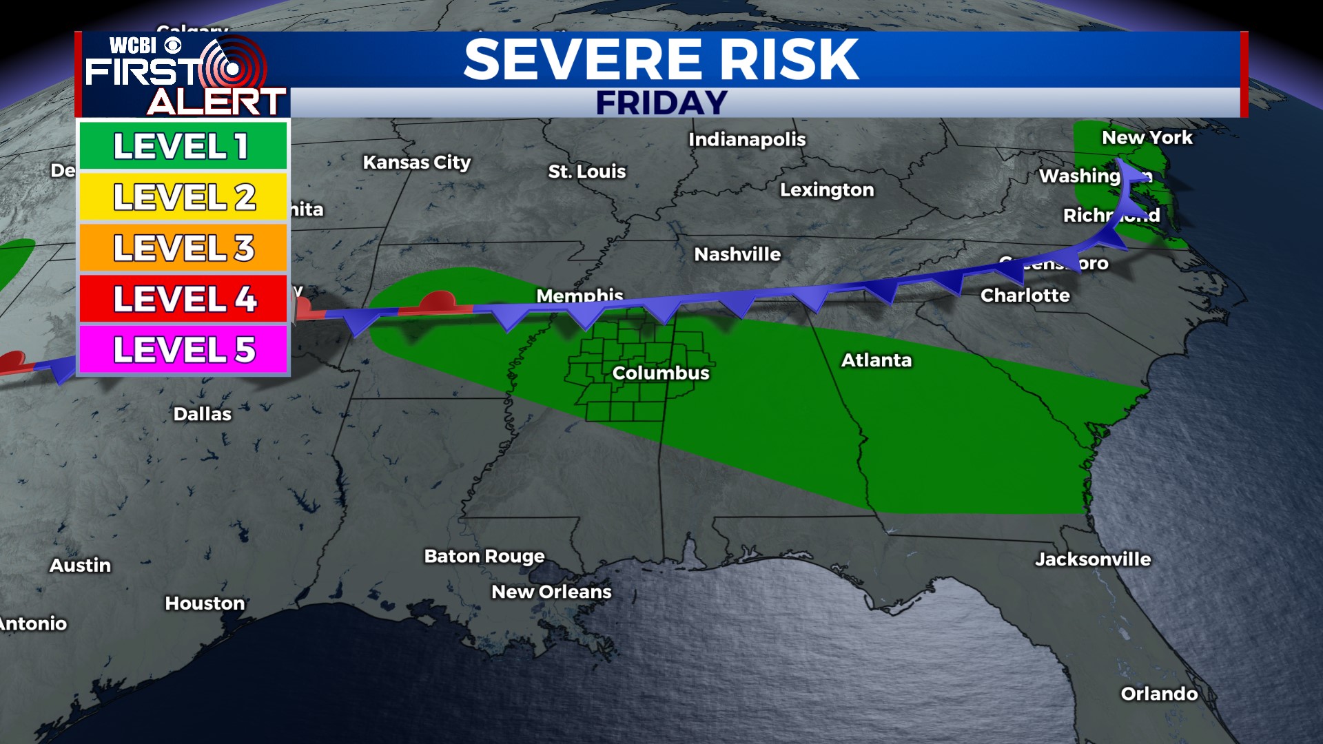
FRIDAY: Still hot, but with extra clouds and scattered storms as a front moves in from the north. High near 94°. There will be plenty of storm fuel and increased flow in the low to mid levels of the atmosphere, so a few storms could become strong to severe with damaging wind gusts. For now, the entire area is in a level 1 risk. Stay alert Friday afternoon and evening for some gusty storms, and we’ll keep you posted!
THIS WEEKEND: As the front moves through, scattered showers and storms are expected again on Saturday. It won’t rain all day, and not all of us will get a storm. Clouds, rain, and the front will keep temperatures well below average on Saturday. Highs are only forecast to reach the mid- to upper 80s! Behind the front, Sunday will be slightly less humid and pleasant. Expect lots of sunshine and a high around 90°.


