Near record heat continues, storms by Monday
COLUMBUS, Mississippi (WCBI) – Tupelo broke its daily record high temperature Thursday. More near record heat is in store for the weekend.
FRIDAY: Sunshine continues today, but high clouds will thicken up late in the day. Daytime highs will once again top out near 80 degrees for most as southerly winds develop.
WEEKEND: Very warm weather continues to be the rule of the forecast. Highs each day will range from 78-83 degrees with a mix of sun and clouds. Saturday’s rain chances should be confined to areas along and west of I-55 into the Delta, while Sunday could bring a spotty shower anywhere in the region.
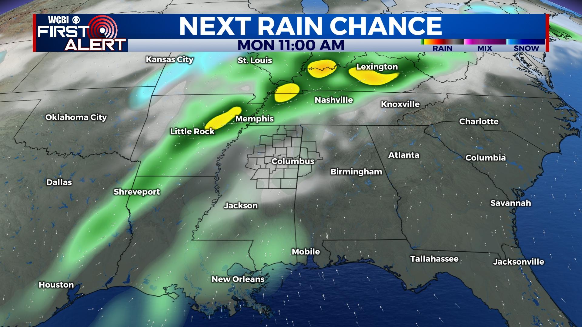
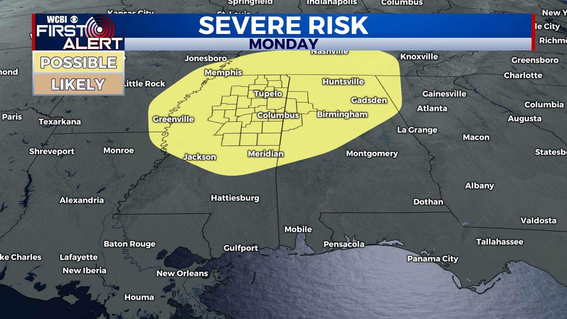
MONDAY: A strong front will move through the region, and showers and storms will accordingly become likely by afternoon. Sufficient shear, instability, and moisture still look to promote at least a small severe threat with this activity. The main threat looks to be damaging wind gusts with any organized storms.
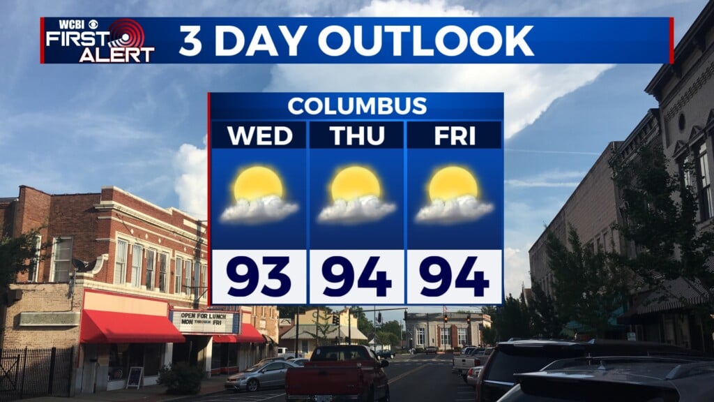
TUESDAY: Following Monday’s front, much cooler air will be moving into the region. Clouds may temporarily clear, but yet another system is set to move in for mid-week.
MID-WEEK: Forecast confidence continues to remain low due to forecast model inconsistency. However, signs are pointing to another area of low pressure moving through Wednesday and early Thursday. Should this pan out, additional rain is likely but severe concerns remain non-existent.


Leave a Reply