Nice but a bit warmer & humid for your Labor Day
SUMMARY: We’ve been enjoying really nice weather through the long holiday weekend. The humidity will be making a comeback through this week. All eyes will be on a cold front to see if it can push through and bring us slightly cooler air by next weekend.
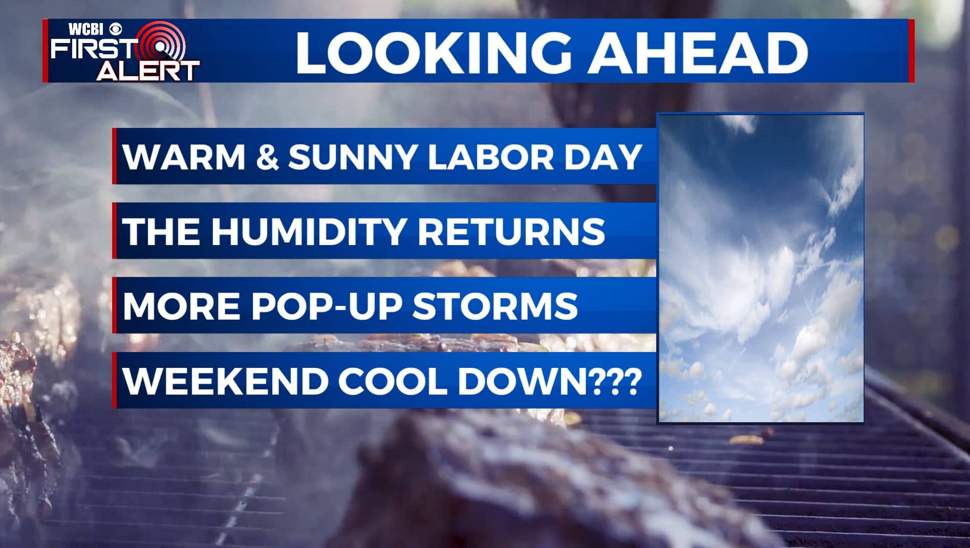
MONDAY: Our Labor Day Monday will once again feature tons of sunshine as we have all weekend long. The only difference is that we can expect slightly warmer temperatures & a bit of the humidity starting to creep back up. Highs will be in the lower 90s. SE light winds.
MONDAY NIGHT: Mostly clear skies and calm overnight. Lows in the 60s.
TUESDAY: A mix of sun clouds as we head back to work and school on Tuesday. There is a chance for an isolated shower or storm. Warm & humid once again with highs in the lower 90s.
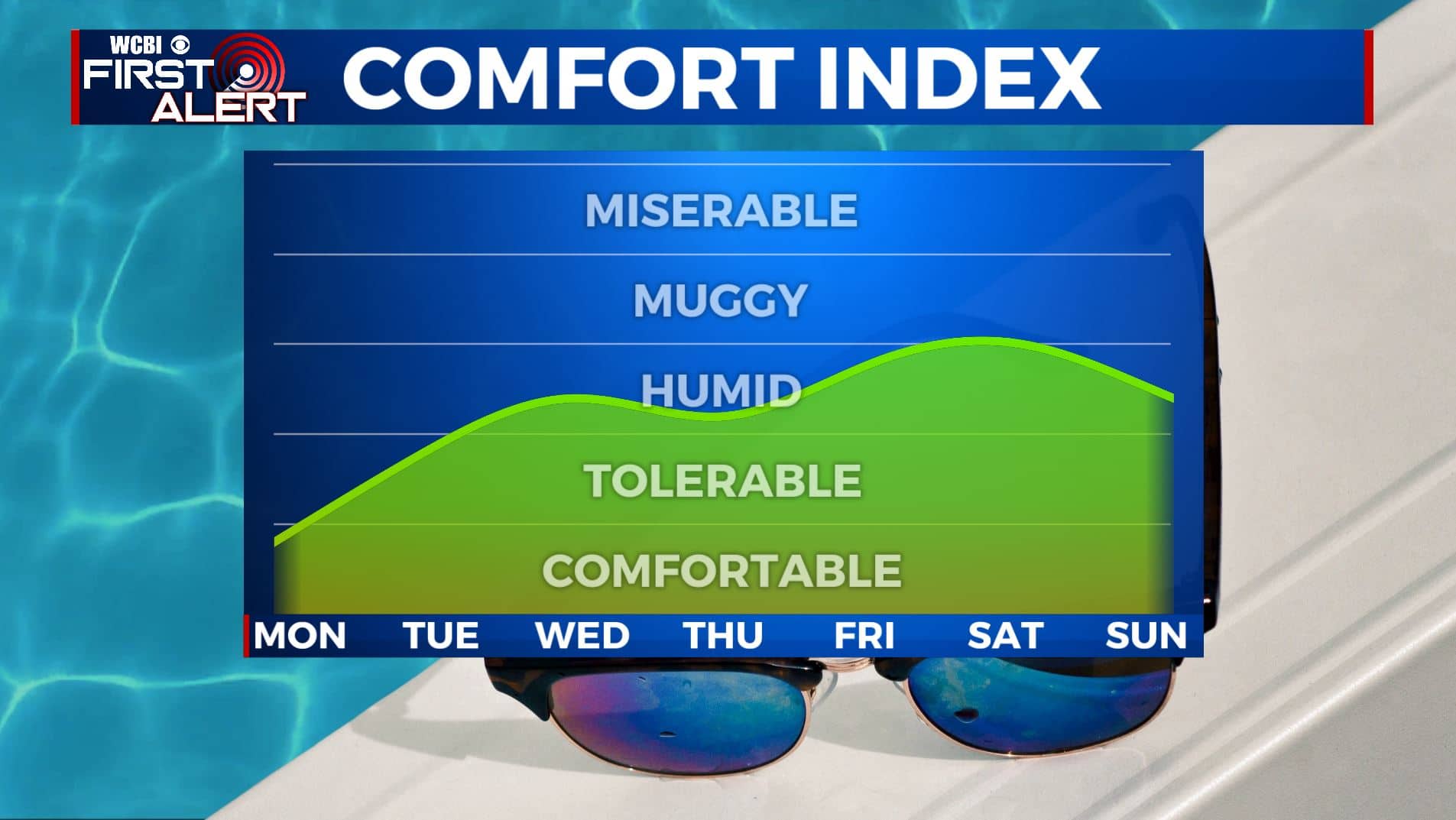
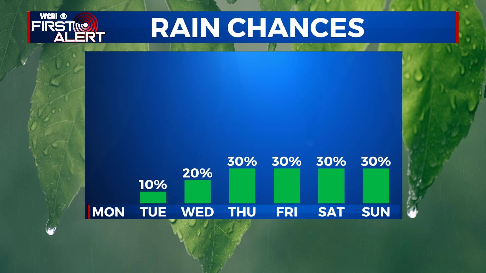
WEDNESDAY-FRIDAY: Chances for some showers and storms will increase for the second half of the workweek as a possible cold front approaches the area. Not everyone will see rain every day, but scattered chances are possible. Temperatures will top out in the upper 80s to near 90 with overnight lows in the 60s.
SATURDAY-SUNDAY: The forecast for the upcoming weekend remains up in the air as we aren’t really sure what this cold front is going to do. If it stays to our north and west, we’ll see showers and storms along with warmer temperatures. If it manages to make it through the area, we’ll see drier and cooler air filter in. For now, until things become a little more clear, we’re going to split it down the middle. We’ll go with highs in the mid 80s and overnight lows in the 60s, along with scattered chances of showers and storms. This forecast can and will change, so check back for updates!
Stay connected with @WCBIWEATHER on Facebook, Twitter, Instagram, and the WCBI News App


Leave a Reply