Nice Thursday; Rain chances returning to the forecast
SUMMARY: After a cold start with areas of frost, we’ll have the sunshine continue for our Thursday. Heavy rain and maybe some thundershowers are possible late Friday night and early Saturday morning. Temperatures will climb back above normal into the 70s and 80s early next week.
THURSDAY: A mix of sun and clouds with highs in the mid to upper 60s. Light SW winds.
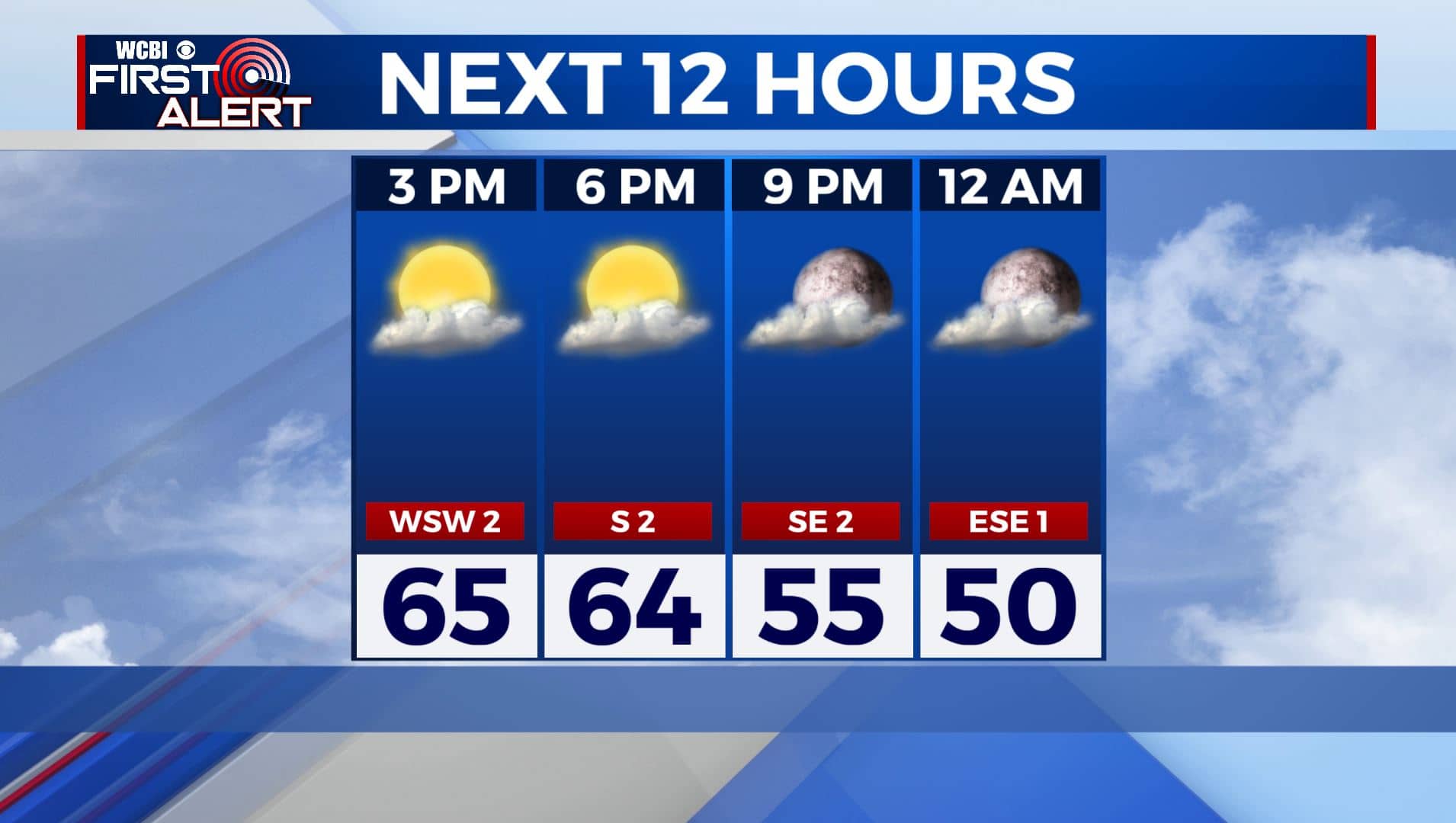
THURSDAY NIGHT: Clouds will start increasing. Overnight lows in the mid 40s.
FRIDAY: Mostly cloudy skies during the day. Highs in the mid to upper 60s.
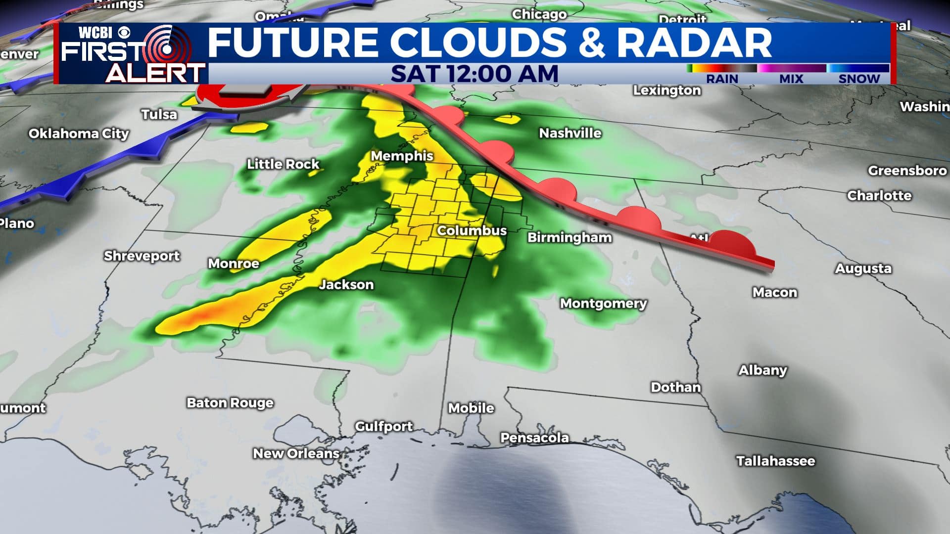
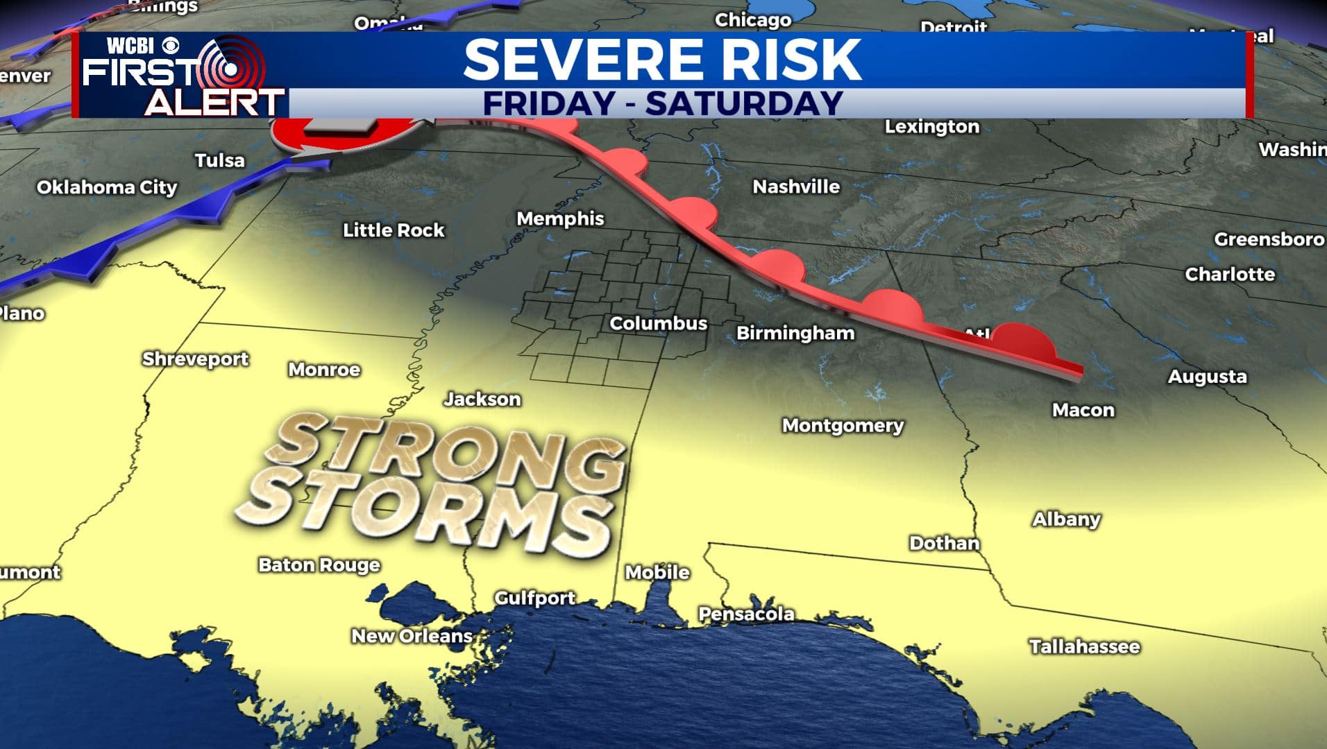
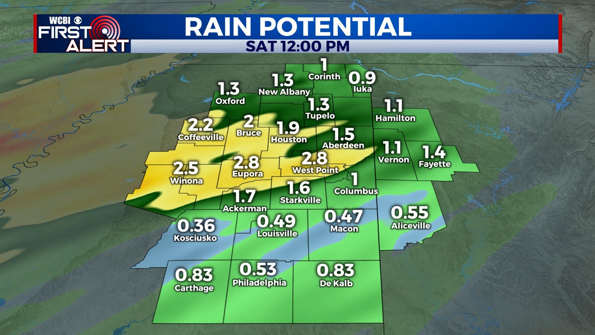
FRIDAY NIGHT-SATURDAY: Any showers will likely hold off until after sunset Friday night, but rain will become more steady and heavy overnight. This rain could last into early Saturday morning before gradually slacking off through the day. Some rain could be heavy with totals approaching 1-2+″ in some spots. However, it appears any severe weather will remain just to our south. Saturday morning lows will be in the mid 50s with afternoon highs in the mid 70s.
SUNDAY: Rain will exit by Saturday afternoon, leaving us dry for Sunday. We’ll see mostly sunny skies with highs in the mid 70s. Overnight lows in the upper 40s.
MONDAY: We’ll see mostly sunny skies with highs continuing to warm up to near 80 degrees. Overnight lows in the 50s.
TUESDAY: A mix of sun and clouds as temperatures continue to warm up into the lower 80s.
WEDNESDAY: Rain chances return to the forecast on Wednesday with highs in the upper 70s to lower 80s.
Stay connected with @WCBIWEATHER on Facebook, Twitter, Instagram, and the WCBI News App.


Leave a Reply