Nice weather to start the week, but severe storms loom on Wednesday
COLUMBUS, Mississippi (WCBI) – SUMMARY: We’ll enjoy beautiful weather to start the week, but severe storms look to interrupt things on Wednesday.
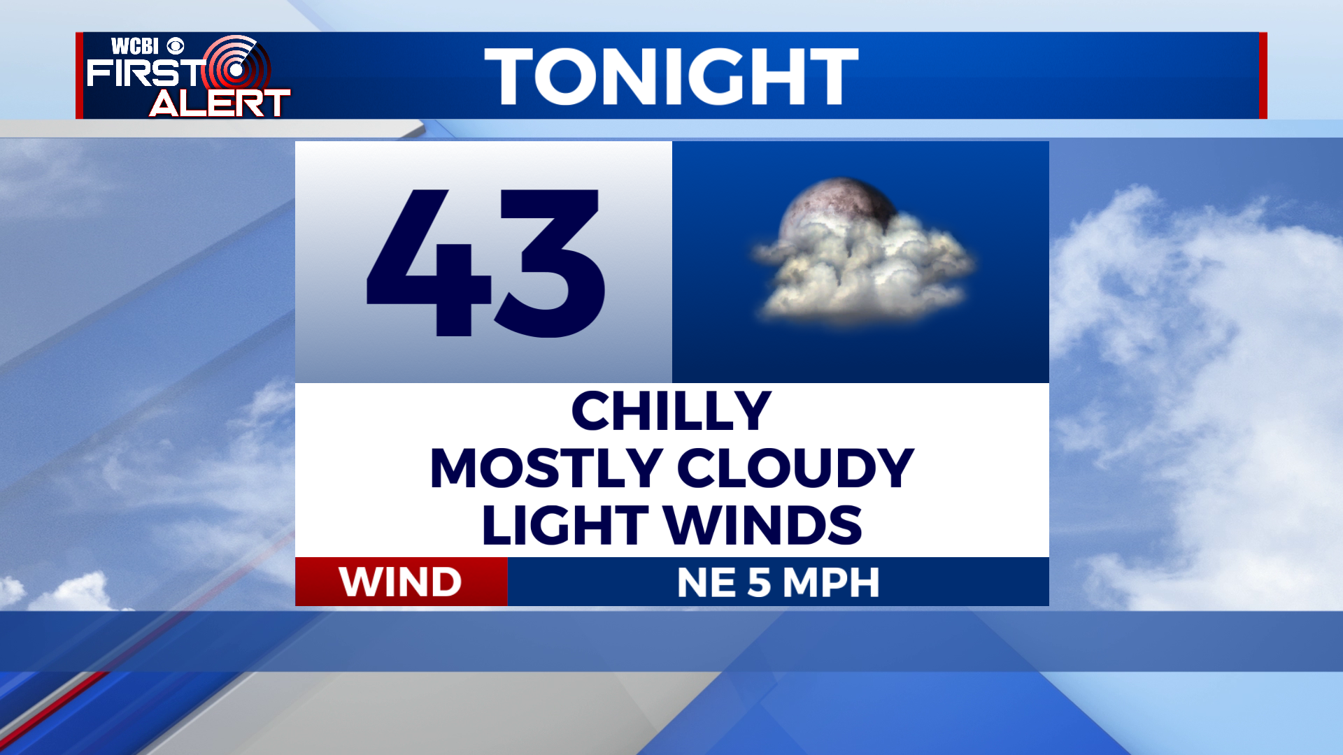
TONIGHT: It will be chilly once again, with lows in the low 40s under mostly cloudy skies. Low of 43 degrees. Winds: NE around 5 mph.
MONDAY: Monday marks the start of a warming trend. It will be warmer than this past weekend, with highs in the mid 70s under mostly sunny skies. High of 74 degrees. Winds: NE, becoming SE around 5 mph. Enjoy the beautiful day!
MONDAY NIGHT: Milder. Mostly clear skies with lows in the low 50s. Low of 53 degrees. Winds: SE around 5 mph.
TUESDAY: Tuesday will be even warmer! I know, crazy right?! Clouds will start to increase as our Wednesday system approaches. High near 80 degrees under partly cloudy skies. Winds: south at 5 to 15 mph. Breezy.
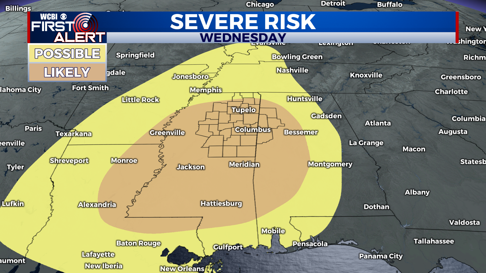
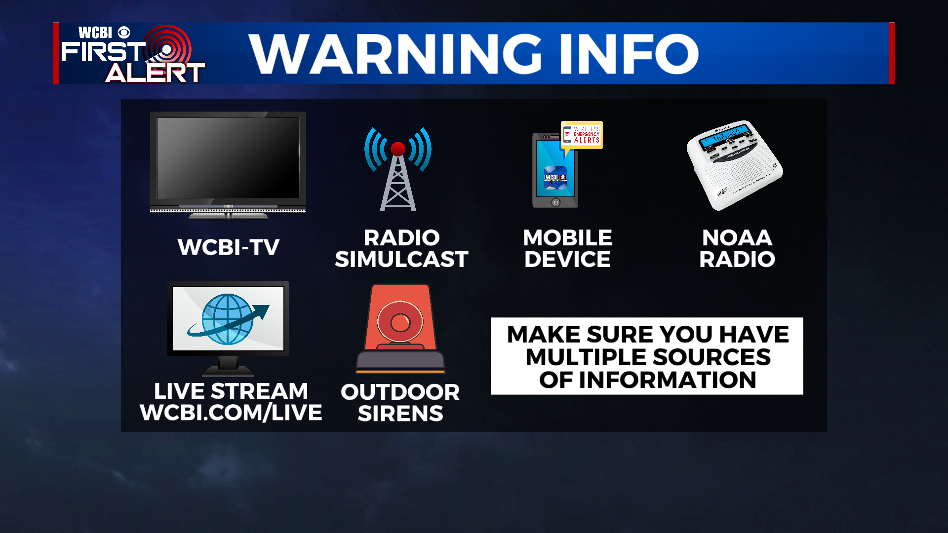
WEDNESDAY SEVERE WEATHER: All signs point to a possible high-impact severe weather event on Wednesday. Each atmospheric component will be in place and favorable for organized severe thunderstorms. The latest computer model data suggests a squall line with embedded damaging winds and tornadoes will move through during the afternoon and evening hours. The amount of wind energy in place will also mean strong tornadoes are possible. The Storm Prediction Center has all of Northeast MS and West AL under a level 3 out of 5 “enhanced risk” for severe weather. I believe a level 4 out of 5 “moderate risk” will be introduced before Wednesday. The entire weather team is monitoring the situation closely and will keep you up to date. Now is the time to make sure you have multiple *reliable* ways to receive weather alerts. We’ve got you covered!