Not As Hot Starting Thursday
SUMMARY: A weak cold front will slide from east to west across the region over the next 24 hours. This boundary may spark a few showers and storms Thursday. It won’t be as hot starting tomorrow and overnight lows will be much more comfortable.
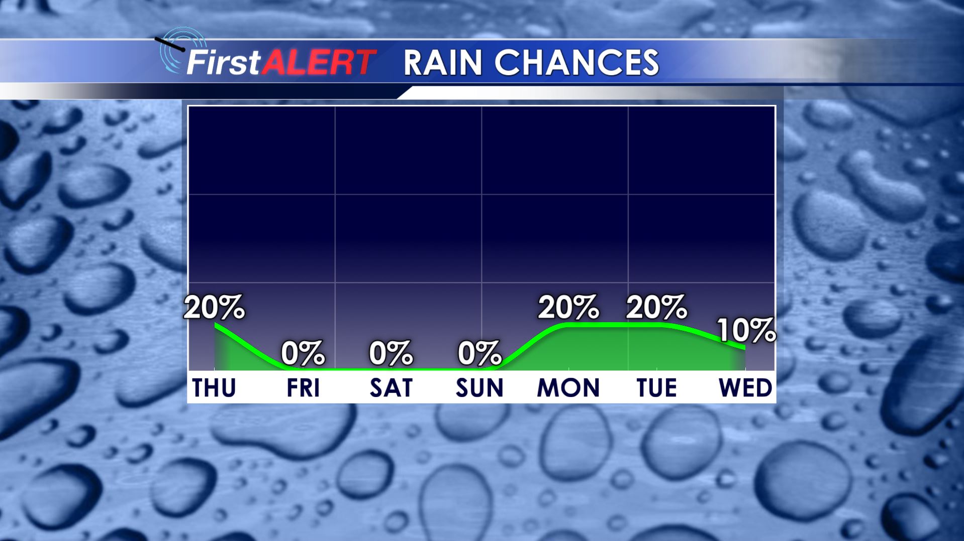
Rain Chances
WEDNESDAY NIGHT: Mainly clear and quiet. Lows near 70.
THURSDAY: Variably cloudy with a 20-30% chance of a few scattered showers and storms. Look for cooler highs in the upper 80s to around 90 with southeasterly winds developing between 5-15 mph.
THURSDAY NIGHT: Clear and more comfortable. Lows in the mid to low 60s.
FRIDAY-SUNDAY: Abundant sunshine will rule the day while mainly clear skies continue during the night. Highs should be in the upper 80s to near 90 with overnight lows in the mid to low 60s.
EARLY NEXT WEEK: A few showers/storms are possible but we’re going to keep the chance of rain at 10-20% for now. Seasonably warm highs in the low 90s are likely to continue.
Stay connected with @WCBIWEATHER on Facebook, Twitter, and Instagram


Leave a Reply