Occasional storms continue this week
COLUMBUS, Mississippi (WCBI) – An active weather pattern will continue into the weekend, translating to daily storm chances.
TUESDAY: Isolated showers and storms are possible again across the region, most notably in our northern counties closer to the TN line. Daytime highs make a run at 90 degrees with heat indices 90-95 degrees before any storms form.
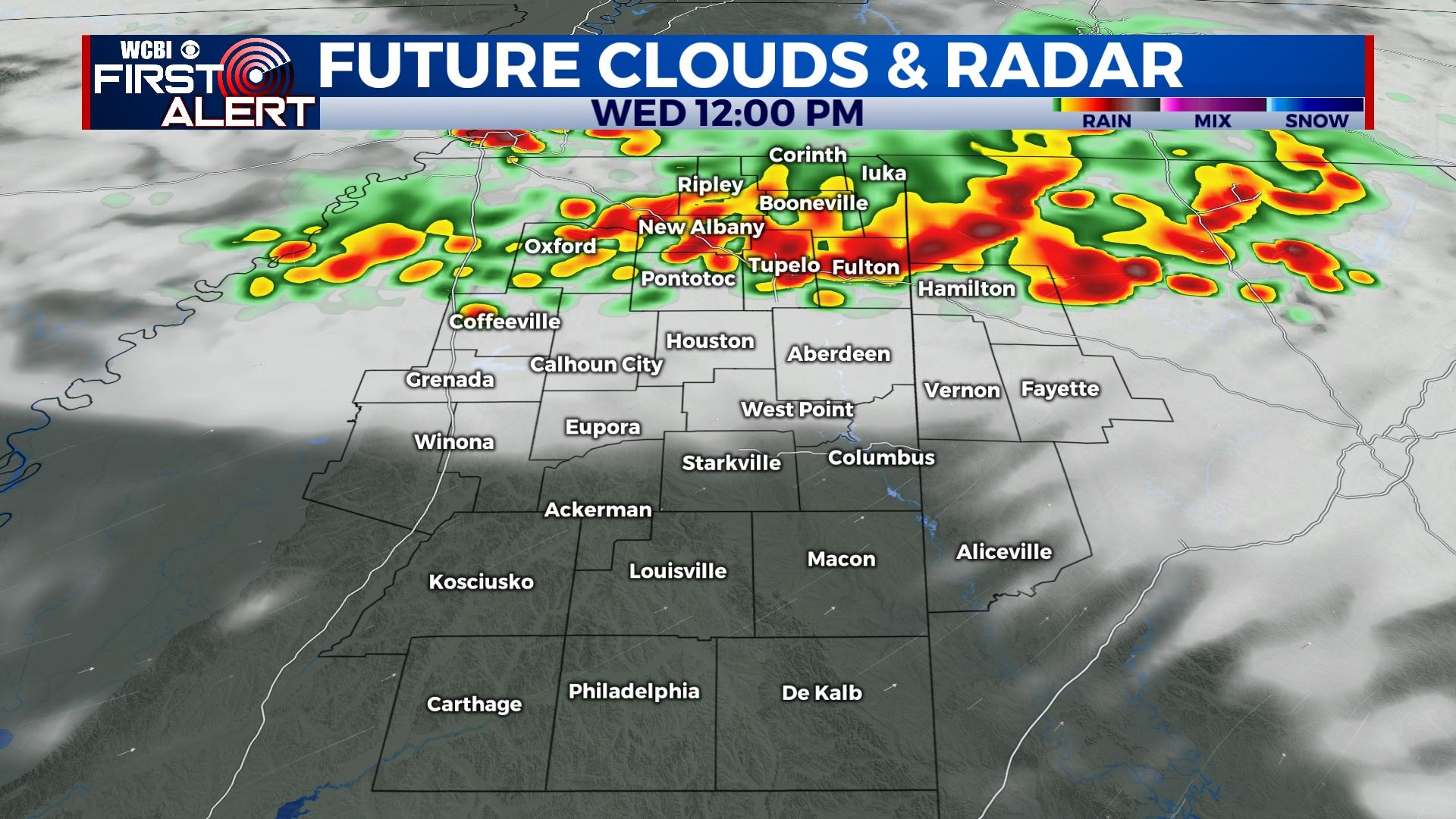
WEDNESDAY: Latest indications suggest a more widespread risk of showers and storms exists, but confidence remains low thanks to active and perturbed pattern. The best chance for rain or storms would be in the afternoon as highs reach the upper 80s.
THURSDAY: We may get a slight reprieve in the number of storms as slightly drier air works in from the north. However, at least isolated downpours will remain possible.
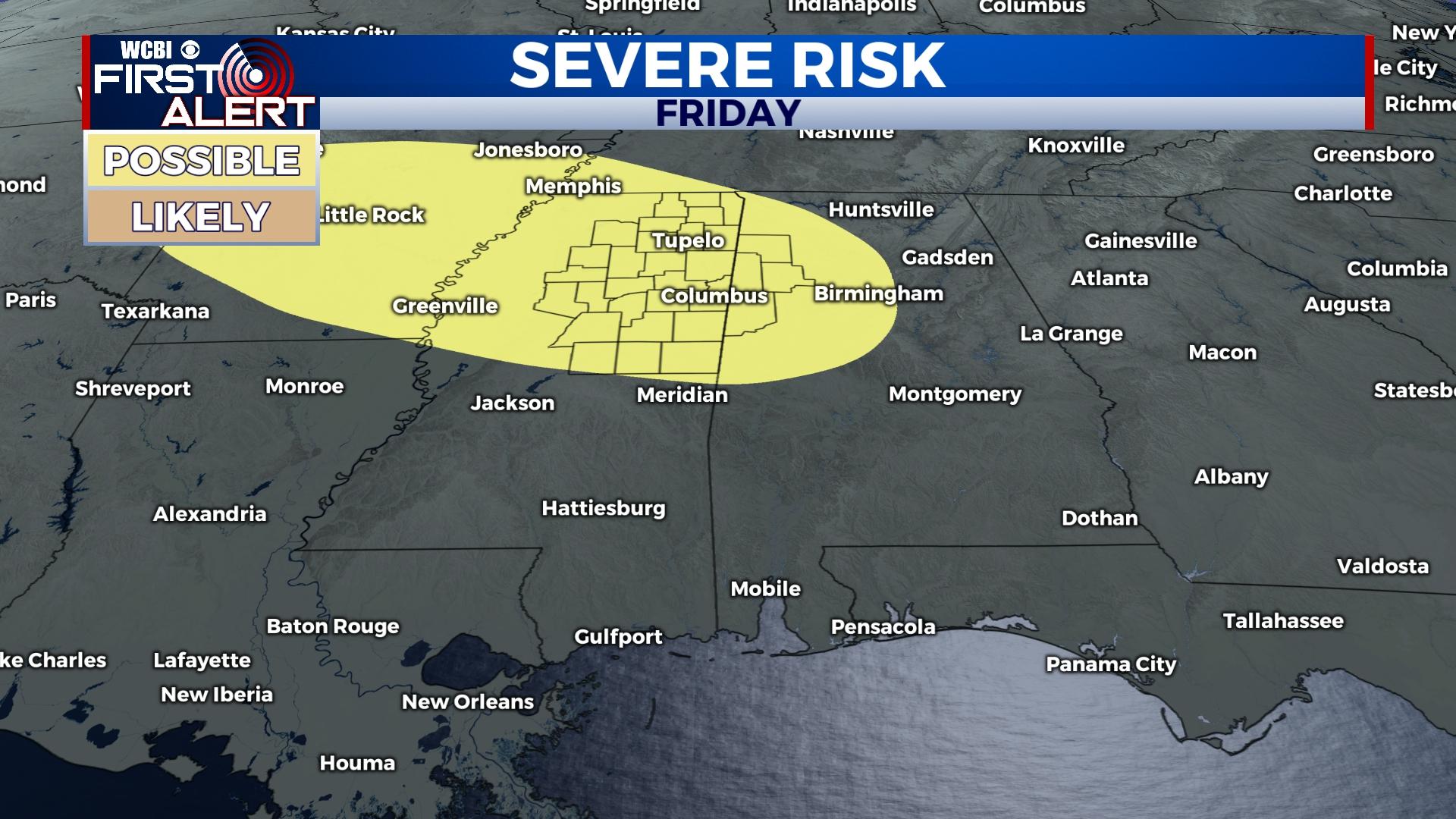
FRIDAY: Showers and storms still look likely as yet another upper disturbance passes through the region. This could promote an increased threat for damaging wind.
WEEKEND: Confidence remains quite low on the evolution of the active pattern. The latest model guidance points to a continuation of said active flow, so at least isolated storms could stay possible.


