One More Hot Day, Then a Front Brings Relief
COLUMBUS, Mississippi (WCBI) – A front will move through tomorrow and bring much more comfortable conditions on Friday.
TONIGHT: Clear skies and calm winds. Mild temperatures. Low near 69°.
THURSDAY: Hot once again. High near 94° with a mix of sun & clouds. A front will arrive during the day, but no rain is expected. Winds will increase throughout the day as the front passes, so it will be breezy at times. Gusts up to 20 mph are possible.

FRIDAY: Much nicer! Thursday’s front will help keep temperatures noticeably cooler than they have been. High near 81° with mostly sunny skies. Breezy at times. Enjoy this break from the heat!
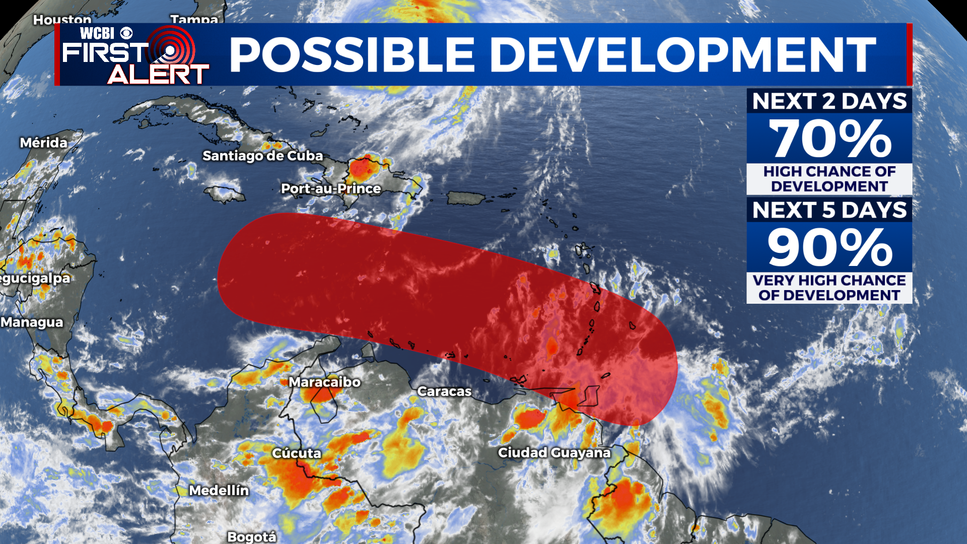
TROPICAL UPDATE: A disturbance near the southern Windward Islands is showing signs of organization and will likely become a tropical depression within the next couple of days. It is forecast to move into the Caribbean later this week. Storms in the Caribbean usually move into the Gulf, but there’s no need to be concerned right now. Could it move into the Gulf late next week? Yes. Could it curve to the north and not impact us? Yes. There are a lot of uncertainties right now because the storm hasn’t even formed yet. For now, just be aware of it and we’ll keep you updated. This thing is still a long way away and we’re watching it closely!
Have a great night!