One more quiet day Tuesday before stormy weather moves back in
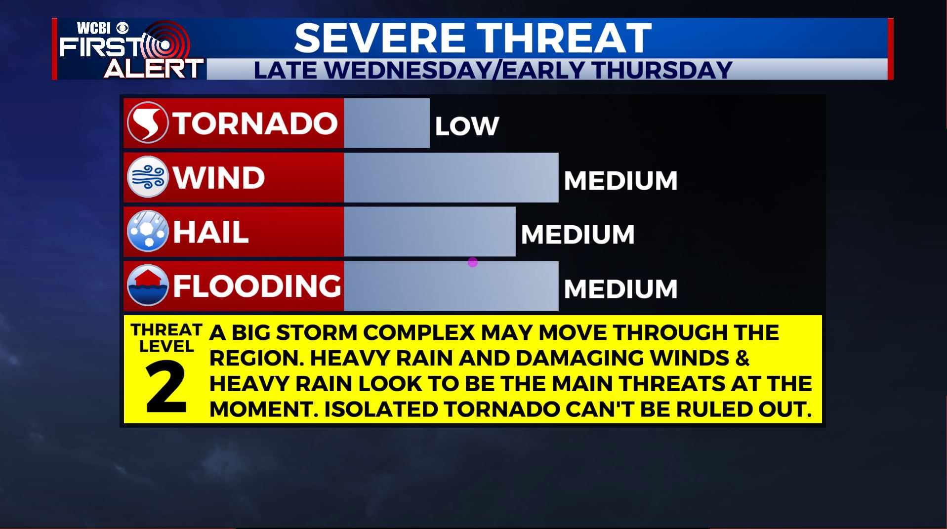
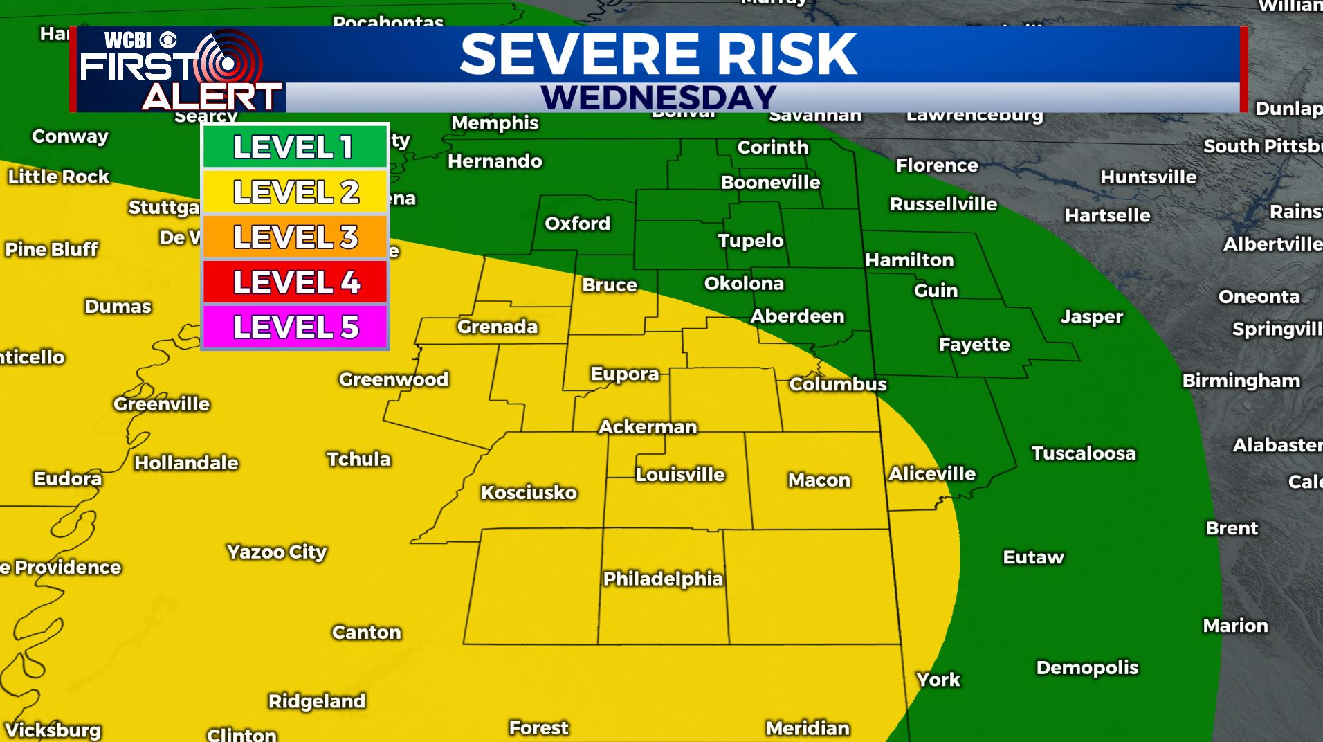
SUMMARY: One more quiet weather day with lots of sunshine for your Tuesday before our active weather pattern picks up again mid to late week. The first will be late Wednesday night into early Thursday morning. Latest SPC Outlook has us still under a Level 1-2 threat for severe weather. The second round will move in late Friday into early Saturday. We’ll have to watch this one as well for potential strong to severe storms and heavy rain.
TUESDAY: Areas of fog are possible this morning. Temperatures near 50. Becoming mostly sunny. Highs in the mid to upper 70s. Winds NW 5-10 mph.
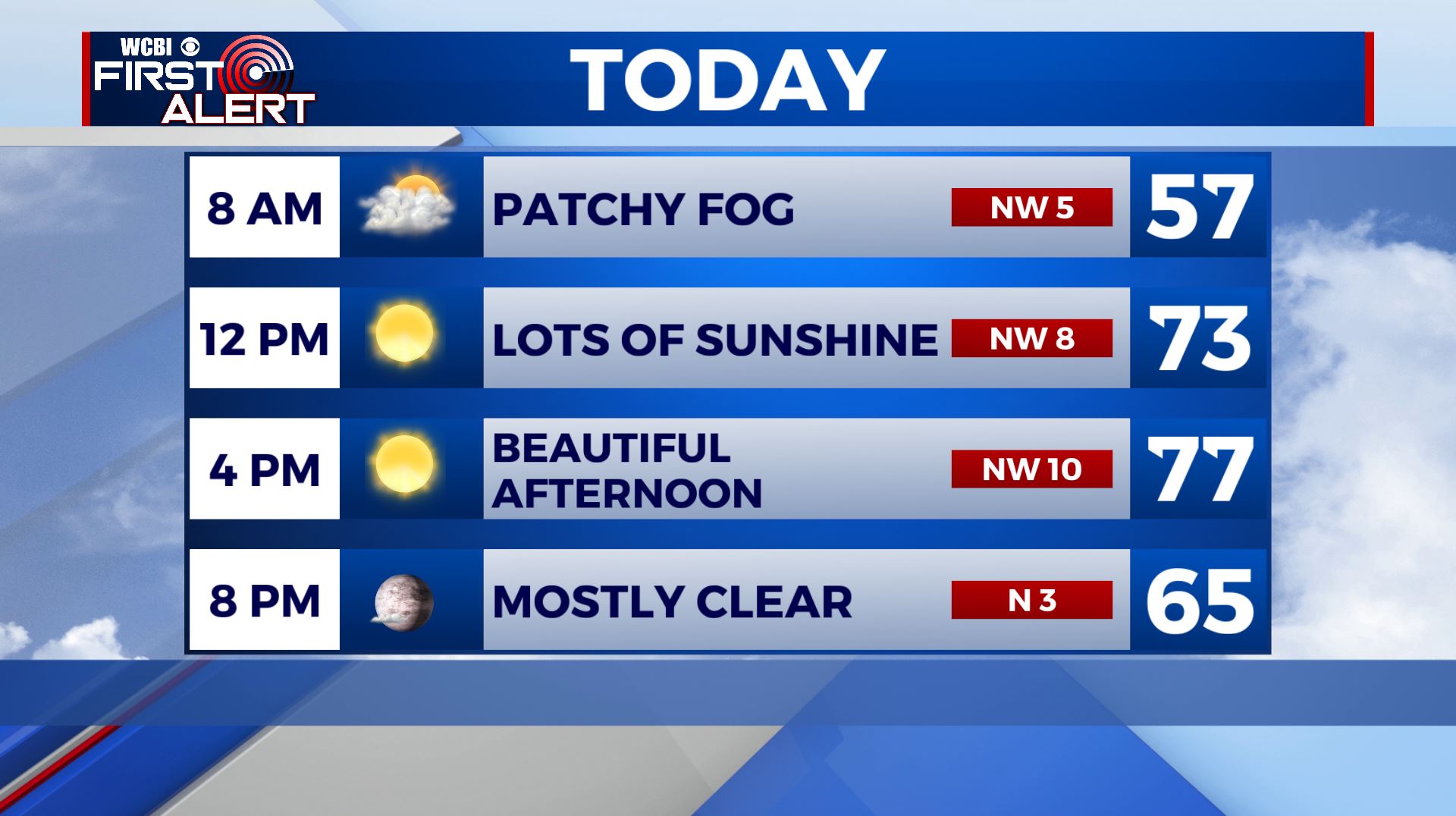
TUESDAY NIGHT: Mostly clear and quiet. Lows around 50.
WEDNESDAY: Clouds will increase throughout the day with highs in the 70s. Stronger SE winds 10-20 mph. While a few showers could develop early in the day the highest odds of rain and storms look to be during the evening into the overnight hours. Heavy rain, large hail and damaging winds are the main severe threats, but an isolated tornado can’t be ruled out. Stay tuned to WCBI as we continue to keep you updated.
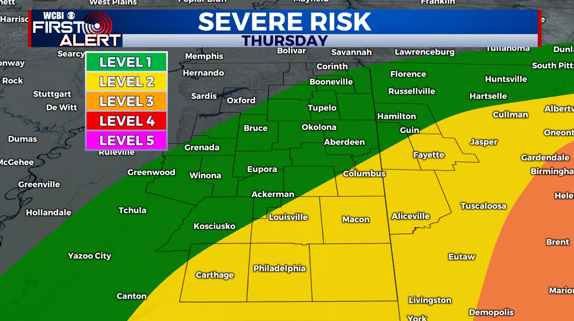
THURSDAY: Morning clouds and showers/storms will linger initially but partly sunny skies should develop during the afternoon. Highs will be in the lower 70s.
FRIDAY: Most of the day is looking pretty good with partly sunny skies and warmer highs in the upper 70s.
FRIDAY NIGHT: Rain and storms are possible. Some could be strong but it’s still uncertain. Lows in the upper 50s.
SATURDAY: Some clouds and showers around early with a mix of sun and clouds by afternoon. Highs in the low to mid 70s.
SUNDAY: Mostly sunny and pleasant. Highs around 70 with lows in the 40s.
Stay connected with @WCBIWEATHER on Facebook, Twitter, Instagram, and the WCBI News App


Leave a Reply