Partly cloudy Tuesday, rain by Thursday
We’ll remain dry and cool for the next couple of days before rain returns Thursday. After that, cooler air moves into the area.
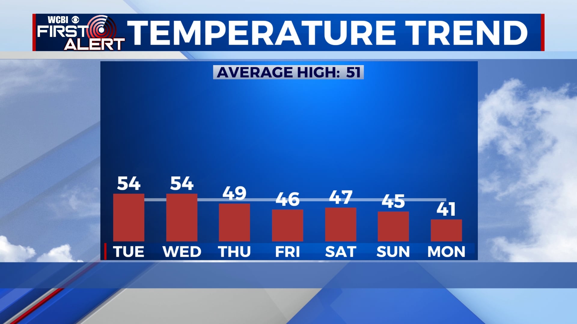
TUESDAY: Morning fog will dissipate by 9am, leaving us mostly sunny to partly cloudy through the afternoon. Highs will be in the mid 50s with a northwesterly wind 5-10 mph.
TUESDAY NIGHT: More clouds will build in overnight tonight. Temperatures will fall to near 30 with a light and variable wind.
WEDNESDAY: Mostly cloudy but dry. Temperatures will be cool with highs in the mid 50s.
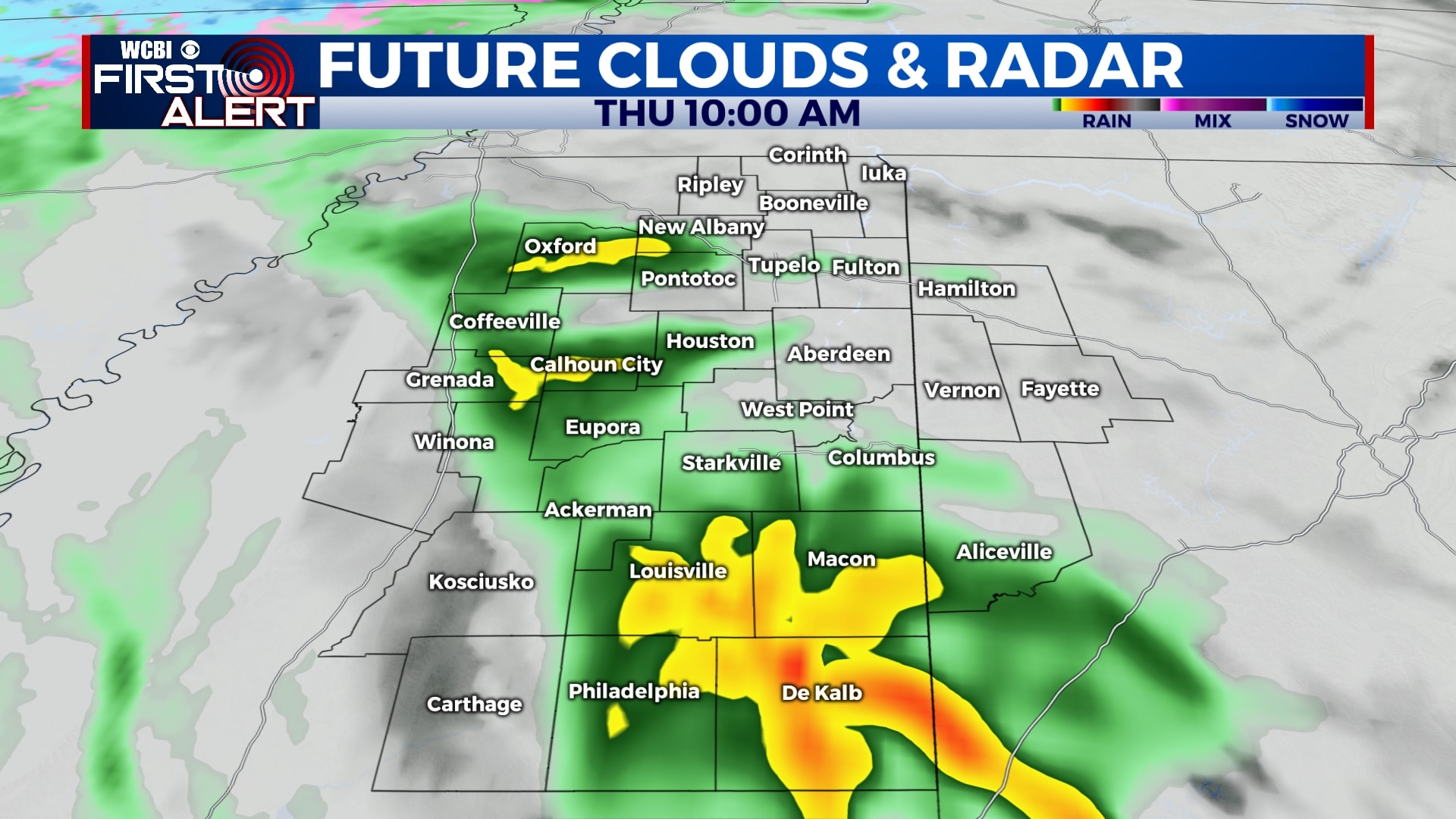
THURSDAY: Rain showers are possible off-and-on through the day, especially before 3pm. It’ll be a cold rain with temperatures in the 40s through the day.
FRIDAY-SATURDAY: We’ll see some clouds on Friday and Saturday but some peeks of sunshine are also possible. Temperatures will be in the 40s each afternoon with lows near 30.
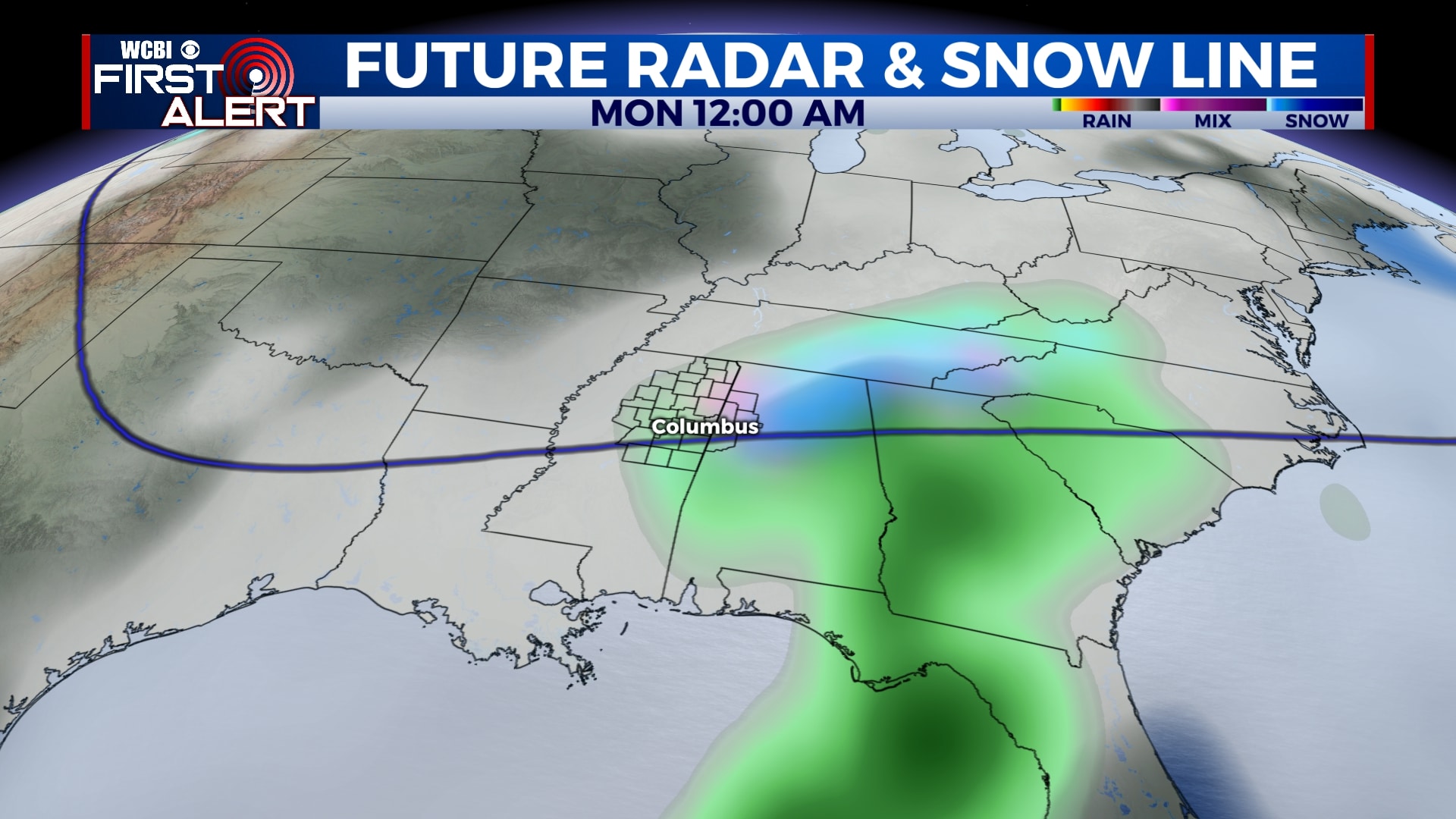
SUNDAY-MONDAY: Rain will return to the area late Sunday and could linger into Sunday night. Any rain that is left in the area by sunset could transition to snow, but confidence remains low in the forecast. Some lingering snow showers are possible into Monday morning as well. Highs will be in the low to mid 40s with lows near 30.
Follow WCBI Weather on Facebook, Twitter, and Instagram
Follow Meteorologist Trevor Birchett on Facebook and Twitter


Leave a Reply