Pop Up Storms; Brutal Heat To End Week.
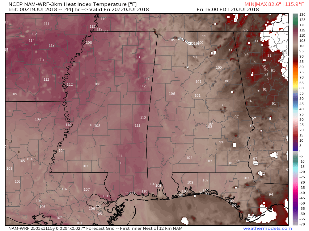
NAM FORECAST HEAT INDEX FRIDAY AFTERNOON
TODAY: Temperatures start in the mid 70s in the morning, and climb into the low 90s this afternoon, with the heat index climbing as high as 105°. Scattered showers are possible in the morning, then scattered thunderstorms are possible in the afternoon and evening. Chance of rain around 30%. Temperatures drop to the low to mid 70s overnight, with a lingering shower or storm possible.
FRIDAY: Brutally hot on Friday, with highs in the mid 90s. The heat index will climb between 105° and 110° in the afternoon. Limit outdoor activity if possible, and be sure to seek out shade if you are spending time outdoors and drink plenty of water. Scattered showers and storms will be possible during the day. Chance of rain around 30%. Overnight, a few scattered storms will be possible into the late overnight hours. Lows in the mid 70s.
WEEKEND: Still quite hot on Saturday, with highs in the low to mid 90s and a heat index climbing around or above 105°. A few scatted storms are possible during the day Saturday. Chance of rain around 30%. Temps in the low 90s Sunday, and with slightly drier air moving in, the heat index will only climb as high as 100°. An isolated stray downpour can’t be ruled out Sunday, but most spots should stay dry.
MON/TUE/WED: A fairly typical July pattern to kick off the work week with highs in the low 90s and daily pop up showers and storms.


Leave a Reply