Quick warmup after cool start to week
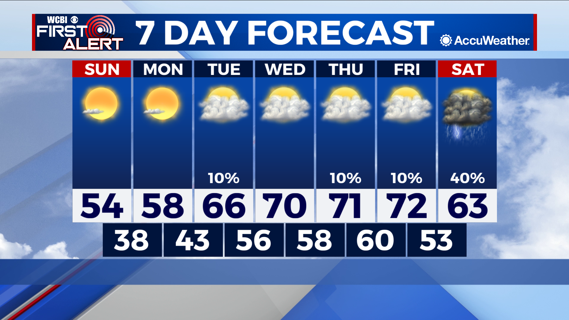
COLUMBUS – SUMMARY: Our early Saturday morning cold front dropped temperatures back down into the 50s but do not expect that to last. Temperatures look to rise quickly back into the 70s by midweek. Our trend of unseasonable temperatures continues as and we will have to wait until at least next Saturday for any relief. Clouds make a swift return as well, although rain chances will be quiet throughout the week.

SUNDAY: The rest of our weekend stays cool as we enjoy a high temperature in the mid 50s Sunday. Mostly sunny skies accompany with no rain chance expected. Lows dip down into the high 30s overnight.
MONDAY: Our warming trend begins Monday as temperatures top out in the high 50s, although lows improve into the low 40s overnight. Clear skies prevail and remain dry.
TUESDAY: Temperatures continue to climb, reaching the 60s by Tuesday. Lows do the same and improve into the 50s overnight. Clouds return and set a trend that will be seen for the rest of the week. The dry trend continues, however.
WEDNESDAY: We break into the 70s Wednesday as we continue to warm up. Clouds remain but the good news there is that the clouds will keep overnight lows up as we only bottom out in the high 50s to low 60s overnight. The pattern remains dry.
REST OF THE WEEK: The warming trend will stall slightly approaching the weekend, leaving us with highs in the low 70s. The cloudiness remains and looks to be accompanied by rain over the weekend as a potential cold front shapes up on Saturday. The temperature impact of the front is yet to be fully determined but highs on Saturday look to not increase past the low 60s.