Quiet Weather Locally as Dorian Slams Bahamas
Nice and quiet weather will continue in our area, but temperatures and humidity will be on the rise through the middle of the week. More comfortable weather returns for the end of this week and next weekend.
TROPICS: Hurricane Dorian is wreaking havoc on the Bahamas today as a Category 5 storm with winds of 185 mph, one of the strongest storms ever recorded in the Atlantic Ocean. Dorian will continue to inch closer to Florida’s east coast over the next few days, but is expected to turn northward before making a direct landfall. Impacts will still be felt on the Florida Peninsula, and the forecast can still change. Even a relatively small move westward of 25 miles could result in a worse scenario for Florida. No impacts from Dorian will occur in Mississippi or Alabama.
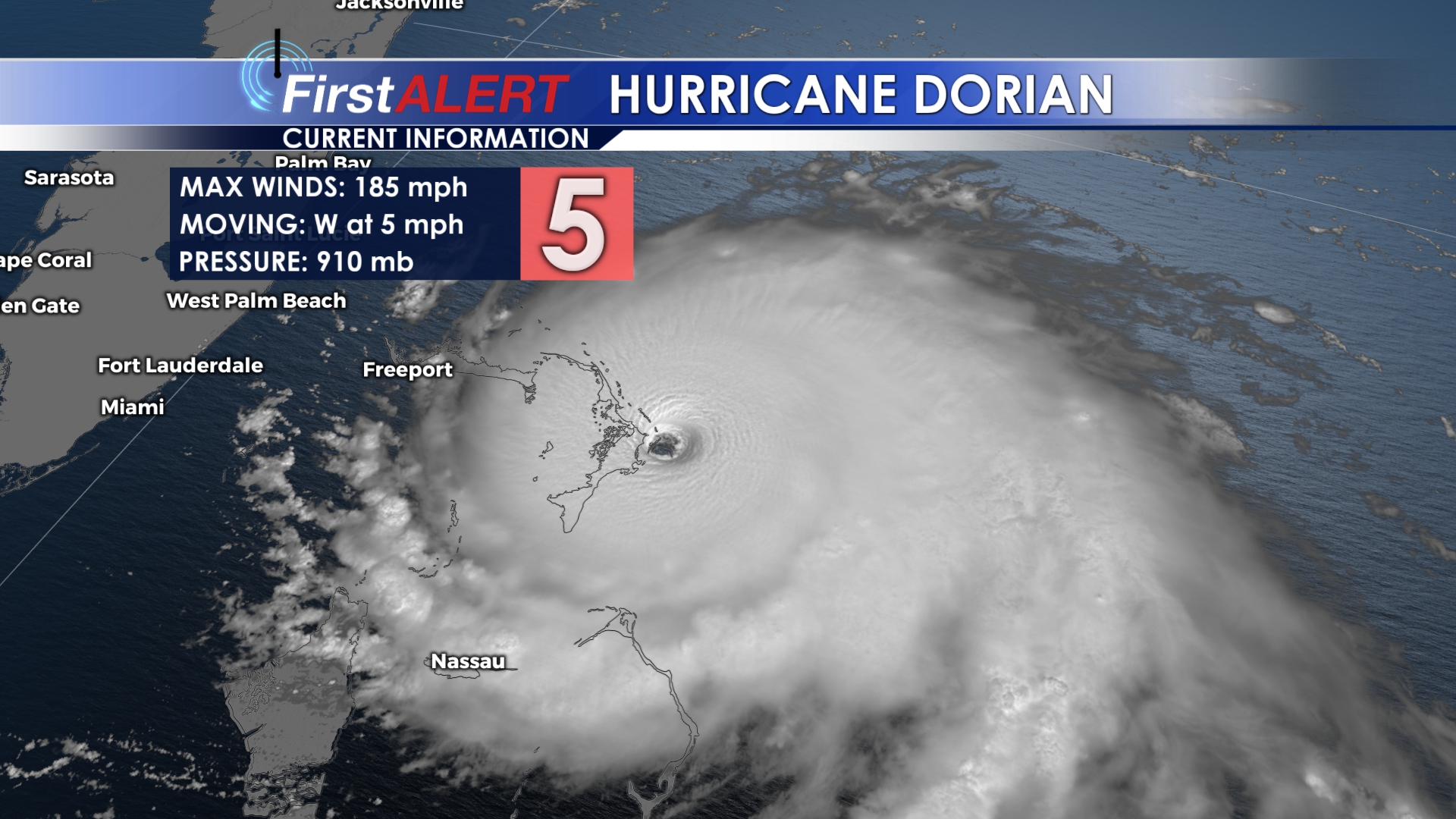
Hurricane Dorian impacts the Bahamas as a Category 5 storm
SUNDAY NIGHT: Another quiet and calm night with lows in the upper 60s. Winds will be relatively calm.
MONDAY: Labor Day looks perfect, but warm weather will continue. Highs will be in the low to mid 90s with heat index values above 95 in many spots. Plenty of sun to go around!
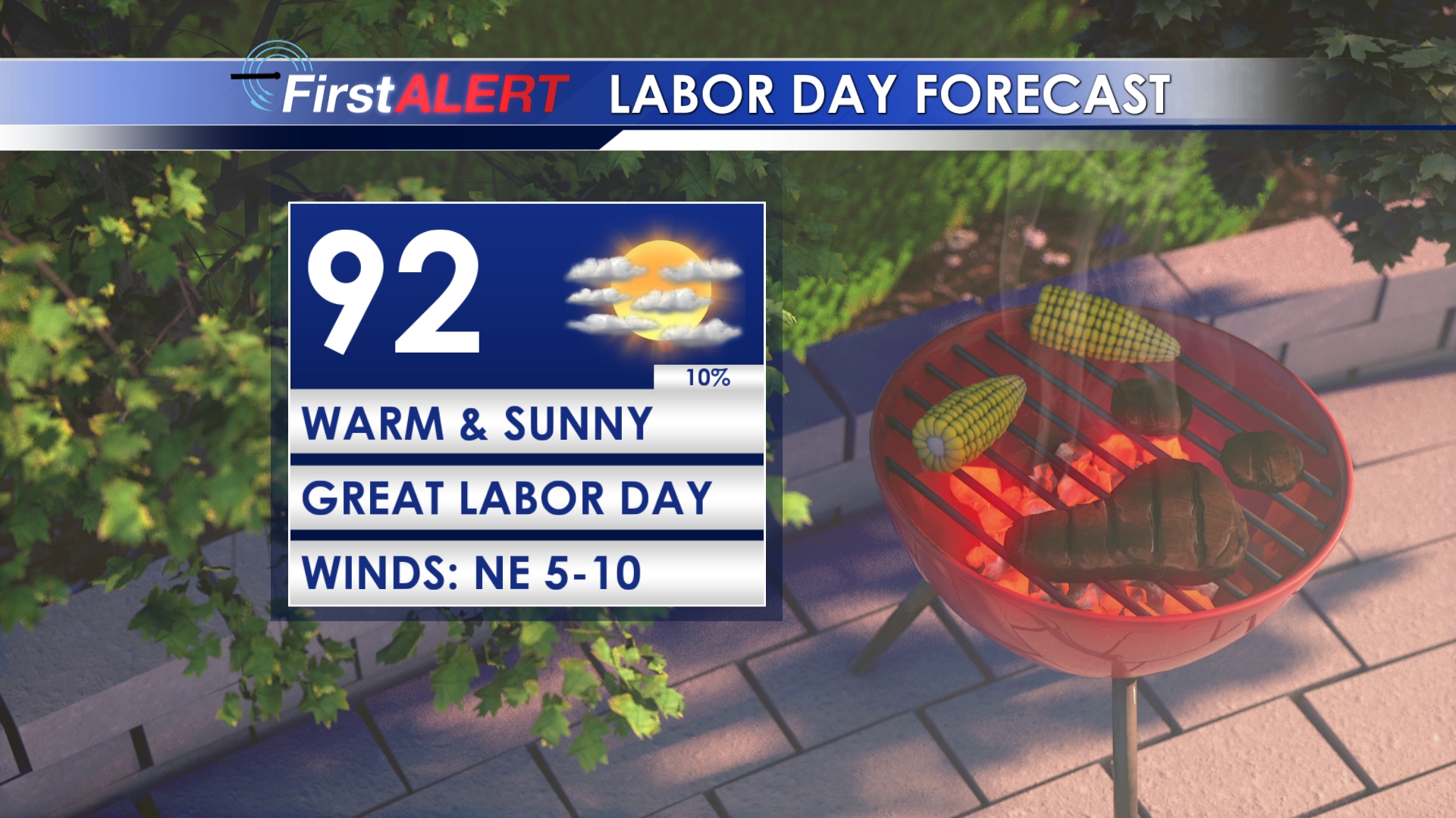
Labor Day Forecast
TUESDAY-WEDNESDAY: Sunny weather continues as temperatures stay on the hot side. Highs will be in the mid 90s with heat index values nearing 100.
THURSDAY-SUNDAY: Absolutely beautiful weather for the end of the week and weekend as highs will be in the upper 80s to near 90. Lower humidity will bring some more comfortable air into the area, making for what could be the best stretch of weather so far this summer.
Follow @WCBIWEATHER on Facebook, Twitter, and Instagram


Leave a Reply