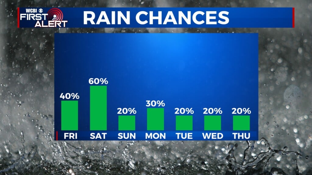
Rain chance and warm temps
COLUMBUS, Mississippi (WCBI) – Continuing the warmer temps and the lighter rain chance throughout the week. The weekend will see a slight drop in temperatures.
TUESDAY NIGHT: A few showers may become possible after midnight across north/northwestern MS, due to a front grazing our northern border. Lows will only drop into the middle 60s, staying mild, with extra clouds and a lingering breeze.
WED – FRI: The cold front will turn stationary by Wednesday, keeping things warm and humid. However, the rain coverage will be very hit and miss. There are some signs we could see a stronger front push in late-week, and this could create a slightly better chance for a few storms late Thursday. High temps will be staying in the upper 70s to low/mid 80s. Overnight lows remain mild too.
WEEKEND: Clouds stick around, and a few scattered showers stay possible Saturday. Slightly higher rain chances are possible Sunday as moisture runs up & over a stalled front to our south. Daytime highs may drop into the low 70s or even upper 60s by Sunday.