Rain Chances Increase, Temps Going Down
Warm temperatures continue for Saturday and Sunday before the first of two cold fronts sweep through the Southeast. These will bring temperatures closer to normal through the week, but will also bring increased rain chances. We could definitely use some rain as much of the area hasn’t seen a drop in nearly a month. Another late-week cold front could bring even cooler air into the area.
SATURDAY NIGHT: Temperatures will stay a little milder tonight as any lingering showers slowly diminish. Lows will be around 70.
SUNDAY: As the first cold front approaches, rain chances will increase through the afternoon. It won’t be raining constantly, but it’ll be a good idea to pack the umbrella as you head out the door. We’ll call it a 50% chance for rain and storms with a high near 87.
SUNDAY NIGHT: Rain and storms continue overnight Sunday into Monday with a low near 67.
MONDAY: Showers and storms likely Monday morning, but as the cold front continues through, rain chances should diminish into the afternoon hours. Highs will only be in the mid 70s as cooler air moves in.
TUESDAY-THURSDAY: Apart from a rouge shower or storm, most everyone should stay dry and sunny through the middle of the week. Highs will be near 80 for Tuesday before climbing back into the mid 80s for Wednesday and Thursday.
FRIDAY-SATURDAY: A second cold front will sweep through the area Friday and Saturday, bringing another pretty good chance for showers and storms on Friday. I think Saturday will be pretty nice once any lingering showers and storms clear out by the early afternoon hours. Morning lows on Saturday will be around 50, with some areas dipping into the upper 40s. Highs will be near 70.
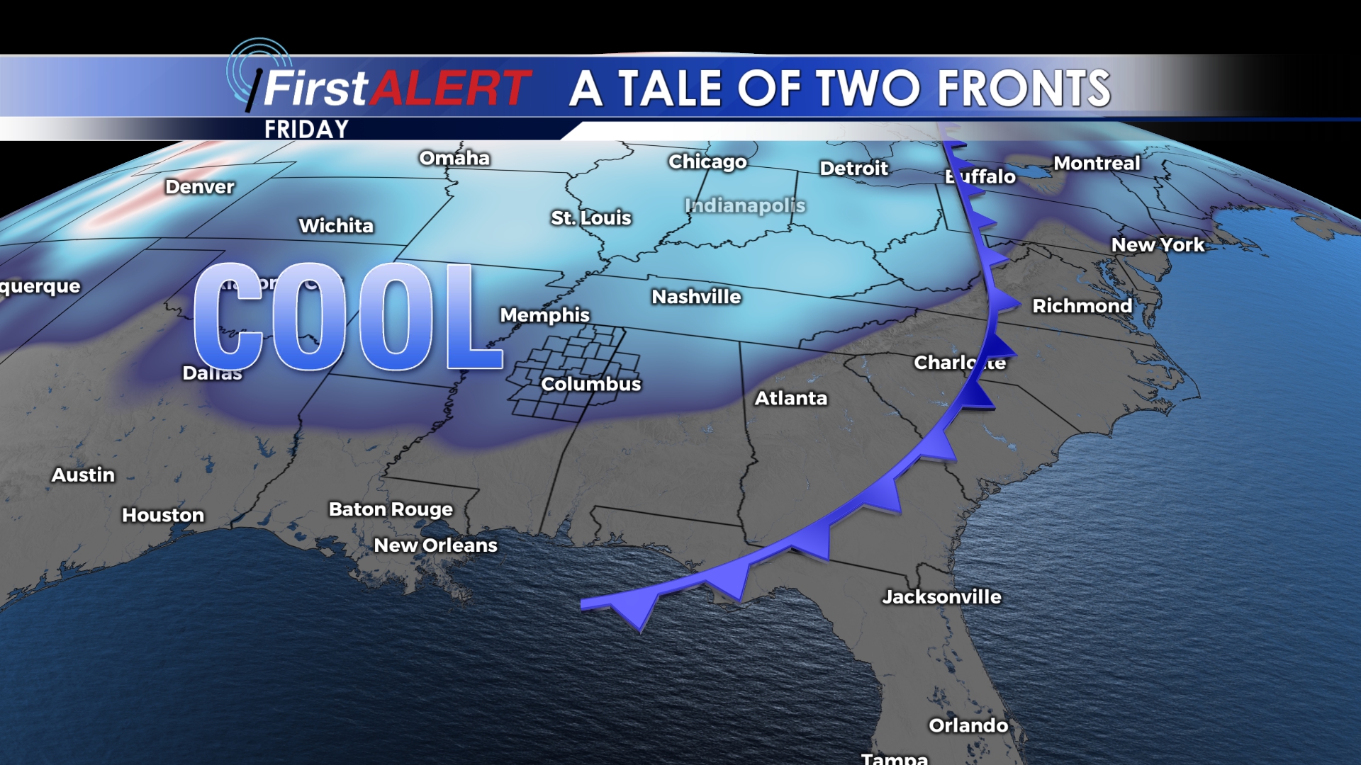
The second of two fronts will bring even cooler air into the area by next weekend.
Follow @WCBIWEATHER on Facebook, Twitter, and Instagram


Leave a Reply