Rain chances increasing
SUMMARY: Mild weather will continue through Friday but rain chances are on the increase. Some showers are possible Thursday but heavier rain and embedded storms are more likely Friday into Saturday morning. Anywhere from 1/2” to over 2” of rain may occur with this system. We’re watching out for an active weather pattern next week that could give rise to a storm system Tuesday-Wednesday and perhaps another one during the Thanksgiving weekend.
WEDNESDAY NIGHT: Scattered high clouds and quiet. Not as chilly with lows in the low to mid 40s.
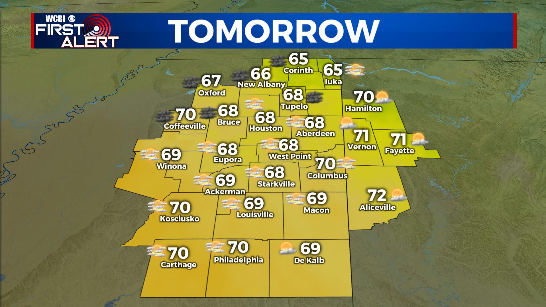
Thursday’s Forecast
THURSDAY: Partly sunny to mostly cloudy. Some showers are possible but the chance of rain is 20% or less. Another mild day with highs near 70 is expected.
THURSDAY NIGHT: Partly to mostly cloudy and milder. Lows in the 50s. A few showers will remain possible.
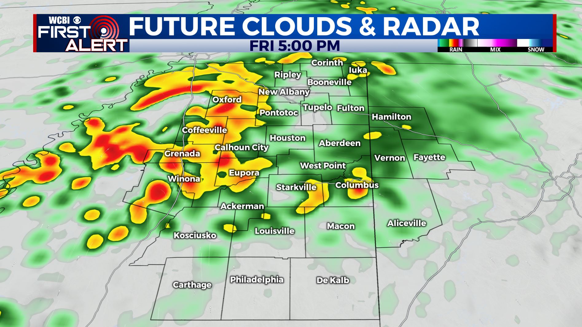
FRIDAY: Areas of rain and storms. The heaviest activity may occur during the afternoon and evening hours. No strong to severe weather is expected at this time. Mild high near 70.
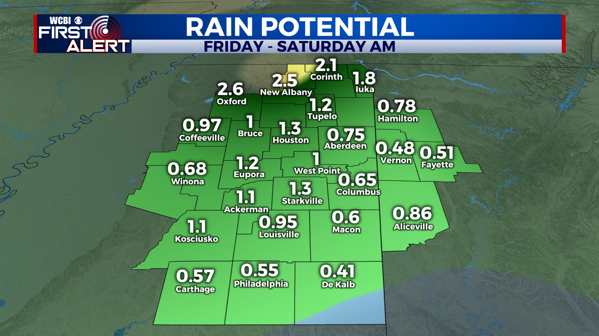
1/2″ to over 2″ of rain are possible
FRIDAY NIGHT: Rain showers continue. Relatively warm temperatures are likely with lows in the 50s.
SATURDAY: Morning clouds and showers will give way to afternoon clearing from west to east. Highs will be in the upper 50s.
SATURDAY NIGHT: Mainly clear and chilly. Lows in the 30s.
SUNDAY-MONDAY: Sunny skies return along with seasonably cool temperatures in the 50s and low 60s.
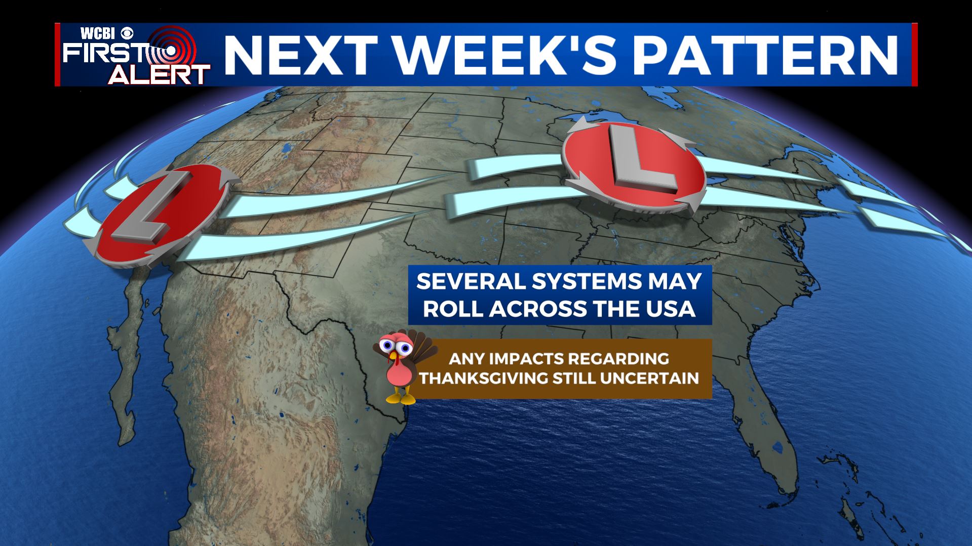
Unsettled pattern next week
TUESDAY-WEDNESDAY: Model data still suggest that there may be some showers and storms in the region. Wednesday morning’s data has backed off on the size and scope of this potential system but we’re still going to watch it closely. Mild highs near 70 are possible Tuesday with cooler air building back in on Wednesday behind the system.
THANKSGIVING DAY: The early outlook suggests seasonable temperatures and the chance for some showers and storms in the region.
Stay connected with @WCBIWEATHER on Facebook, Twitter, Instagram, and the WCBI News app


Leave a Reply