Rain chances stay elevated, tropics very active
SUMMARY: Thanks to a front which will stall over the area, as well as tropical storm Fred, wet weather looks likely over the next few days and as we start next week. Rain and cloud cover will hold our highs down into the mid to upper 80s Sunday to Wednesday, a nice reprieve from the heat! Scattered shower and storm chances continue through next week, and highs slowly return to the low 90s by Friday. The tropics are also very active as we get closer to the peak of hurricane season, and the storm behind Fred is definitely one to watch as it could bring impacts here late next week. 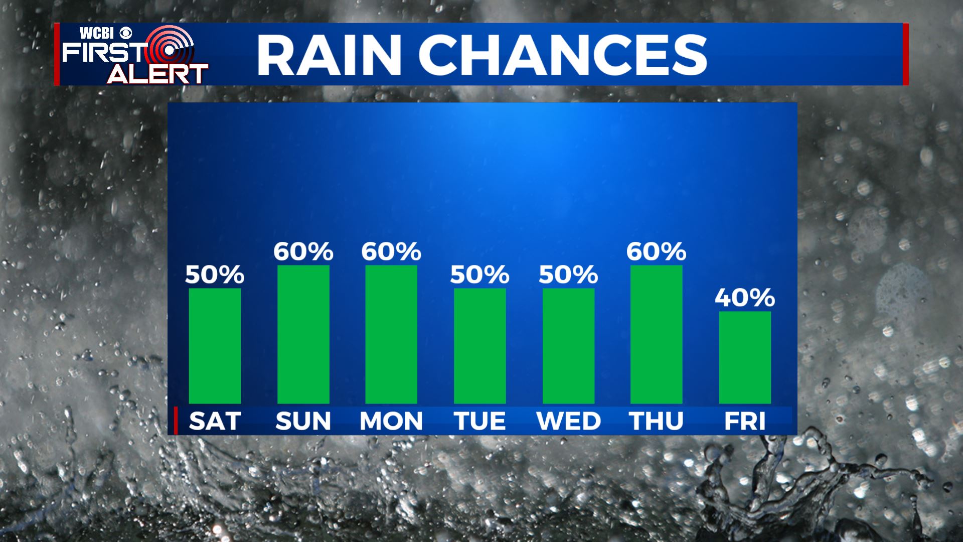 FRIDAY NIGHT: Any showers and storms across the area will quickly taper off once the sun sets. Partly cloudy skies with lows in the low 70s. SATURDAY: Highs top out right around 90 degrees for Saturday, with partly cloudy skies to start the day followed by scattered showers and storms for the afternoon. SATURDAY NIGHT: Showers and storms once again end after sunset, but a couple stray overnight showers are not out of the question. Otherwise, partly cloudy with lows in the low 70s. SUNDAY: Cooler and wetter weather for Sunday, with highs in the mid to upper 80s and widespread afternoon showers and storms. Moisture from TS Fred will begin to move into the area Sunday evening. MONDAY TO FRIDAY: Monday looks cooler and wet, with highs in the mid to upper 80s as TS Fred makes landfall along the gulf coast. Due to Fred’s slower movement, it is now looking like it won’t pass the area until Tuesday morning to our east. Since we will be on the weaker, drier side of the system, effects here look limited to cloudy skies and periods of rain for Monday and Tuesday. After Fred passes, shower and storm chances stick around for the rest of the week. Highs slowly return to the low 90s by the end of the week, with lows remaining in the low 70s. We’ll be closely watching the storm behind Fred, likely to be Grace, as it could bring impacts to the USA/ our viewing area next weekend or early the following week. As always, stay tuned for updates!
 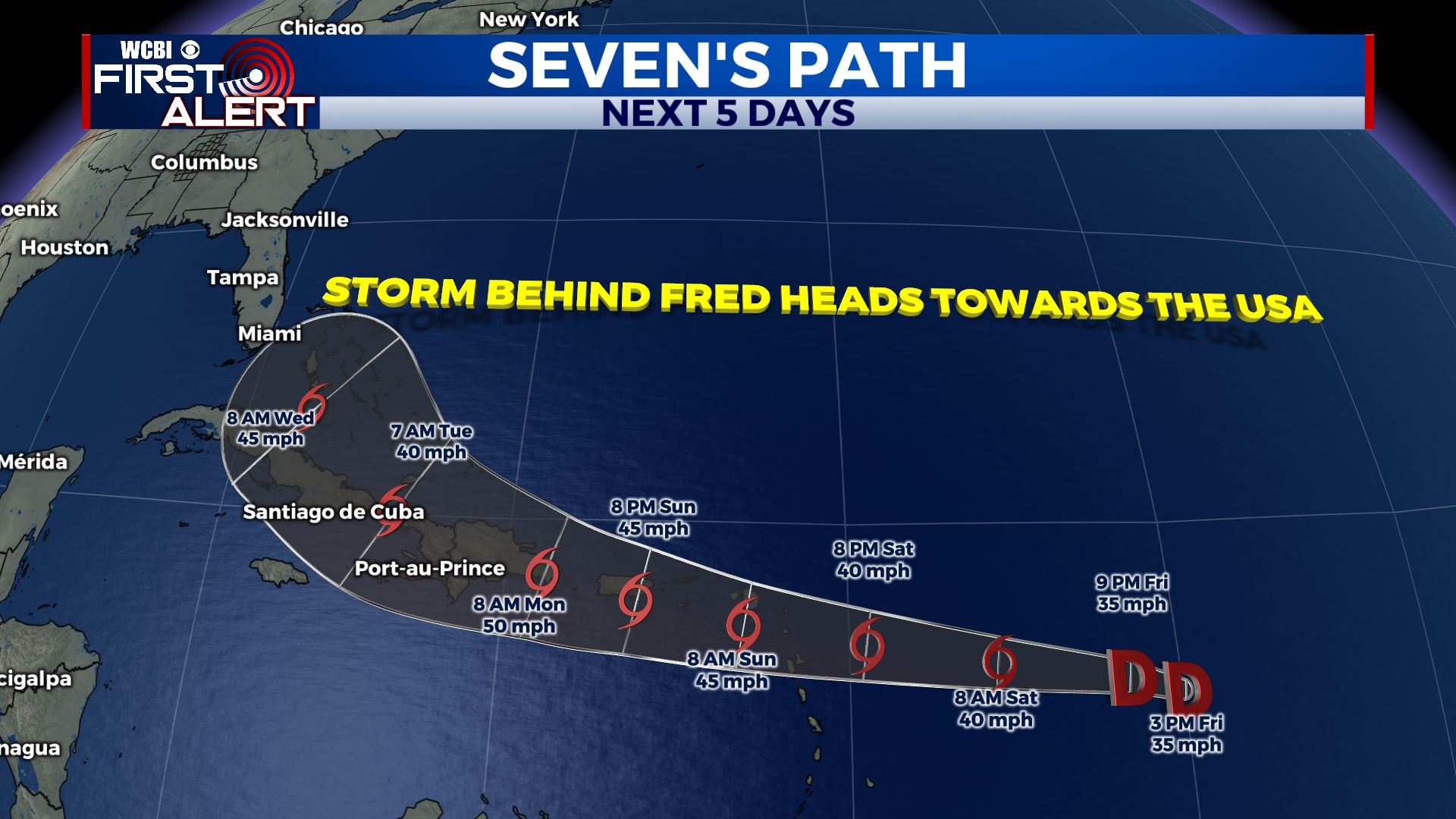 Stay connected with @WCBIWEATHER on Facebook, Twitter, Instagram and the WCBI News App


Leave a Reply