Rain Likely Tuesday, Drier Mid-Week
Showers will dissipate this evening and leave us dry and mostly cloudy as we get into the overnight hours. Temperatures will warm up on Monday before chances for rain return on Tuesday. Some areas could see 1-3″ of rain on Tuesday.
SUNDAY NIGHT: Mostly cloudy and a little milder, lows in the low 50s with light winds.
MONDAY: Temperatures warm briefly as we start the week with highs near 80 for Monday. Clouds will stick around through the day for most of the area, but some of us (especially Tupelo and points north) could see some sunshine.
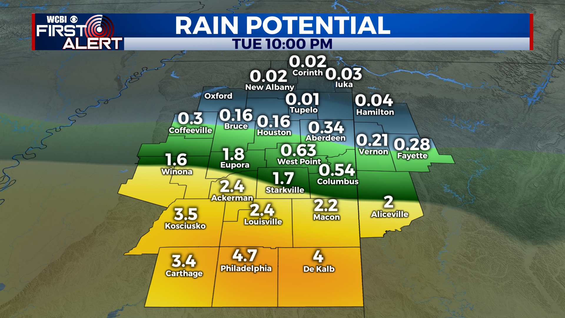
TUESDAY: Rain will begin to move into the area early Tuesday morning with showers continuing through the day. We’re not expecting much in the way of storm activity as this will be more of a slow and steady rain. Depending on where you are, you could pick up 1-3″ of rainfall. However, some areas, especially closer to the Tennessee state line, may not see much rain. It’s probably a good idea to pack the rain boots and wear the rain jacket either way. Highs will be near 70.
WEDNESDAY-FRIDAY: Rain chances decrease as cooler air returns to the area for the middle of the week. Highs will be in the mid to upper 60s for Wednesday and Thursday before returning to the 70s for Friday.
SATURDAY-SUNDAY: Clouds return for the weekend with a chance for a few scattered showers. The weekend won’t be a washout, but some rain is possible. We’ll keep it at a 20%-30% chance for now. Highs will be closer to 80.
Follow @WCBIWEATHER on Facebook, Twitter, and Instagram


Leave a Reply