Rain returns Tuesday afternoon
COLUMBUS, Mississippi (WCBI) – Briefly drier weather Monday turns soggy again Tuesday as rain returns to the forecast.
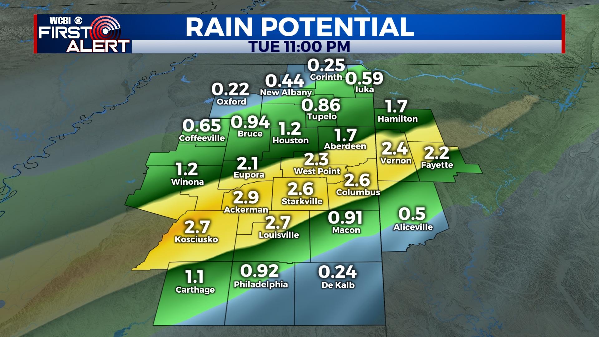
TUESDAY: The day starts dry and mostly cloudy, though clouds will fill back in quickly through the day ahead of the next rain chance. Rain is forecast to become widespread across this region between 3-6p today, lasting into the evening and overnight hours. Some of the rain will be heavy, and a few claps of thunder are possible as well. Total rain amounts over one inch look likely for most spots.
WEDNESDAY: Widespread rain will shift away from the region early in the day, but clouds will linger for the remainder of the day. Temperatures will hold in the 50s as a result with spotty afternoon showers staying possible.
THURSDAY: A decent weather day is on tap in between storm systems with a mix of sun and clouds and highs in the upper 60s.
FRIDAY: A wild 24-36 hour stretch of weather is in store. Temperatures will climb into the 70s during the day with an area of low pressure developing nearby. Showers and embedded storms should break out in the afternoon hours, but the severe threat remains near zero with this activity.
FRIDAY NIGHT: Following afternoon and early evening rain and storms, temperatures will crash quickly. There remains decent model agreement on a band of snow developing in north to northwest Mississippi after sunset. Accumulations are possible northwest of the Trace, but confidence drops off on anything other than flakes southeast of the Trace. Stay tuned for updates on this forecast. Otherwise, temperatures in the upper 20s with wind chills in the teens are possible overnight into Saturday morning.
WEEKEND: Clouds will clear rapidly Saturday, but highs will likely hold in the 30s much of the day. Sunday morning looks quite frigid with lows in the lower 20s. Sunday afternoon brings back nicer weather as highs bounce back into the upper 50s with sunshine.