Rain Saturday, Colder Next Week
We have one more round of rain to get through on Saturday before we enter a drier and much cooler pattern. Showers and storms look to return to the area by next Friday.
FRIDAY NIGHT: Increasing clouds with a few light showers. Temperatures will fall to near 50 with gusty southeasterly winds.
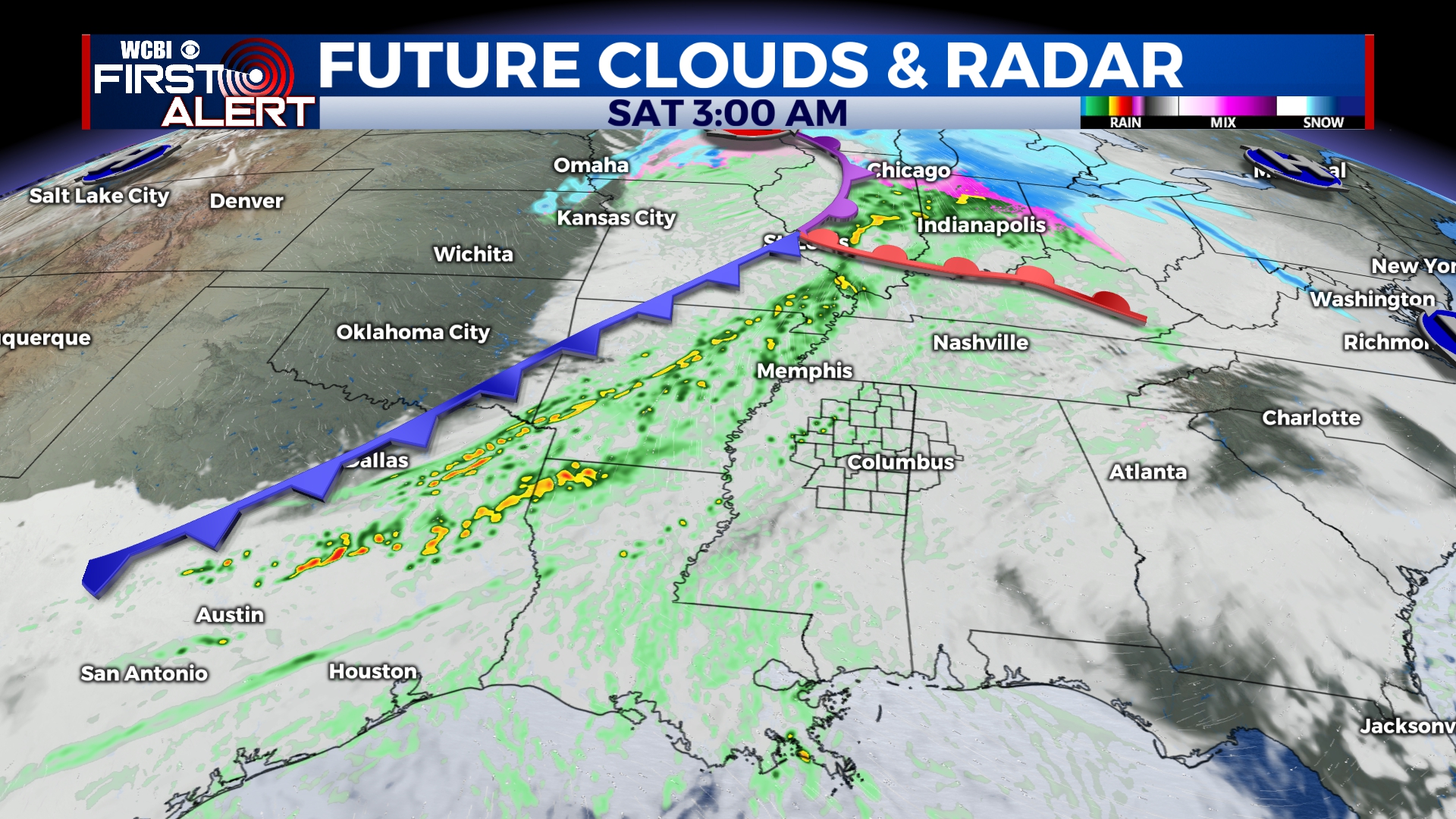
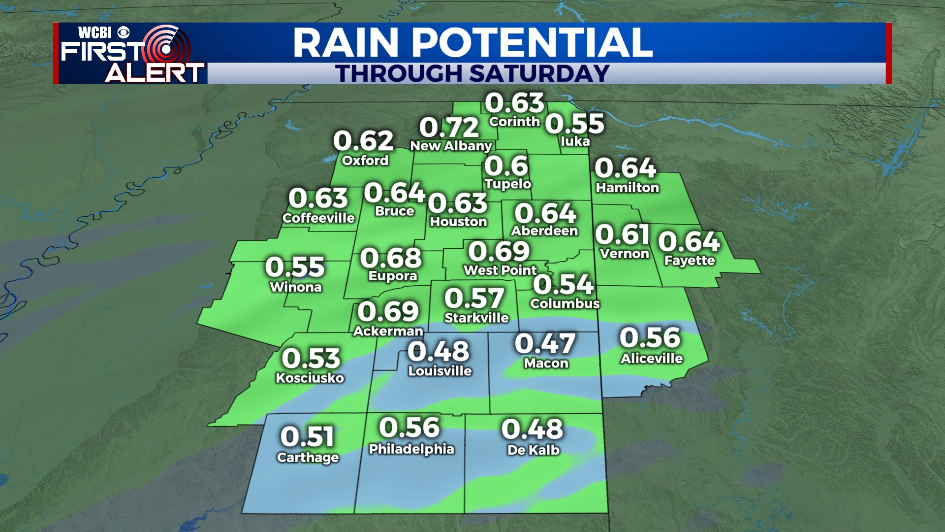
SATURDAY: Rain will be moving into the area by sunrise and continue into the afternoon and evening. A rumble of thunder or two is possible, but no severe weather is expected. Rainfall amounts will generally be under an inch. Highs will be in the mid 60s with wind gusts as high as 30 mph. Rain will exit the area by sunset.
SATURDAY NIGHT: Clouds will slowly clear out of the area as colder air begins to rush in. Lows will be near freezing across the area.
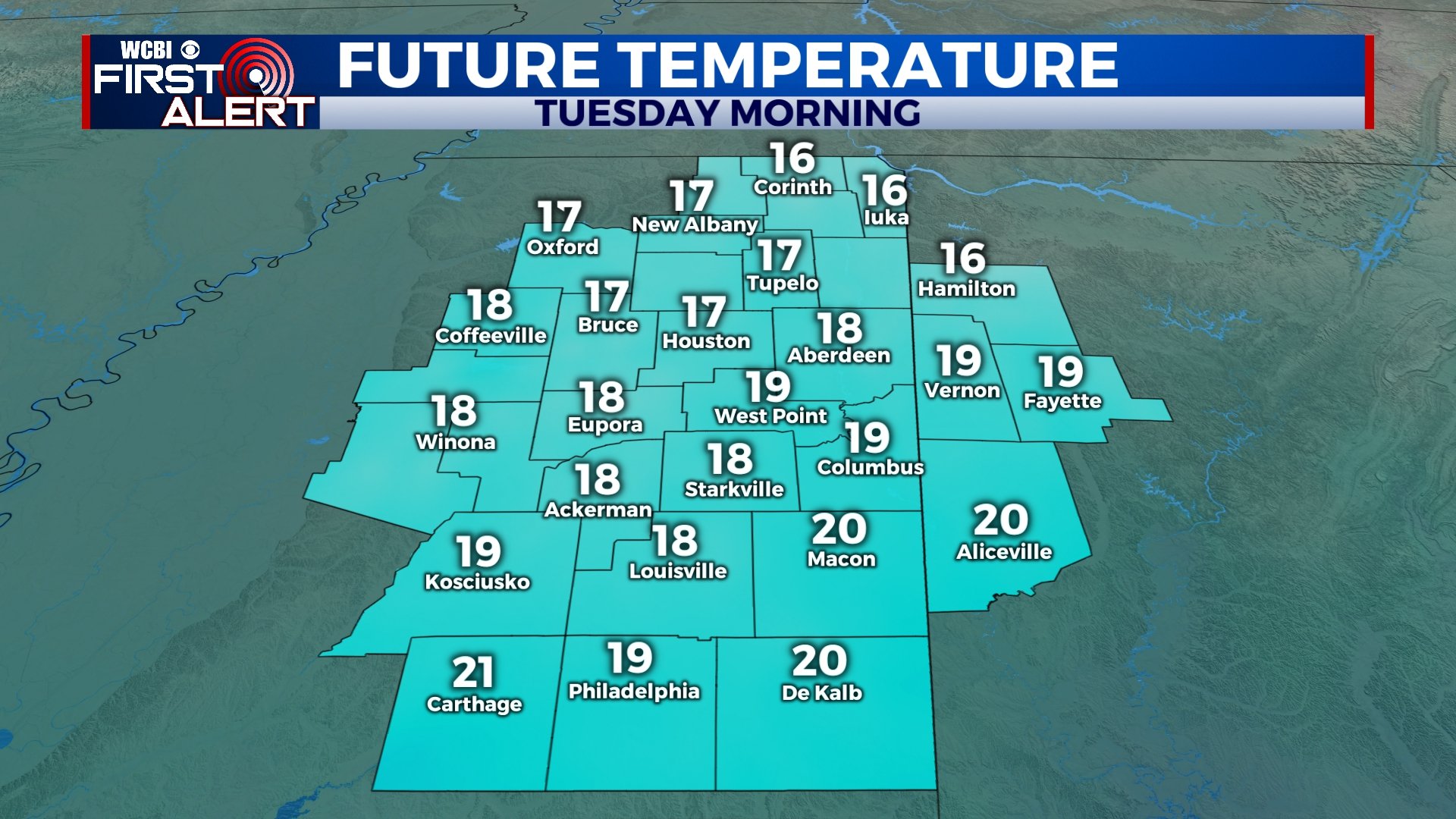
SUNDAY-TUESDAY: We’ll have plenty of sunshine for Sunday and the beginning of the week, but winter-like temperatures will return. Highs will be in the low to mid 40s with morning lows in the 20s. Some areas could dip into the upper teens on Tuesday morning with wind chills even lower.
WEDNESDAY-THURSDAY: Clouds will increase across the area with afternoon highs in the upper 40s on Wednesday and mid 50s on Thursday. We could see some showers and possibly even a storm late on Thursday, but most of that will hold off until Friday.
FRIDAY: Another system will approach the area, bringing the chance for some showers and storms to end the week. Temperatures will be in the 60s by the afternoon.


Leave a Reply