Rain showers with a chance of severe storms
COLUMBUS, Mississippi (WCBI)- Heavy rain showers and storms will be pushing through Mississippi tonight, along with a severe risk. Rain chances will become lighter by the end of the week, returning next week.
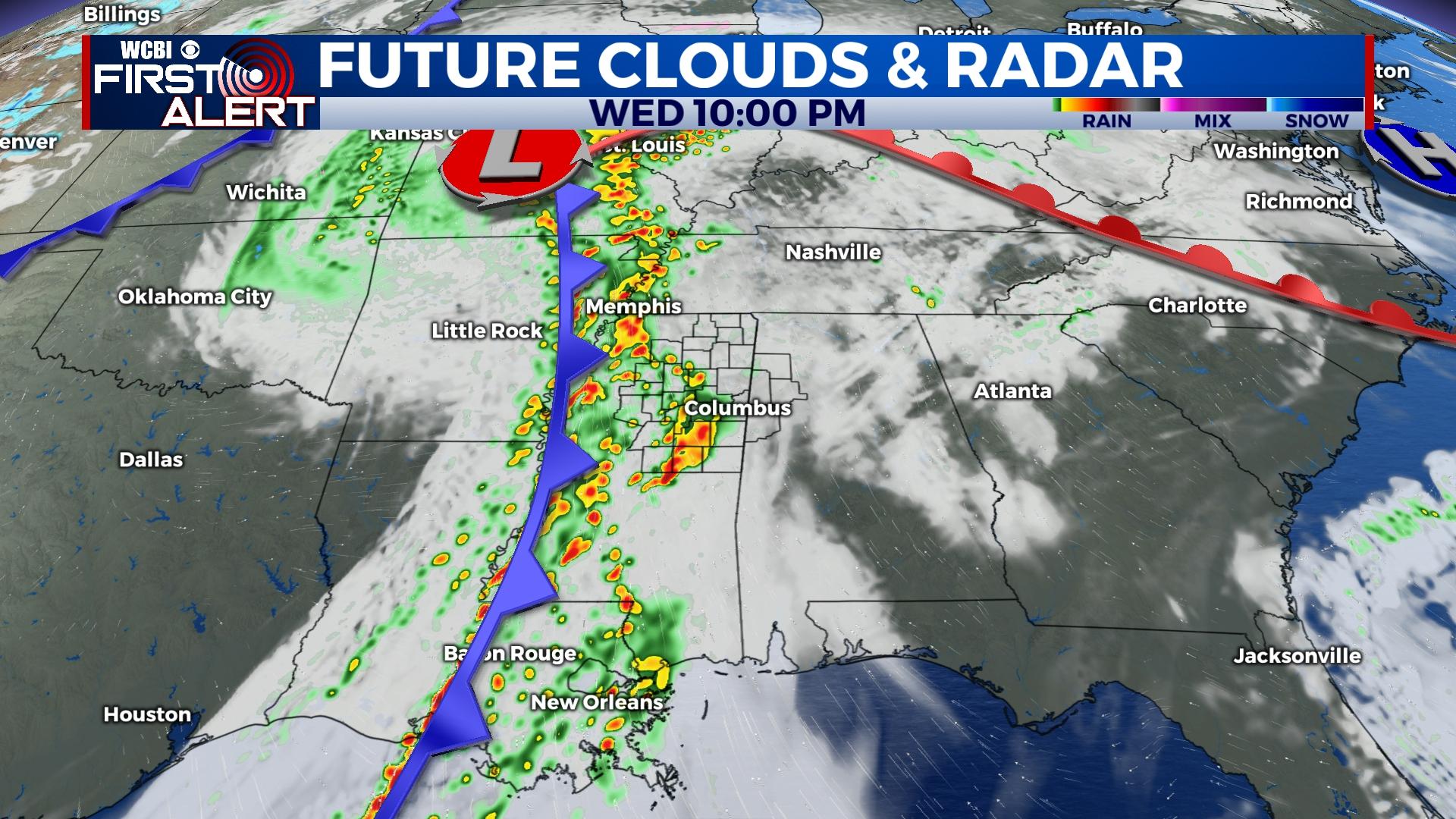
WEDNESDAY NIGHT: A storm’s brewin’! Rain showers and storms will be moving across Mississippi tonight, beginning around sunset. The main line of storms, within our viewing area, has a timeline of 9pm-3am. There is now a split across the state of Levels 1,2, and 3 severe weather risks. Damaging winds and isolated tornadoes cannot be ruled out. Be weather aware tonight. Make sure to have several ways of receiving weather information, for watches and warnings.
THURSDAY: Rain will continue lightly as the system moves off to the East, early Thursday morning. Movement East will clear out the rain and a lot of the heavy cloud coverage. Thursday will have high temperatures in the middle 60s and low temperatures in the lower 40s. Sky conditions will be partly cloudy with the sun peeking through.
FRIDAY: A cold front will be passing through northern Mississippi on Friday. Clouds will build back in, becoming mostly cloudy for the end of the week. There will also be a light chance of seeing some rain showers too. The high temperatures will again be within the low to middle 60s. Low temperatures will drop into the lower 40s.
WEEKEND: Saturday will be the coolest day of the week, only reaching the upper 40s/lower 50s. The heavy cloud coverage will remain into Saturday, with another light chance of seeing a few rain showers and possibly even flurries for some. Low temperatures overnight will be in the lower 30s. Sunday will be slightly warmer and overall mild. The temperatures will reach into the middle 50s, with low temperatures in the middle 30s. Sunday is going to be a great day to enjoy the outdoors before heading inside for the big game.


