Rain slowly exits Friday, cold returns
COLUMBUS, Mississippi (WCBI) – A soggy start to St. Patrick’s Day weekend dries out Friday afternoon, but the freeze threat returns!
ST. PATRICK’S DAY: Locally heavy rain will continue through the morning hours, slowly tapering to light rain by midday/early afternoon. Temperatures will fall into the 40s after lunch as well with chilly northwest breezes.
FRIDAY NIGHT: Clouds will be slow to clear for some, but temperatures should still drop into the 30s area-wide. Freezing temperatures are possible across northwestern MS, but most of the WCBI coverage area should be safe from freezing temps at least for tonight.
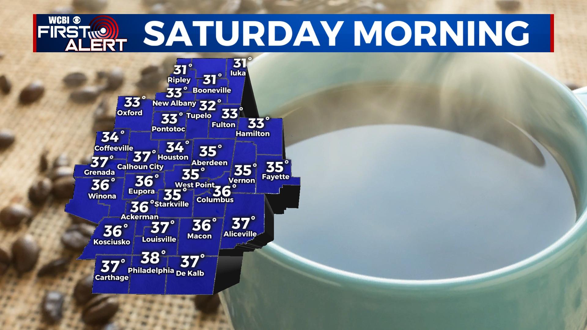
WEEKEND: Variable clouds will continue Saturday as mid/upper-level moisture remains. This will likely keep highs in the lower 50s for most spots. Temperatures will drop into the upper 20s overnight as clouds finally depart. Sunday looks to be coldest, and fittingly so as it is the last full day of winter! Afternoon highs will hold in the upper 40s despite full sun. Lows Sunday night are expected to drop into the middle 20s.
NEXT WEEK: A cool start to the week gets progressively warmer by Wednesday and Thursday. In fact, highs will be in the 70s Thursday afternoon ahead of another strong front. The weather looks to stay dry through Thursday, but showers and storms could move in by next Friday.


