Rain & Storms Coming Back
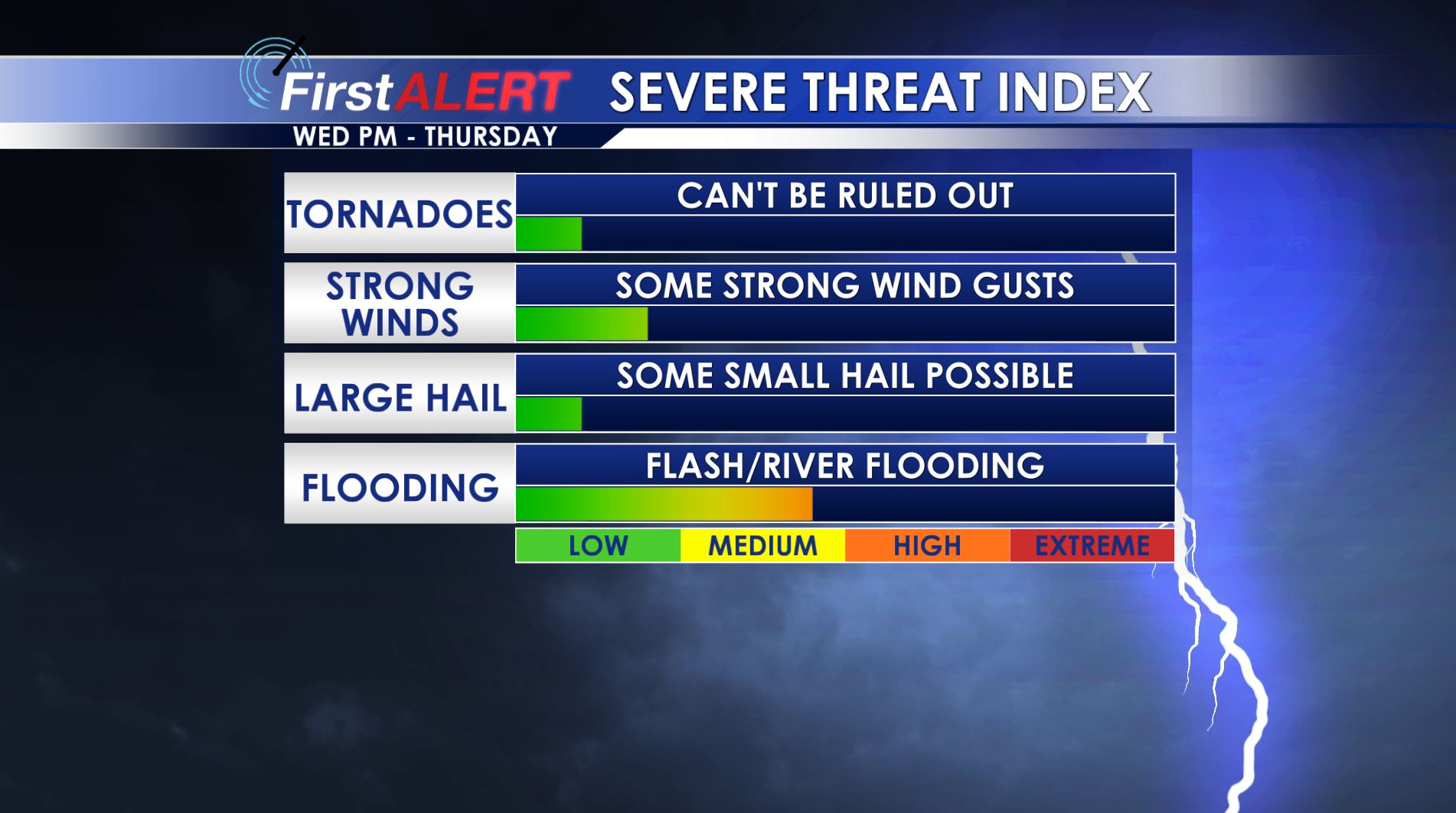
Severe Threat
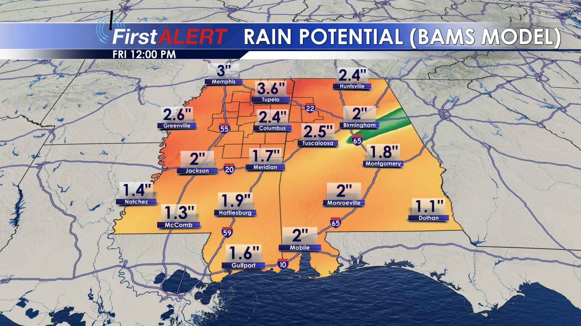
Rain Potential
TUESDAY NIGHT: Clouds will fill back with southeasterly breezes continuing between 10 and 20 mph. Lows should only fall to the low 60s.
WEDNESDAY: Morning showers and isolated storms are possible mainly NW of the Natchez Trace. Additional showers and storms may develop farther southeast during the afternoon and evening. Southerly winds between 10 and 15 will usher in warmer mid to upper 70s. The chance of rain is 50%
WEDNESDAY NIGHT: A line of heavy rain and storms is expected to cross our area. A few isolated strong to severe storms can’t be ruled out. The main severe threat looks to be isolated damaging wind gusts put the tornado threat isn’t zero. Very heavy rain may lead to some flooding. The chance of rain is nearly 100%.
THURSDAY: The heaviest rain and storms are most likely going to occur during the first half of the day with lingering showers during the afternoon. Highs in the upper 60s to lower 70s are likely. The chance of rain is 90%. Total rainfall may be anywhere between 1 and 4 inches.
FRIDAY: High pressure returns for Good Friday and that means a good day of weather! Plan on mainly sunny skies with highs in the upper 60s. Cool low 40s or even upper 30s are possible Friday night.
SATURDAY: Mostly sunny skies and mild weather is likely. This bodes well for any Easter egg hunt scheduled around the region. Afternoon highs should top out in the low 70s.
EASTER SUNDAY: We’re going to keep forecast highs in the 70s but a cold front may sag into the region during the day. If that occurs then we’ll have more cloud cover and even a chance of showers. The rain chance is just 20% but that may change as new information comes in.
Follow @wcbiweather on Facebook, Twitter, Instagram, and Snapchat


Leave a Reply