Rain & Storms Return Thursday
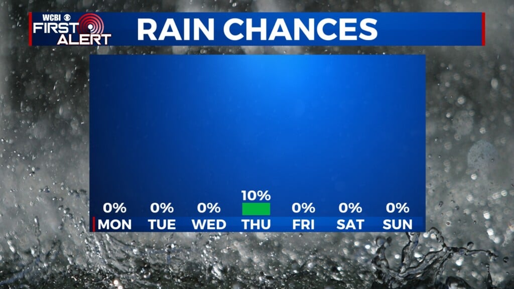
COLUMBUS, Mississippi (WCBI) – Temperatures will remain above average as we head towards the weekend with cloudy conditions as well. Storms are possible Thursday, but likely on Friday.
TUESDAY: Cloud cover will hold strong for your Tuesday with highs in the upper 60s to low 70s. Rain is limited, but a light shower can’t be ruled out. Also, it is going to be a gusty day with wind gusts up to 20 mph possible.

TUESDAY NIGHT: Overnight lows will be in the 50s with passing clouds overhead. The winds will calm down overnight.
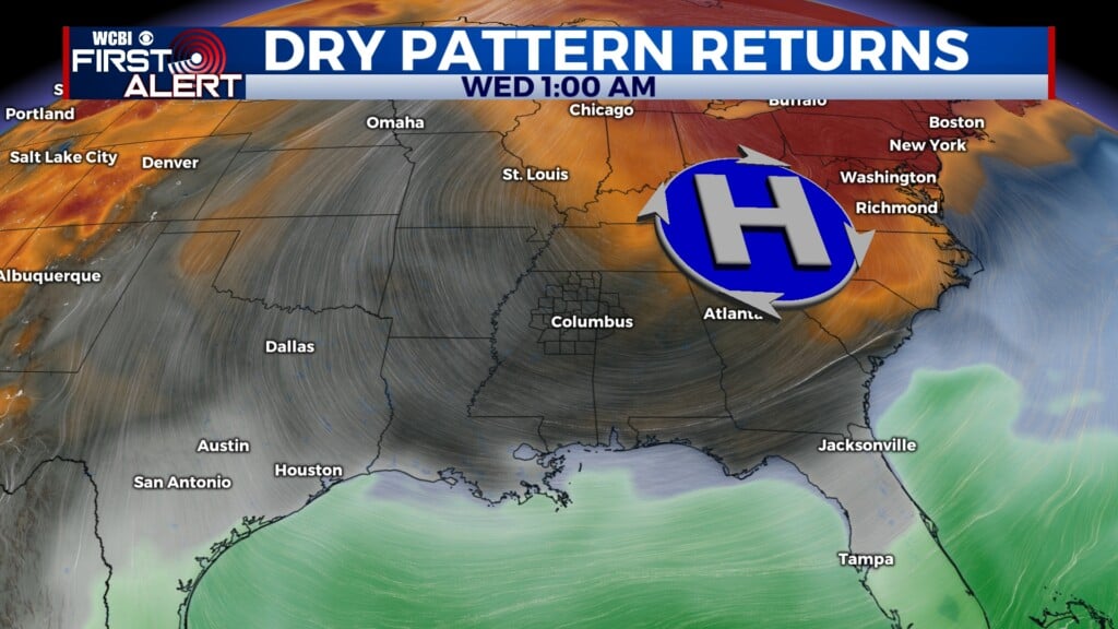
WEDNESDAY: It will be almost copy and paste of Tuesday with highs in the 70s, but it will be a dry day and no wind gusts up to 20 mph. Lows will be in the mid 50s overnight. Make sure to soak up the dry day before rain returns on Thursday.
THURSDAY-FRIDAY: On Thursday, isolated showers are possible throughout the day. The main chances of storms is on Friday though. An approaching cold front will bring storms to the NE portion of Mississippi. Our coverage area is currently under a Level 2 (slight) Risk for severe weather on Friday morning. With that being said, the main threat is wind gusts up to 60 mph. As we are still a few days away, the timing is still uncertain, but it appears the main line of storms will push through Friday afternoon to the evening hours. Make sure to stay up to date with us as we track this out and give you all the updates.