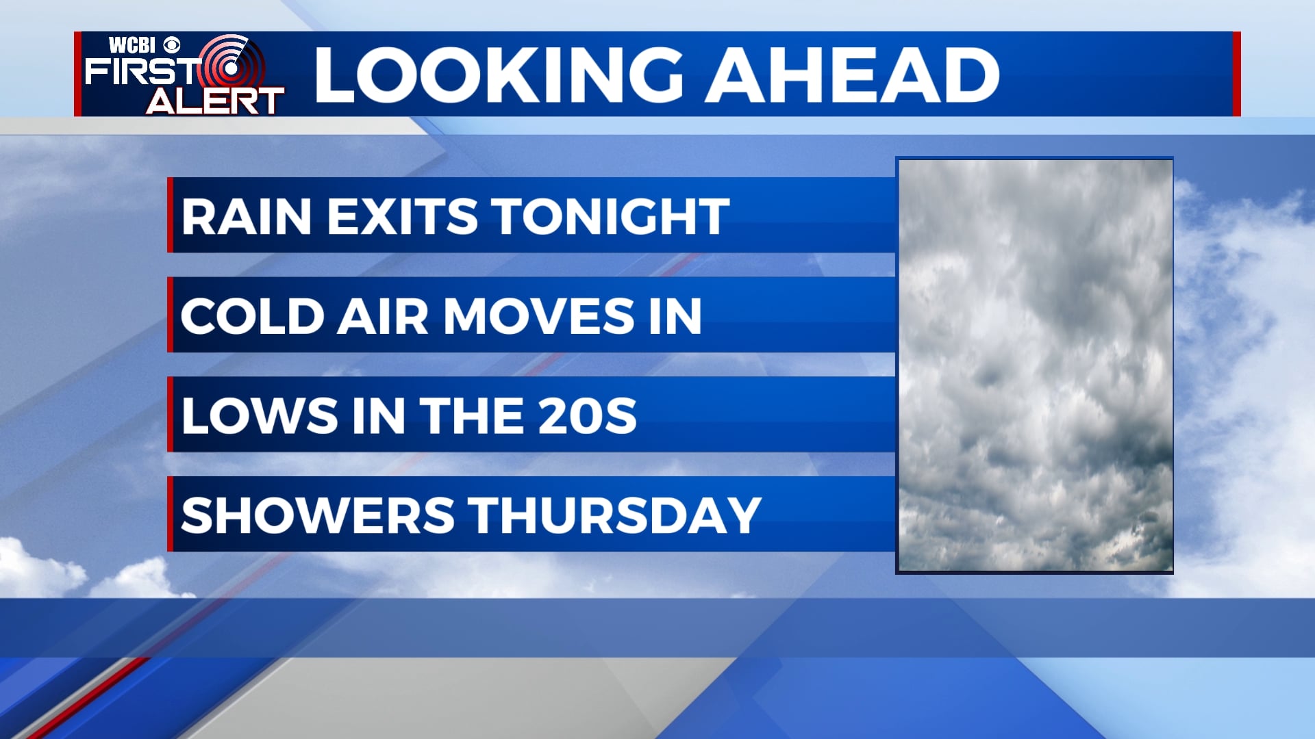
Rain on the way out, cold air on the way in
After a dreary and rainy Sunday, drier weather is on the way along with much colder air. Temperatures will remain below average this week with another chance for showers on Thursday.
SUNDAY NIGHT: Rain will exit by midnight, but clouds will continue through the morning. Temperatures will fall to the upper 30s with a breezy northwesterly wind. Gusts could be as high as 25 mph.
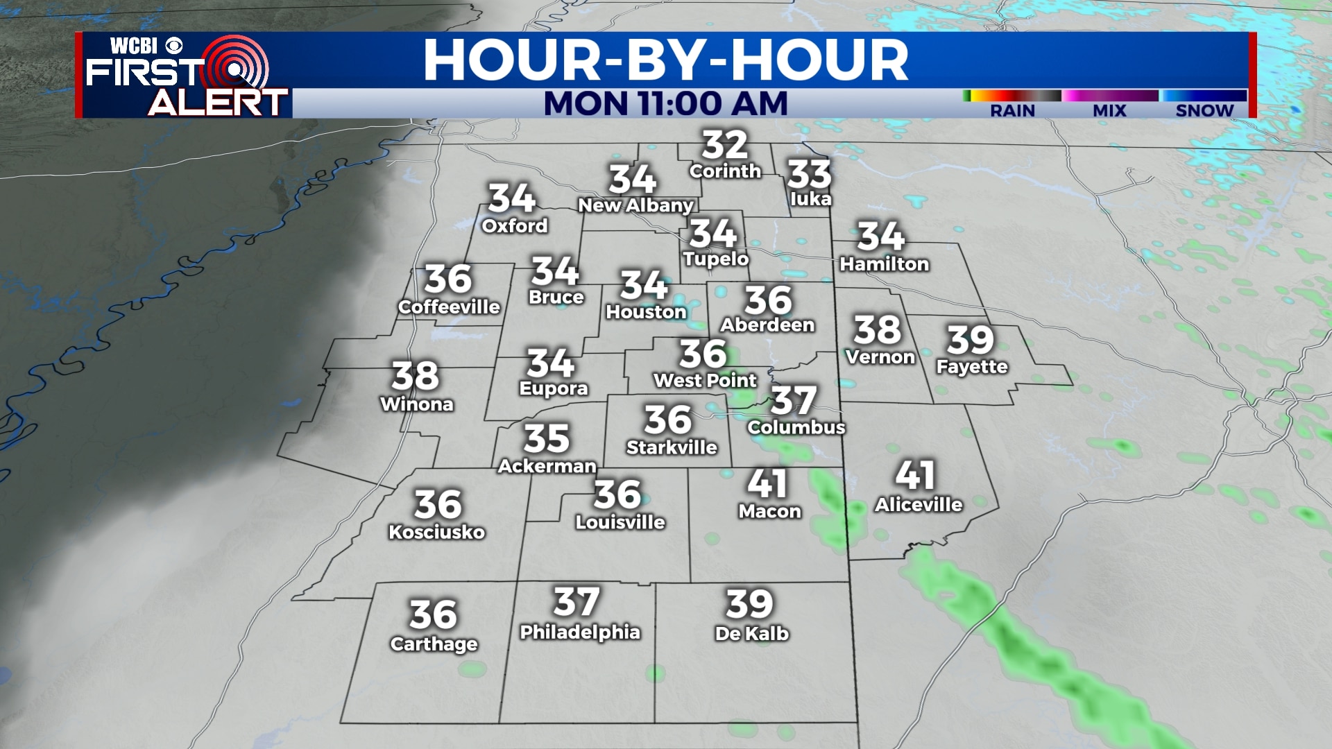
MONDAY: We’ll begin Monday under a mostly cloudy sky, but we will see a few peeks of sun by the evening. While most of the rain will be gone, there is a slight chance of a sprinkle or even a flurry through the morning and afternoon. Temperatures will be in the low 40s in the morning but will fall into the 30s through the day. Winds will remain breezy with gusts up to 25 mph out of the northwest.
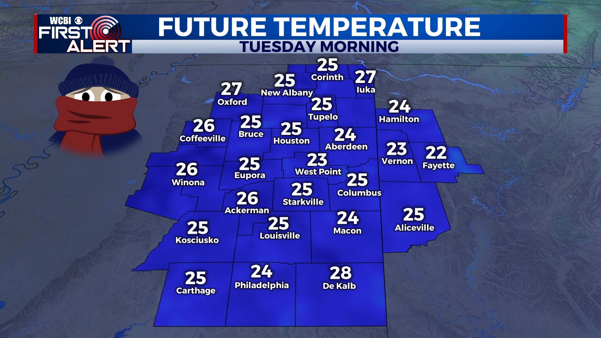
TUESDAY: A hard freeze is expected Tuesday morning as much of the area will see lows in the low and mid 20s. We’ll remain sunny through the day, but temperatures will remain cool with highs only in the mid to upper 40s.
WEDNESDAY-FRIDAY: Our next chance for showers will be late Wednesday night into Thursday, with a sprinkle or two possible on Friday as well. Wednesday morning will also be cold with temperatures in the low and mid 20s. Lows will be in the upper 30s for Thursday and Friday with highs in the 40s and 50s.
SATURDAY-SUNDAY: Temperatures will remain in the 50s for the weekend and, aside from a few clouds, we’ll generally remain mostly sunny.
Follow WCBI Weather on Facebook, Twitter, and Instagram
Follow Meteorologist Trevor Birchett on Facebook and Twitter


Leave a Reply