Rainy Monday, Then Bitterly Cold
Rain will start to move into the area after noon on Monday and will last into the pre-dawn hours of Tuesday. Bitterly cold air will then rush in, which could break some record lows across the area.
SUNDAY NIGHT: A few clouds will start to stream into the area, but it should be a quiet night. Lows will be in the 40s.
MONDAY: The day will start off dry with a few peeks of sun, but a cold front will bring showers to the area after noon. Rain will continue through the evening and into the overnight hours. Highs will be in the mid 60s, but temperatures will fall once the cold front passes.
TUESDAY: Rain will continue into the pre-dawn hours of Tuesday. As colder air rushes in, there is a slight chance for a few snow flurries or ice pellets to briefly mix in before sunrise. However, even if there are a few flakes, ground temperatures will be too warm for anything that may fall to stick. Therefore…no accumulation or problems on the roadways are anticipated. Precipitation will exit the area completely by 7am and we should be dry for the rest of the day. It’ll be a very cold day with highs only in the upper 30s to near 40. Winds will gust as high as 30 mph at times, meaning the wind chill will be in the single digits and teens in the morning hours.
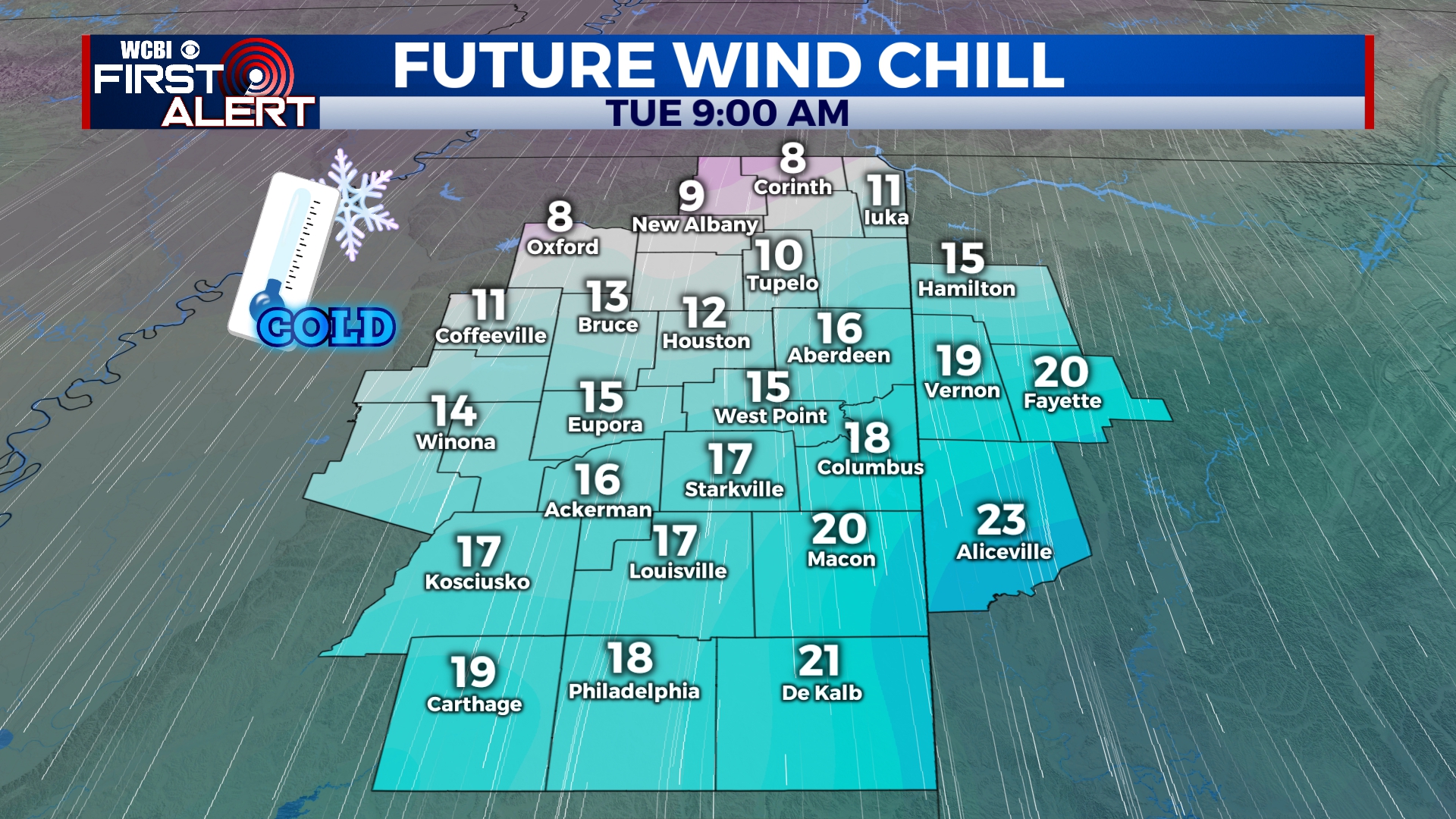
The brisk winds will be bitterly cold on Tuesday.
WEDNESDAY: Record-breaking cold is likely Wednesday morning as temperatures will drop to near 20 degrees before sunrise. The winds won’t be as brisk through the day, so it won’t feel as bitterly cold. Highs will be in the upper 40s.
THURSDAY-SUNDAY: Partly cloudy skies will continue for the end of the week and end of the weekend. Highs will be in the 50s to near 60 on Saturday with morning lows in the 30s.


Leave a Reply