Rainy Weekend Upcoming
Weekend Rain Potential
TONIGHT: Clear and chilly weather sticks around for one more night. Look for lows mainly in the low 30s with light wind.
FRIDAY: A fair amount of sun is going to be enjoyed for the first half of the day but clouds are expected to fill in during the afternoon. There is a 30% chance of showers during the late afternoon and evening. Highs should push back into the low to mid 60s.
FRIDAY NIGHT: Warmer air will continue to push in and that means lows will only be in the 50s. Areas of showers are likely.
SATURDAY: Widespread showers and embedded storms are likely during the day. The chance of rain is 80 to 90%. Highs should remain in the 60s.
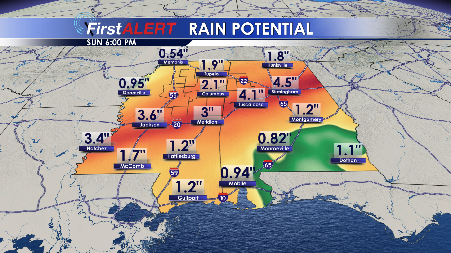
SUNDAY: Additional showers are possible along with a storm or two. Highs stay in the 60s. Total weekend rainfall may be in the 1″ to 3″ range.
MONDAY: We’ll get a little break from widespread rain but a few lingering showers can’t be ruled out. Slightly cooler highs in the mid to upper 50s return for a day.
TUESDAY – THURSDAY: Rain chances stay on the lower end of the spectrum overall but there may be a slight uptick by Thursday. Above average highs and lows stick around.
Follow @WCBIWEATHER on Facebook, Twitter, Instagram, and Snapchat


Leave a Reply