Record heat possible tomorrow but rain returns this weekend
COLUMBUS, Mississippi (WCBI) – SUMMARY: Record heat will remain possible the next few days, then storms arrive Saturday night.
TONIGHT: Mostly clear and seasonably mild with lows in the low-70s. Calm wind.
THURSDAY: Sunny and breezy. Highs in the low-90s. West wind 5-19mph with gusts up to 20 mph.
THURSDAY NIGHT: Mostly clear. Overnight lows in the upper-60s. South wind around 5 mph.
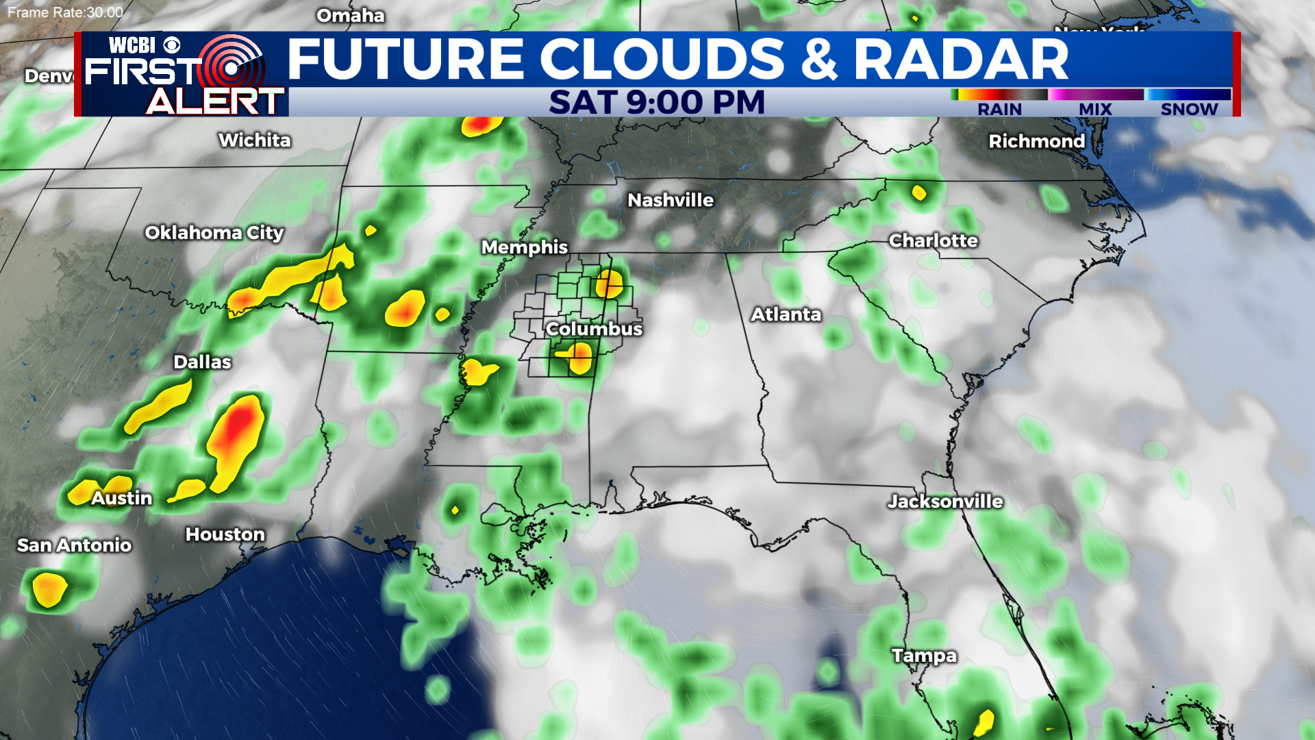
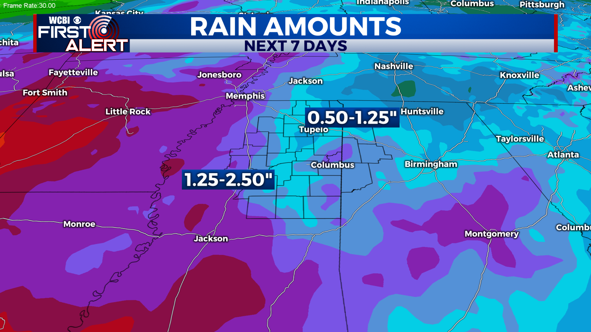
EXTENDED FORECAST: We’ll remain hot and dry through Saturday afternoon with highs in the upper-80s to low-90s daily. Heat index values could reach the upper-90s to low-100s during the afternoon tomorrow and Saturday. Be sure to drink plenty of fluids. Our next chance of rain arrives to the region this weekend. Showers and thunderstorms are likely Saturday night and Sunday. A few storms may be strong with heavy rain, frequent lightning, and gusty winds. An active weather pattern will continue through at least Wednesday of next week.