Record warmth is expected Friday ahead of a stormy start to the weekend
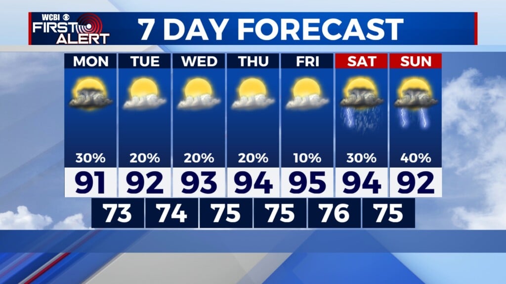
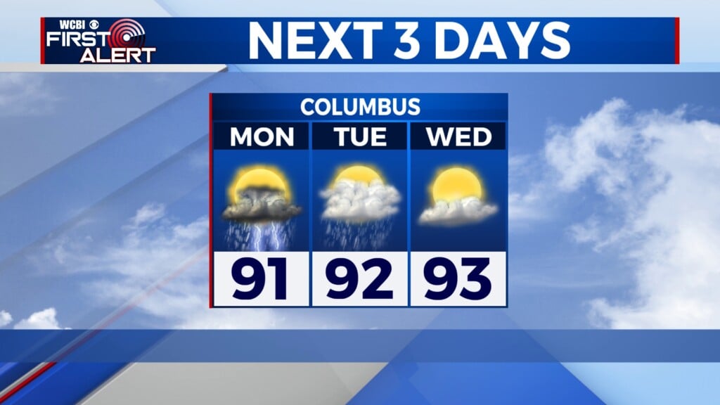
COLUMBUS, Mississippi (WCBI) – SUMMARY: Clouds departed the region this morning, and we were able to warm into the upper-50s under a sunny sky this afternoon.

TONIGHT: Mostly clear becoming overcast with lows in the upper-30s. Calm wind.
THURSDAY: Overcast with a stray afternoon shower possible. Afternoon high temperatures in the mid-60s. Calm wind. Chance of rain: 20%. South wind 5-10 mph with gusts up to 15 mph.
THURSDAY NIGHT: Overcast with scattered showers and perhaps an isolated thunderstorm. Lows in the mid-50s. Southeast wind 3-7 mph with higher gusts in thunderstorms. Chance of rain: 40%.
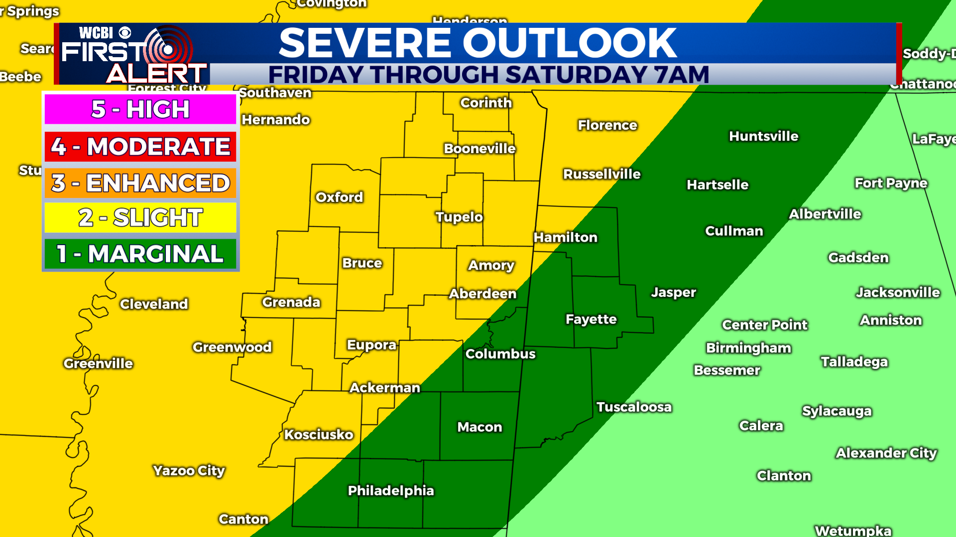
THIS WEEK: We are set to close out the week with an active weather pattern across our region. Scattered showers and thunderstorms are possible Friday afternoon as a warm front lifts over the region from the south. Overnight Friday into Saturday morning, a strong cold front will arrive from the northwest and lead to widespread showers and thunderstorms. A few storms may be strong to severe with frequent lightning, heavy rain, and gusty winds. An isolated tornado may also be possible. The front will move through by Saturday afternoon as a dry air mass settles in for Saturday night and Sunday.