Record warmth possible tomorrow followed by storms tomorrow night
COLUMBUS, Mississippi (WCBI) – SUMMARY: All is quiet across the region today, but severe storms are back in the forecast tomorrow ahead of a strong cold front.
TONIGHT: Overcast with isolated showers. Lows in the upper-30s. South wind around 10 mph.
FRIDAY: Scattered showers and thunderstorms developing after 2pm. A few storms may be severe. Afternoon high temperatures in the upper-70s to low-80s. Chance of rain: 40%. South wind 5-15 mph with gusts up to 30 mph.
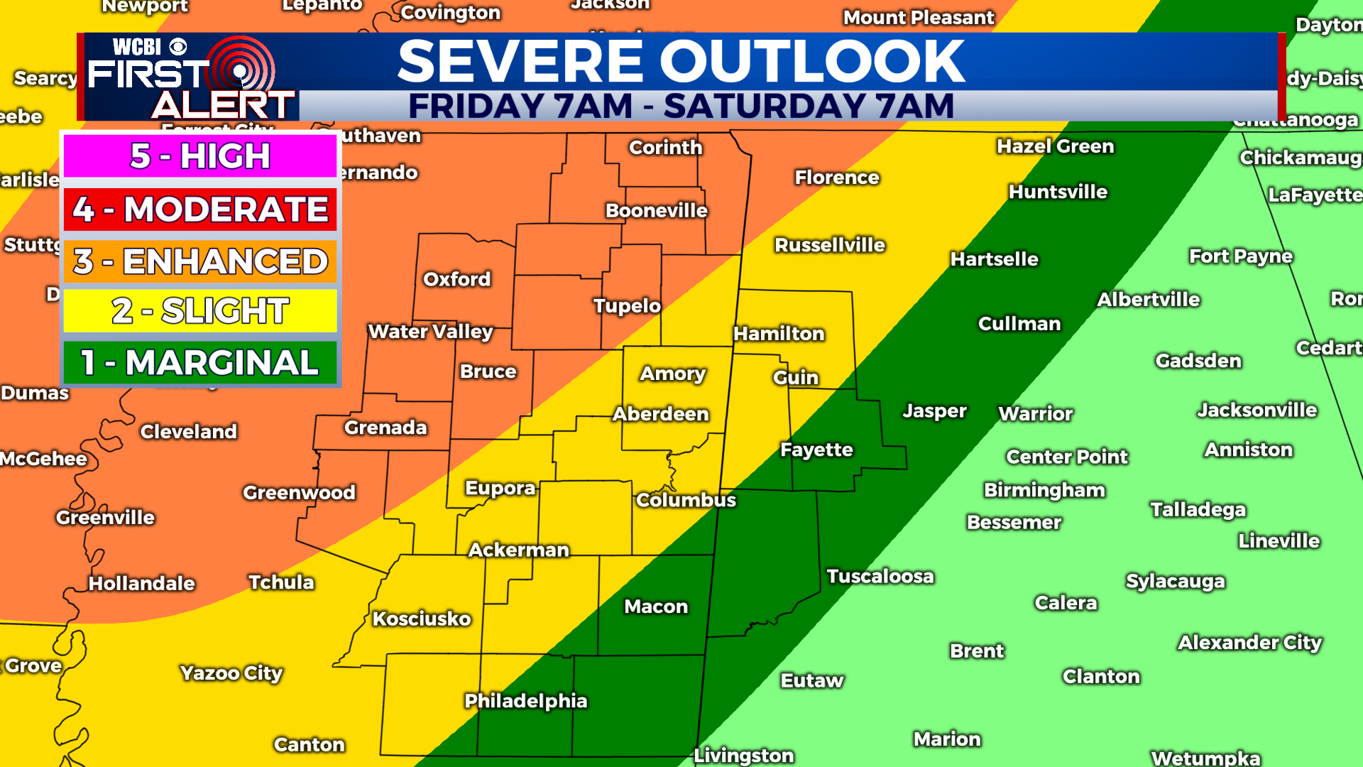
FRIDAY NIGHT: Scattered thunderstorms before 2am (chance of rain: 40%) becoming likely after 2am (chance of rain: 90%). Some storms may be severe. Lows in the mid-60s. South wind 5-15 mph with higher gusts in thunderstorms.
***Have a way to receive severe weather warnings overnight Friday into Saturday early morning! And that method should be loud enough to wake you up should a tornado warning be issued for your area!***
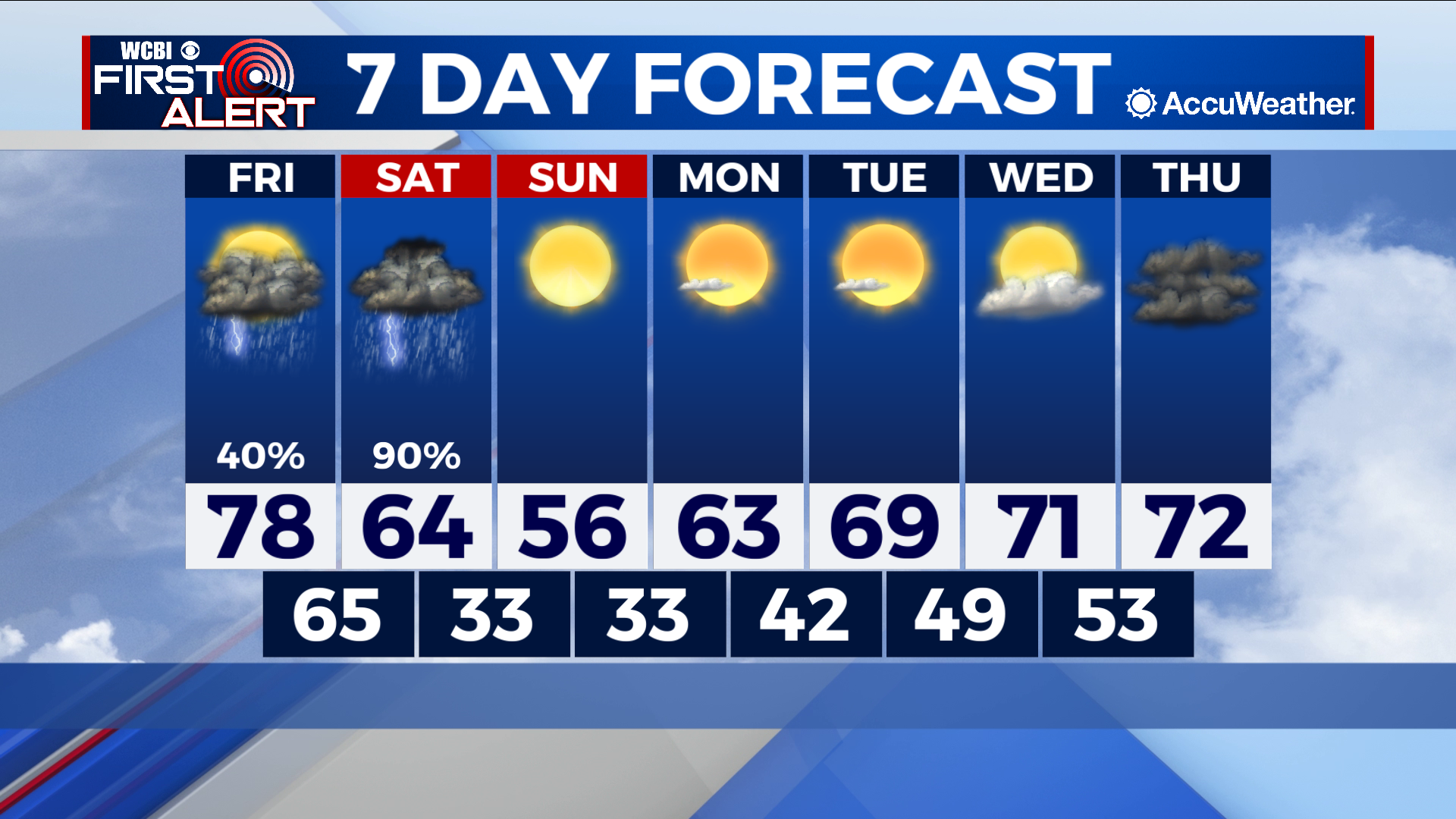
THIS WEEKEND: Showers and thunderstorms will continue across the eastern and southern portions of our area. Storms should move into central Alabama by 8am, along with the threat of severe weather. A northerly breeze Saturday afternoon will usher in cooler, dry air with afternoon highs in the mid-50s Sunday.


