Round 3 of severe threat rolls in Tuesday
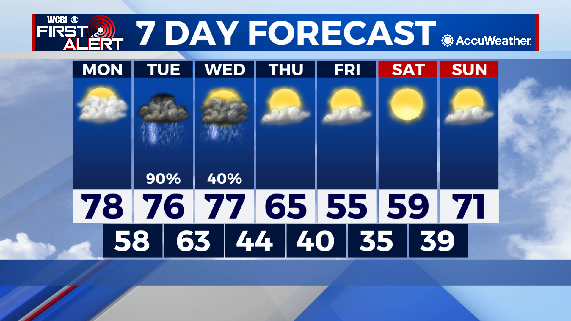
COLUMBUS – SUMMARY: The week starts warm and comfortable before Tuesday yields yet another severe threat, although this time around the risk factor is significantly reduced. Wednesday brings yet another chance for rain, as a cold front moves through the area and drops highs into the mid 50s by Friday.
MONDAY: Highs top out at their warmest of the week in the upper 70s. Partly cloudy skies accompany, and some sunshine could push temperatures to 80 in some counties. The day stays dry, and lows bottom out in the upper 50s overnight.
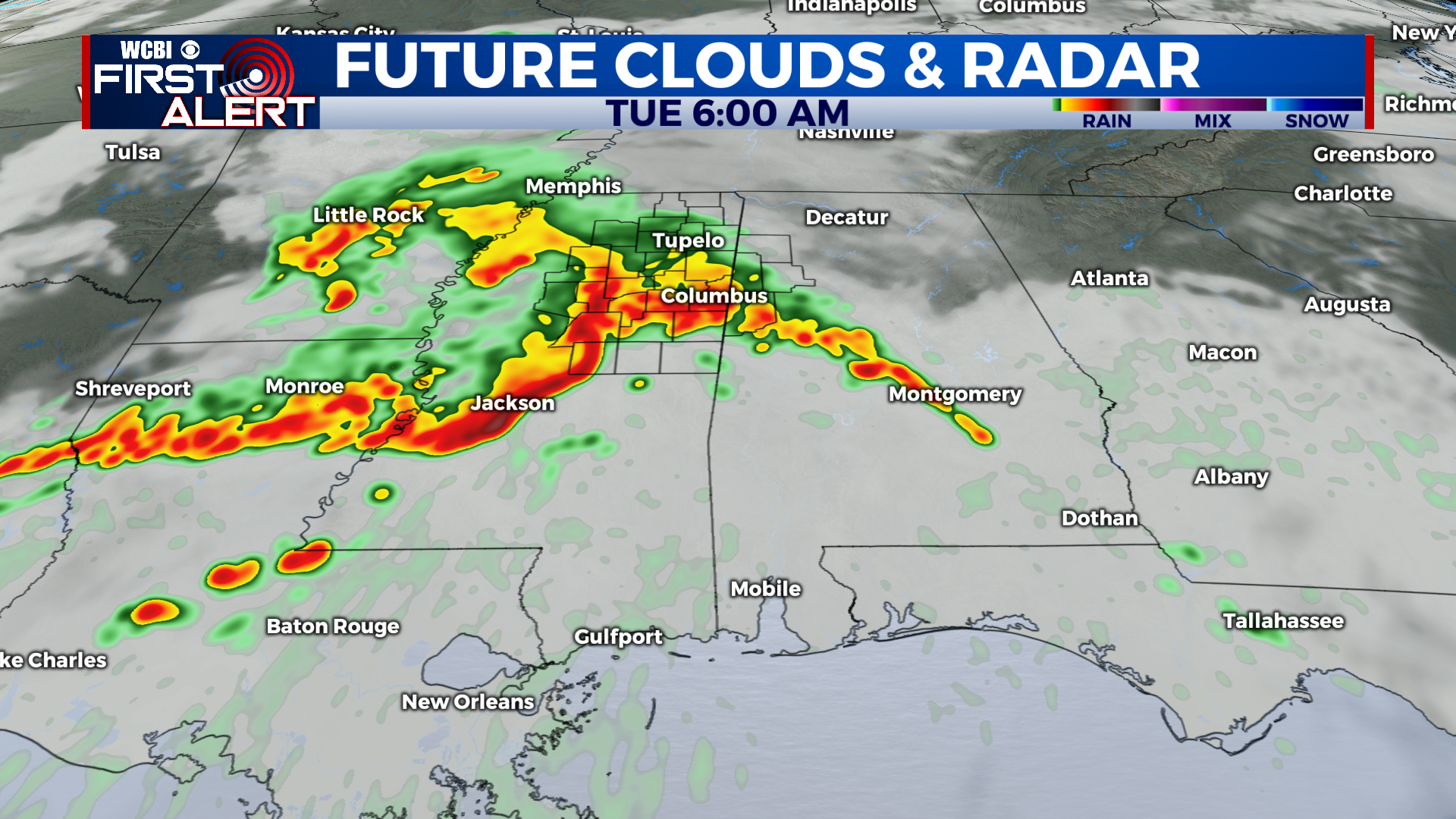
TUESDAY: This week’s storm set does not pose nearly as much of a hazard as the past few weeks but caution should still be taken when making plans Tuesday. The primary hazards with storms Tuesday will be strong winds and some localized flooding, although the odd tornado cannot be ruled out. Timing at the moment puts the system in our area around sunrise with a mid-afternoon exit time. Timing and severity can change however, and we will keep you updated on the situation as it evolves.
REST OF THE WEEK: A cold front Wednesday brings with it the last major rain chance of the week before conditions dry up. The front will knock highs down into the mid 50s by Friday, slowly rebounding into the 70s by Sunday. Lows will also take a hit, dropping into the mid 30s by overnight Friday. Skies will generally clear up after Wednesday with some partly cloudy conditions expected near the end of the week.