Rounds after round of storms set up over next week
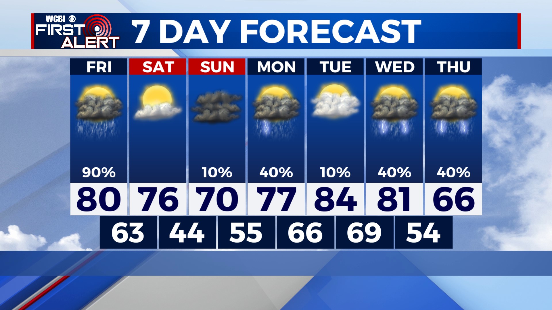
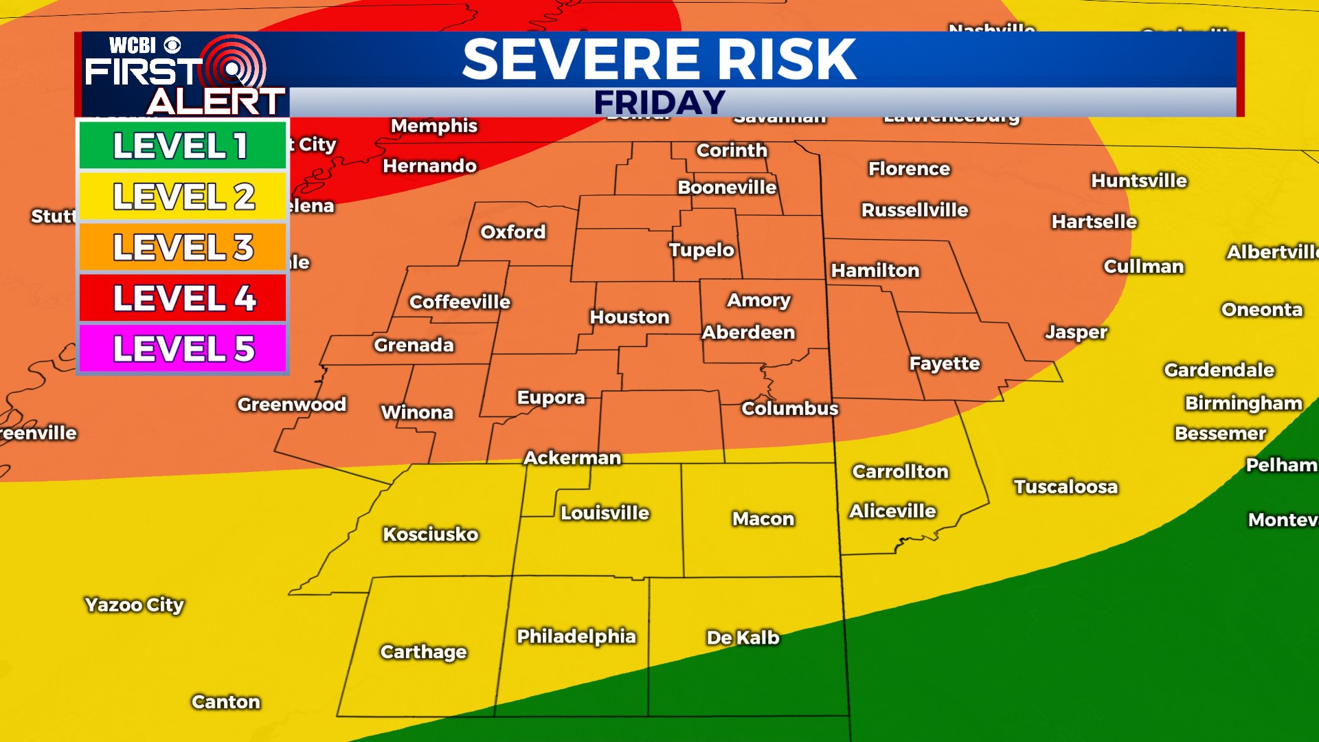
COLUMBUS – SUMMARY: Yet more chances for storms take shape next week as our next big severe weather threat takes aim Friday night into Saturday morning. Mild to warm conditions prevail throughout the week.
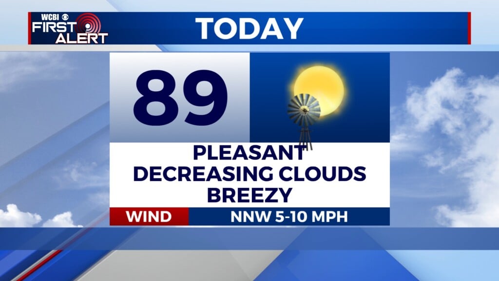
FRIDAY: Warmer temperatures in the low 80s and strong southerly winds will boost instability in the region ahead of our severe weather threat later that night. At the moment, the greatest risk for severe weather is concentrated in the northern half of our viewing area with damaging winds and a few tornadoes being the risk factors there. We will continue to update you on the situation as it evolves.
SATURDAY: Much clearer weather awaits Saturday with a bit of sunshine and highs in the upper 70s. Lows drop into the mid 40s overnight. No rain is expected Saturday.
SUNDAY: More clouds return to the area as highs top out in the low 70s. Lows bottom out in the mid 50s. Other than the lone shower no rain is expected Sunday.
REST OF THE WEEK: Multiple rain chances shape up next week, including at least one risk for Severe weather Tuesday into Wednesday. Temperatures generally remain warm in the afternoons in the 80s until a cold front mid week brings highs into the mid to upper 60s. Lows remain between the 50s and 60s throughout the early part of next week.