Rounds of rain through mid-week
COLUMBUS, Mississippi (WCBI) – Several more rounds of rain will be moving through Mississippi through the middle of the week. Flooding is going to be a big concern. Sunshine will be returning end of week and into the weekend.
TUESDAY NIGHT: Additional rain with embedded storms are expected to move back in late and last through much of the night. Additional rain amounts of 1-2″ are possible, continuing the flood risk.
A flood watch is continuing for most of our viewing area until WEDNESDAY NIGHT at 7PM. Other areas continue until THURSDAY MORNING.
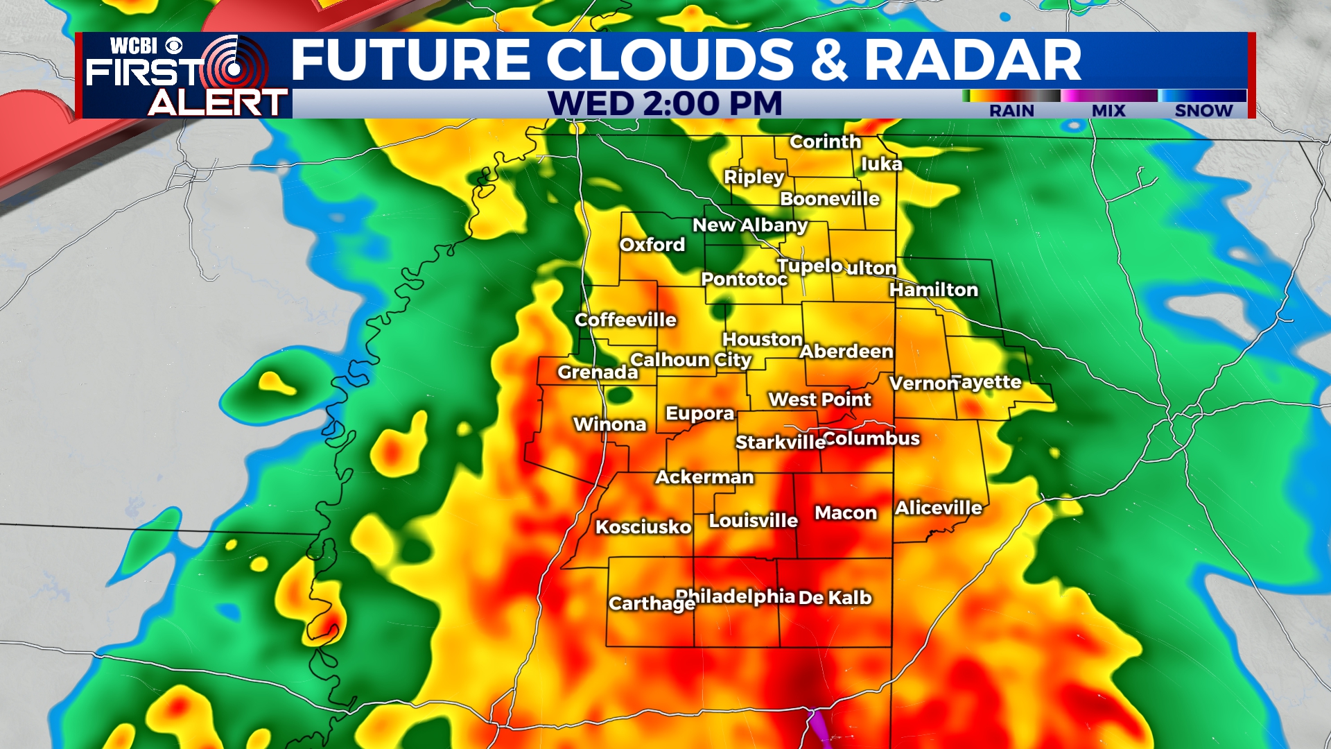
WEDNESDAY: Uncertainty remains quite high as to the exact evolution of things, but there will be a lot happening across Mississippi. We expect widespread rain and embedded storms to move into the region by mid to late morning, lasting into the afternoon hours. If enough unstable air can return northward, a severe threat would accompany this activity. Ongoing heavy rain to our south may block the inflow of such unstable air and reduce our severe threat. Another wild card is a faster evolution, with unstable air recovering quickly enough by late afternoon & evening to fuel new storms forming. Flooding and damaging winds will be our main concern for NE MS.
THURSDAY: The heavy rain will be mostly cleared out by late Thursday morning. Clouds and lingering showers are possible to continue the rest of the day. Temperatures will initially start in the 50s but should recover into the 60s.
FRI/WEEKEND: End of the week and weekend sunshine! We expect increasingly warm afternoons (possibly the 80s) with pleasant mornings and plentiful daytime sunshine. Enjoy it after this soggy week!