Sally to bring rain by Wednesday and Thursday
All eyes are on Tropical Storm Sally as the storm tries to intensify in the Gulf of Mexico. After landfall, Sally will likely approach our area and bring a threat of heavy rain by the middle of the week. We are also looking at the chance of a cold front which could dry us out and cool us down by next weekend.
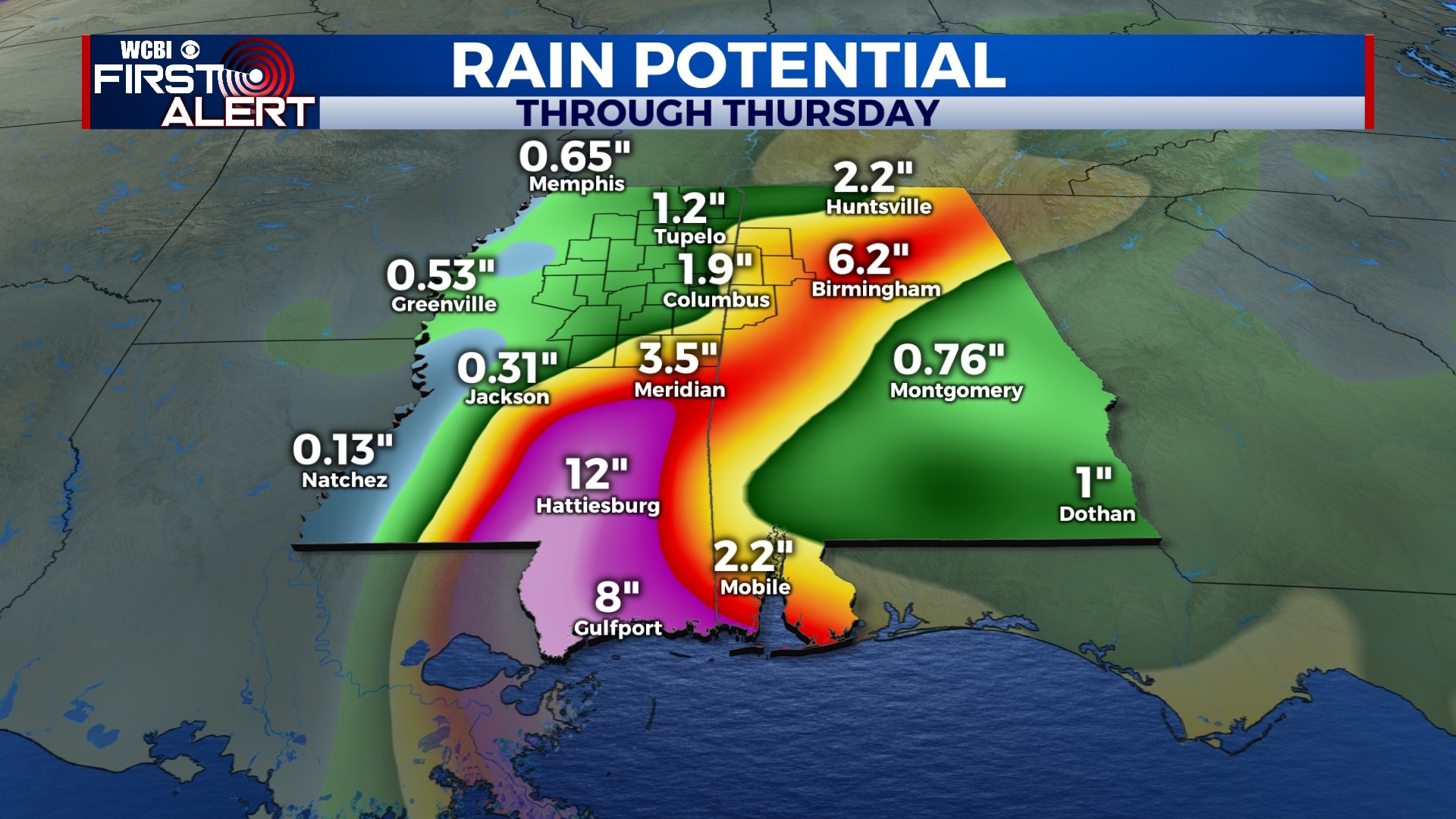
TROPICS: As of 5 pm Sunday, Tropical Storm Sally was located in the eastern Gulf of Mexico. Winds were sustained at 60 mph and the pressure was down to 998 mb. The storm is expected to eventually strengthen into a category 1 hurricane with winds of 90 mph before landfall in southeastern Louisiana on Tuesday. Major storm surge, flooding rain, and wind will be issues along the LA/MS/AL coasts, with heavy rain continuing to be an issue further inland.
SUNDAY NIGHT: Any rain will exit the area by 10 pm, leaving us dry and mostly cloudy overnight. Temperatures will fall to the low 70s with light northeasterly winds.
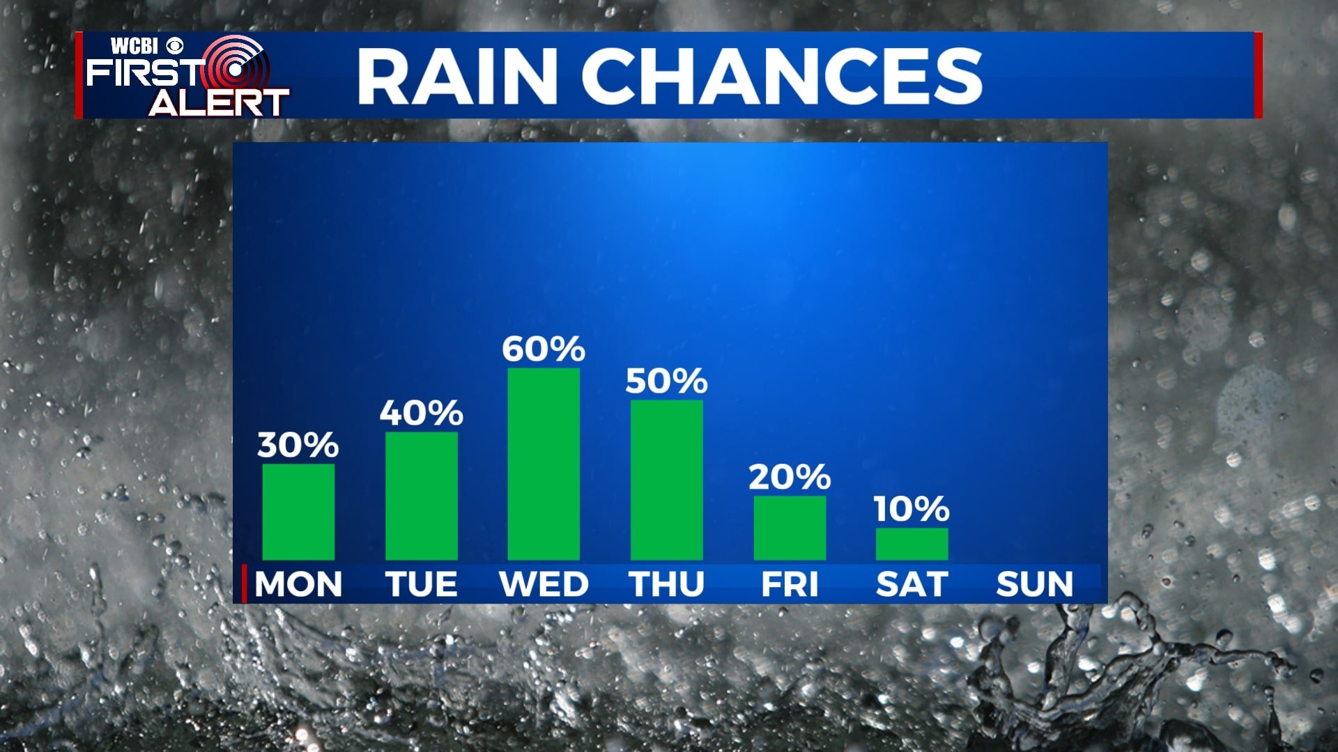
MONDAY-TUESDAY: Chances for some pop-up storms will remain in the forecast for Monday and Tuesday, but any rain won’t be very widespread. We’ll generally see a mix of sun and clouds with temperatures climbing to the upper 80s each afternoon. Overnight lows will be in the low 70s.
WEDNESDAY-THURSDAY: Impacts from the remnants of Sally will likely be felt in our area by Wednesday and Thursday. We’ll see several rounds of rain showers starting Wednesday afternoon and through the day on Thursday. Depending on the exact positioning of the storm, 1-3″ of rain can be expected for many locations, in addition to gusty winds at times. Because of the way this storm is tracking, areas to the north and east (Oxford, New Albany, Tupelo, Coffeeville, etc.) may not see as much rain as other spots. The tornado threat with this system looks to remain to our south and east. Rain will help to keep us cooler, with highs only near 80 each day.
FRIDAY-SUNDAY: Our first sample of fall could come with a cold front moving through the area by the end of the week. This will help to move any leftover rain out of the area and knock our temperatures down a bit. Overall, for Friday and the weekend, we’re looking dry and partly cloudy with highs in the low to mid 80s. Morning lows will be in the low 60s, with a few upper 50s not out of the question.


Leave a Reply