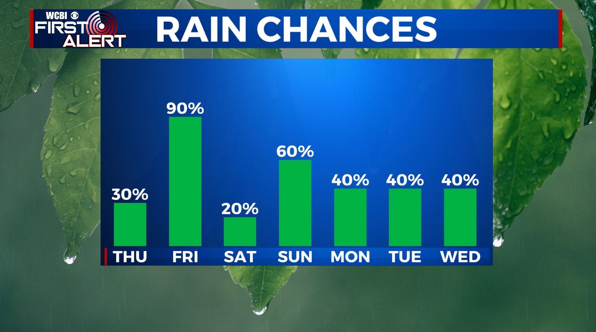
Scattered rain chances Thursday; Better chances on Friday
SUMMARY: Temperatures will be warming up to near 80 again on Thursday but rain chances are going to remain low and very scattered. The best chance for widespread, heavy rain and perhaps some storms is looking to be Friday as a cold front presses into north Mississippi and Alabama. No severe weather is expected. Cooler air settles back in for the weekend with more on/off again rain chances through early next week.
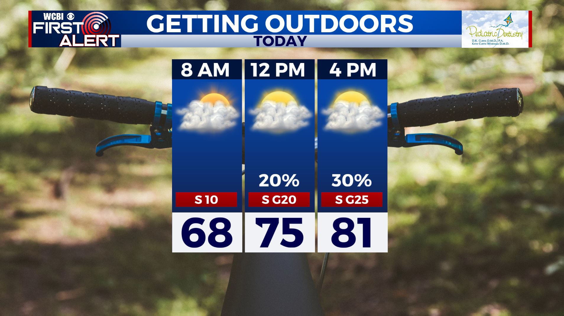
THURSDAY: Partly to mostly cloudy, breezy, and warm. Highs ranging from the upper 70 to lower 80s. Southerly winds 10 to 20 mph with gusts perhaps over 25 mph. Spring officially begins at 10:49 p.m.

THURSDAY NIGHT: Breezy and warm. Lows in the upper 60s to around 70. A few showers and storms are possible, especially across our northwestern counties.
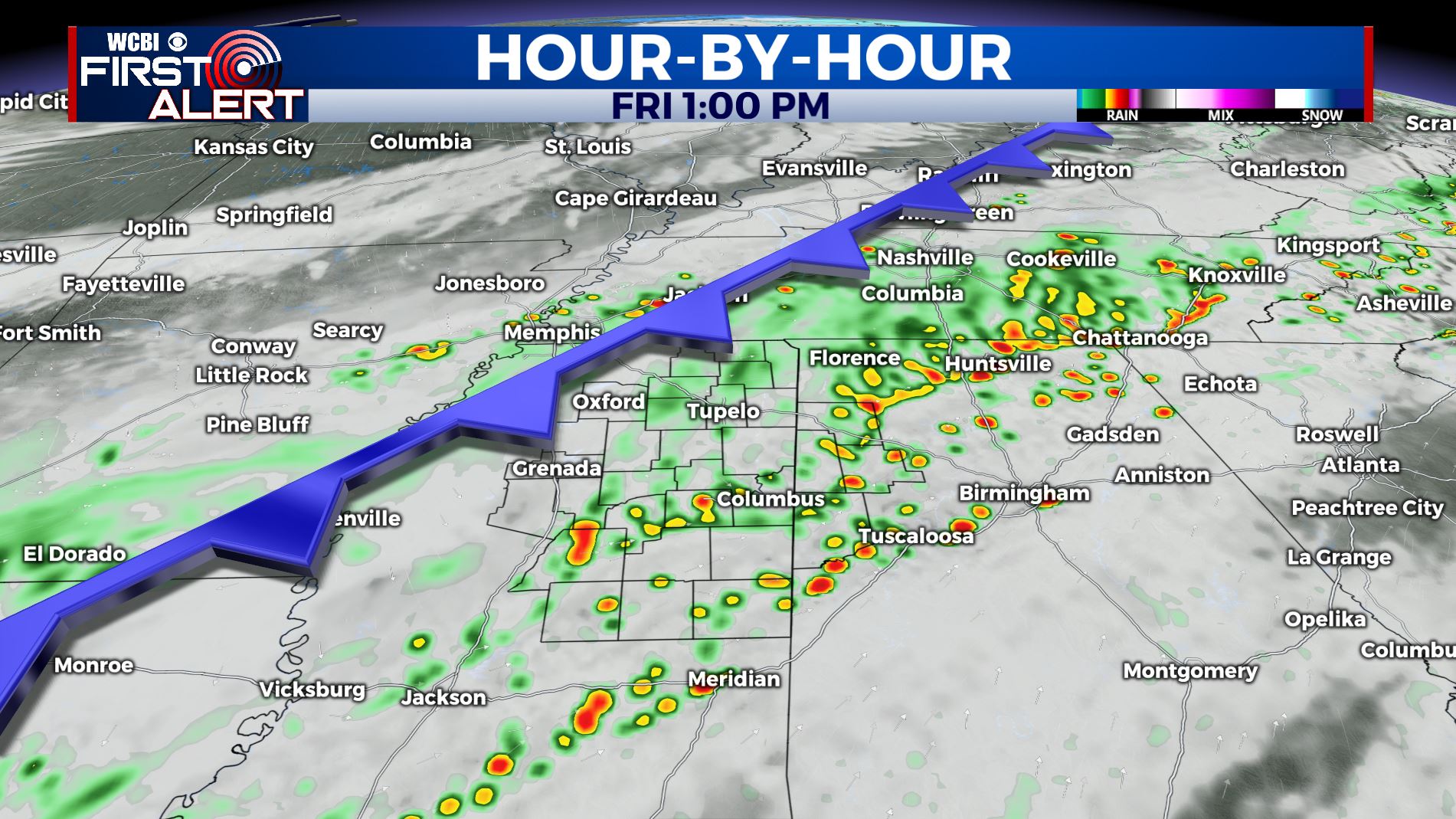
FRIDAY: Staying mild with highs in the lower to mid 70s. A cold front moving through the region will produce a good chance for showers and storms. No severe weather is expected, but we could see some heavy downpours with 1-3 inches possible. Highs in the lower 70s.
FRIDAY NIGHT: Lingering showers and cooler. Lows in the upper 40s.
SATURDAY: The chance of some morning showers. Otherwise variably cloudy and quiet with highs in the 60s.
SUNDAY: Mostly cloudy with areas or rain likely. Highs the 50s and 60s.
MONDAY: Mostly cloudy with another chance of on/off again rain chances. Highs back up into the mid 60s.
MIDWEEK: Staying unsettled with a continuing chance of some rain and storms. Temperatures moderate back into the 70s and lower 80s by Wednesday.
Stay connected with @WCBIWEATHER on Facebook, Twitter, Instagram, and the WCBI News App


Leave a Reply