Scattered showers Tuesday, severe storms possible Wednesday
COLUMBUS, Mississippi (WCBI) – Warm, humid conditions continue with strong to severe storms possible Wednesday afternoon and evening.
TUESDAY: Expect the sky to be mainly cloudy much of the day with passing showers possible. Outside of occasional rain, the weather stays warm and humid with highs in the middle 70s.
TUESDAY NIGHT: A few showers or rumbles of thunder are possible overnight with lows in the 60s.
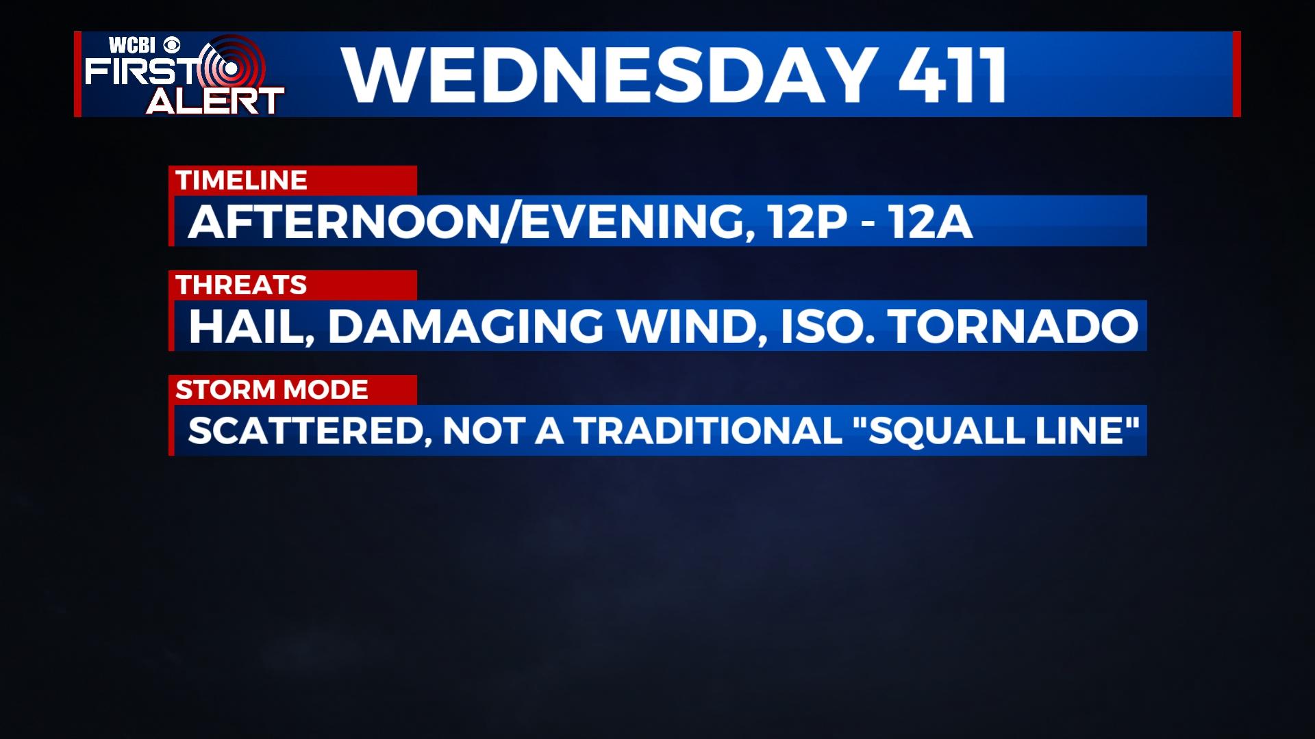
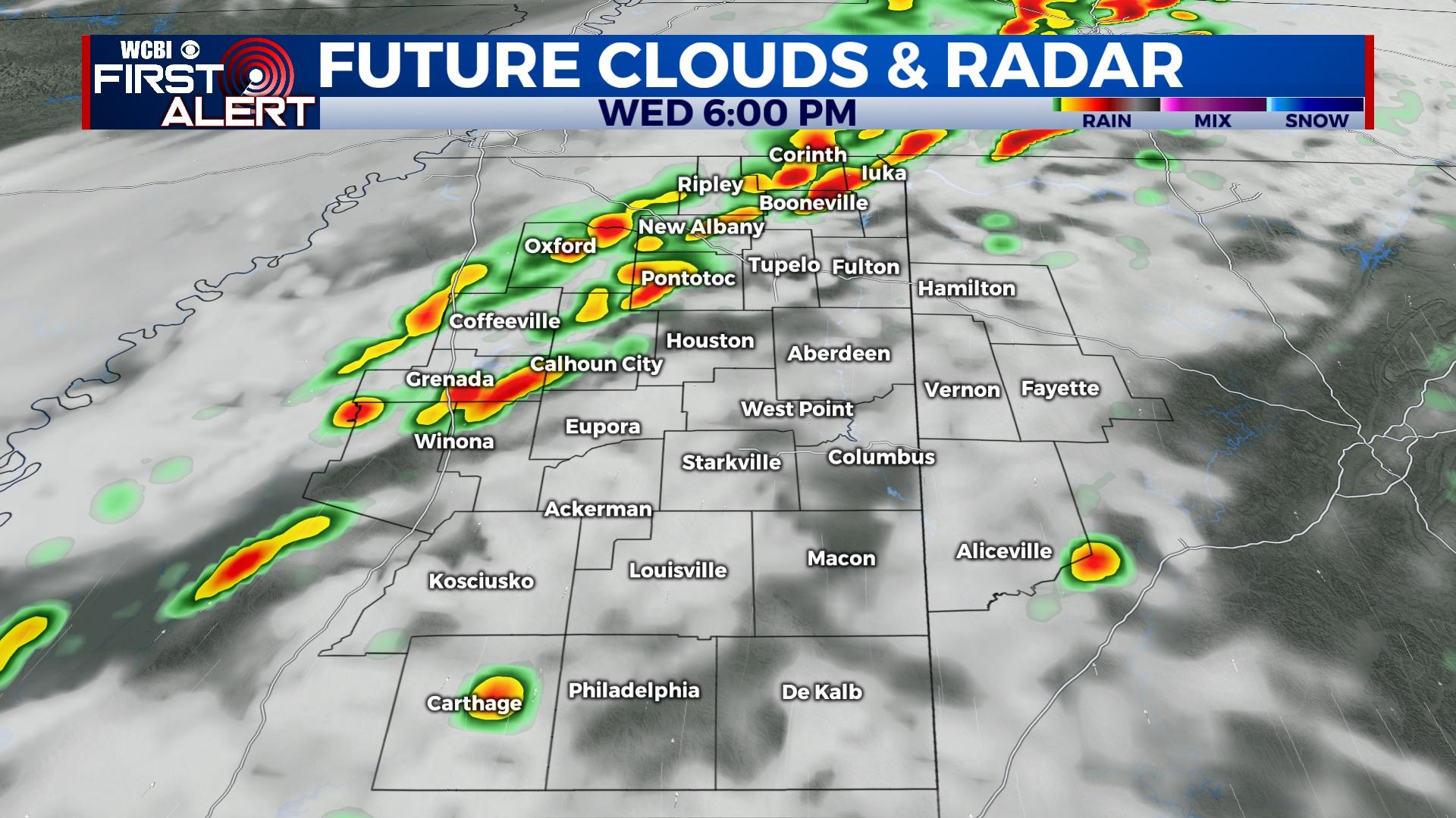
WEDNESDAY: Early morning showers should give way to a midday lull in activity. Isolated to scattered storms are expected to then develop in the afternoon hours. Environmental conditions favor storms to potentially grow severe with all modes of severe weather (hail, wind, tornado) possible. Since storm mode will likely be cellular, a tornado threat could be more pronounced…especially if low-level shear increases. Otherwise, hail and damaging wind will be possible with the strongest activity. The main time frame to watch is the afternoon and evening hours, from roughly 12p to 12a.
END OF WEEK: A brief reprieve in rain is expected Thursday, but returning warm, humid air Friday could lead to additional showers. Highs both days will stay in the 70s.
WEEKEND: A dynamic system is still expected to sweep through the region, bringing about a major temperature swing along with more rain and storms. For now, the best chance of heavy rain and storms will come Saturday afternoon and Saturday night. The latest models remain inconsistent on the exact placement of the best ingredients for severe weather. Having said that, these types of systems historically produce at least some degree of risk for stronger weather, and Saturday will need to be watched for severe potential. MUCH colder air is set to move in Sunday – temperatures will start in the 60s and fall into the 40s and 30s by afternoon. Expect a hard freeze with temperatures down in the 20s Monday morning.


