Scattered storms possible next few days
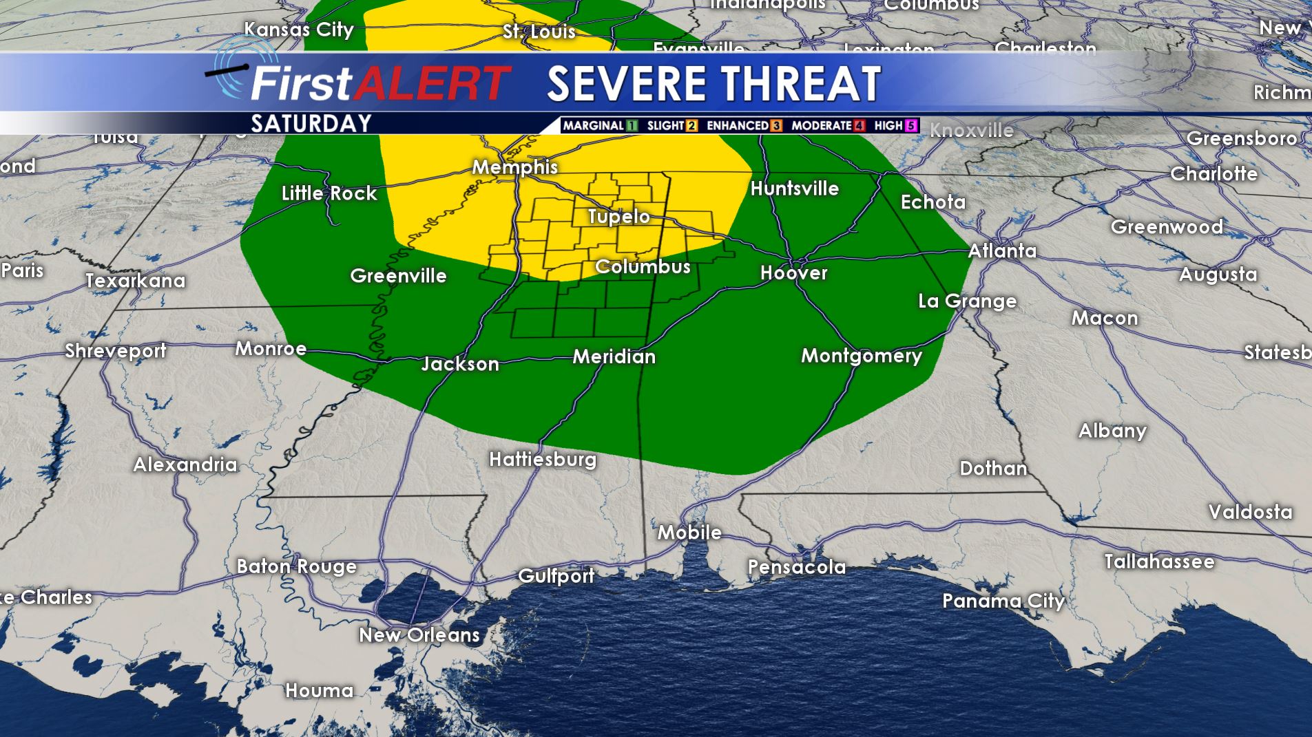
Severe Threat Saturday
THURSDAY NIGHT: Partly cloudy, warm, and muggy conditions should be the norm for most of the region. A few storms are possible in extreme north MS & AL near the Tennessee border. Overnight lows are going to be mainly in the lower 70s.
FRIDAY: Scattered showers and storms are possible during the day and a few of them may be locally strong. Odds are highest across our northern and eastern counties. The chance of rain is 30%. Many locations will probably not get a storm and that will allow those areas to climb into the lower 90s. The heat index will push up close to 100°.
SATURDAY: A few pop-up storms are possible during the day but not everyone will see one. Afternoon highs may zoom into the mid 90s with heat indices pushing into the 100s. It’s likely going to be the hottest day of the week. A complex of strong to severe storms with wind and hail is also possible by the evening and the overnight hours with an approaching cold front.
SUNDAY: Early morning showers and storms are possible but drier air is going to win out for the 2nd half of the day. Look for highs in the 80s with noticeably lower humidity by the afternoon.
NEXT WEEK: New data suggest seasonably warm conditions along with generally lower humidity levels. Plan on highs in the mid to upper 80s with a fair amount of sunshine. While storm chances won’t go to zero they will be reasonably low for at least a few days.
Follow @WCBIWEATHER on Facebook, Twitter, Snapchat, and Instagram


Leave a Reply