Sct’d Storms Next 2 Days, Drier Sunday & Monday
Tropical Disturbance
THURSDAY NIGHT: Showers and storms may linger during the evening but they’ll fade away as time goes on. Look for lows in the low 70s with light and variable winds.
FRIDAY: There is a 40% chance of pop-up showers and storms. A few could linger into the early evening. Some high school football games could be affected but most games will probably start on schedule. Highs look to be around 90 but temperatures will fall into the 80s and 70s during the evening. Winds will be from the southeast between 5 and 10 mph.
SATURDAY: A 40% chance of rain exists around the region. Have a poncho or umbrella if a passing shower/storm moves through your area. Coverage will lessen during the early evening hours and that should lower the rain threat for the MSU home opener in Starkville. Afternoon highs will be around 90 with easterly winds between 5 and 10 mph.
SUNDAY-WEDNESDAY: We still anticipate a lower 20% chance of rain each day. Highs should be in the low 90s with overnight lows staying in the low 70s.
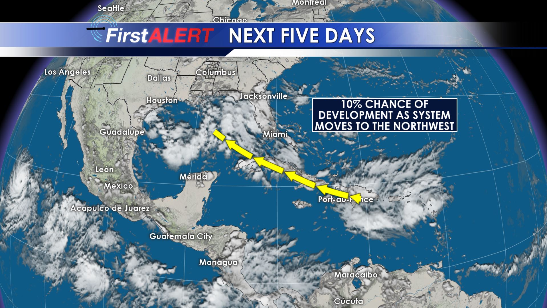
TROPICS: An unorganized disturbance near Puerto Rico is drifting WNW. There is a slight chance it may try to organize as it approaches the eastern Gulf by early next week. We’ll continue to monitor it. If nothing else it may provide areas closer to the coast enhanced rainfall by the middle of next week.
Follow @WCBIWEATHER on Facebook, Twitter, Instagram, and Snapchat


Leave a Reply