Several chances for rain in the coming days
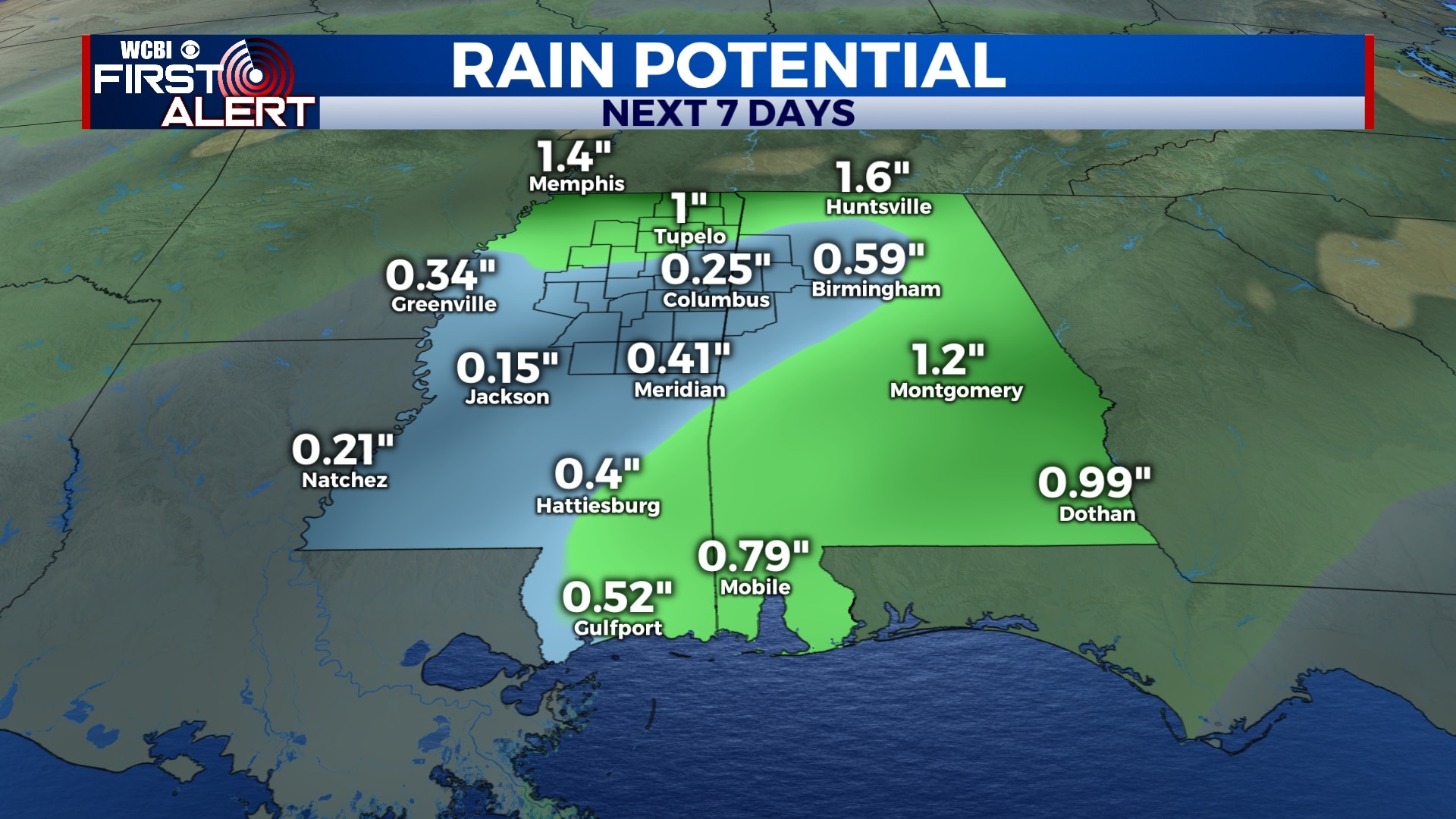
We’re keeping tabs on several systems that will bring us numerous chances for rain in the upcoming week. The bottom line is…have your umbrella on standby.
SATURDAY NIGHT: Clouds will continue to move in tonight and most of us will remain overcast. An isolated sprinkle is possible. Temperatures will fall to the low and mid 40s with a light southeasterly wind.
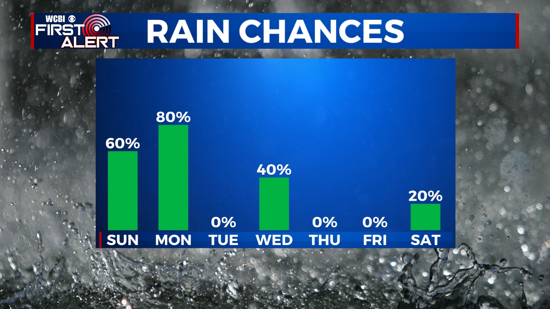
SUNDAY: Rain showers will continue off-and-on all day Sunday with perhaps a rumble of thunder or two possible. Highs will be in the upper 50s with a south-southeasterly wind, 5 to 10 mph.
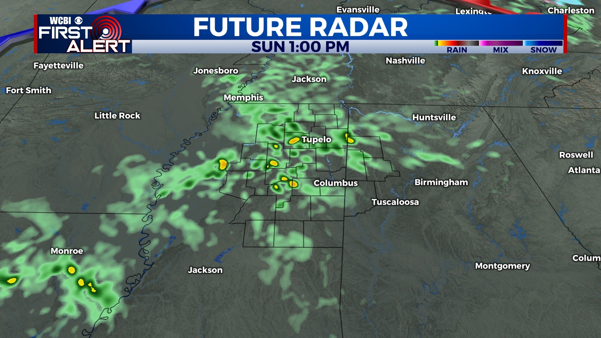
SUNDAY NIGHT: Rain showers will continue into Sunday night and Monday morning. We’ll get warmer overnight with temperatures into the low 60s by Monday morning.
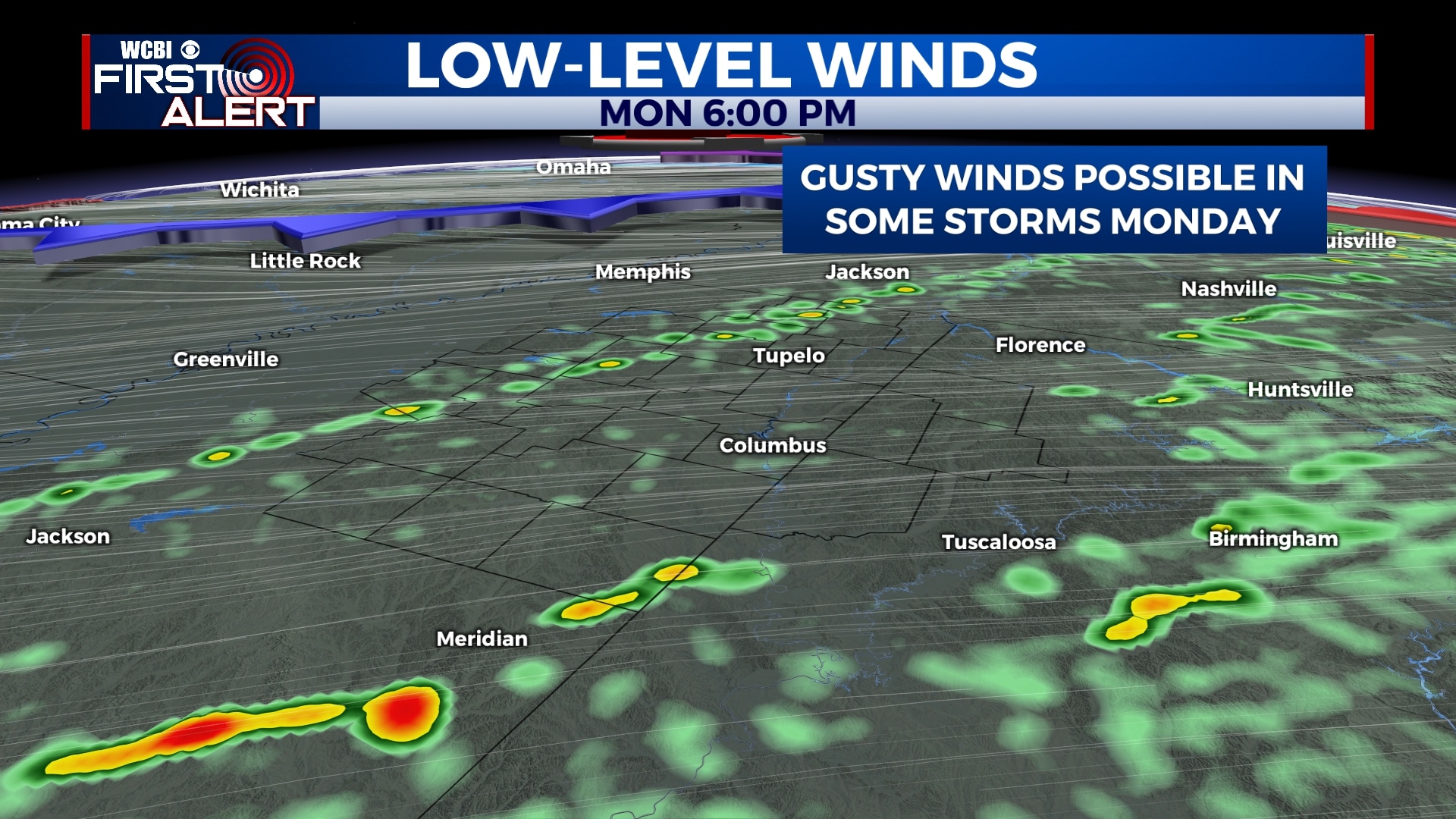
MONDAY: Rain showers and storms are possible through the day on Monday, especially into the afternoon and evening. While we aren’t expecting major severe weather, some storms could produce gusty winds and quick downpours. Temperatures will be unseasonably warm with highs in the low to mid 70s.
TUESDAY: We’ll be dry on Tuesday with a mix of sunshine and clouds. Temperatures will remain above normal with highs in the mid 60s and lows in the mid 40s.
WEDNESDAY: More off-and-on showers are possible through the day on Wednesday. Highs will be in the mid 60s with lows in the mid 40s.
THURSDAY-SATURDAY: Fortunately, it looks like the end of the week will be dry with a mix of sunshine and clouds. Most of Saturday looks dry, but some rain could move in Saturday night into next Sunday. High temperatures will be in the 50s with lows in the 30s.
Follow WCBI Weather on Facebook, Twitter, and Instagram
Follow Meteorologist Trevor Birchett on Facebook and Twitter


Leave a Reply