Several chances for rain and storms this week
After a few light showers on Sunday, we’ll enjoy dry and cooler weather for Monday and Tuesday. Storms will return to the forecast for Wednesday, with more rain possible by next weekend. As of now, Thanksgiving Day itself looks nice.
SUNDAY NIGHT: All of the rain will be out of the area by 8 pm, leaving us dry for the overnight hours. Clouds will gradually clear and we’ll be mostly clear by sunrise. Temperatures will be cooler behind a cold front with morning lows in the upper 30s on Monday. Winds will remain out of the northwest at 5 to 10 mph.
MONDAY-TUESDAY: We’ll be dry for the first part of the week as cooler air moves in. We’ll be mostly sunny for Monday with highs in the low 60s, with a few more clouds moving in by Tuesday. Overnight lows will remain in the mid to upper 30s.
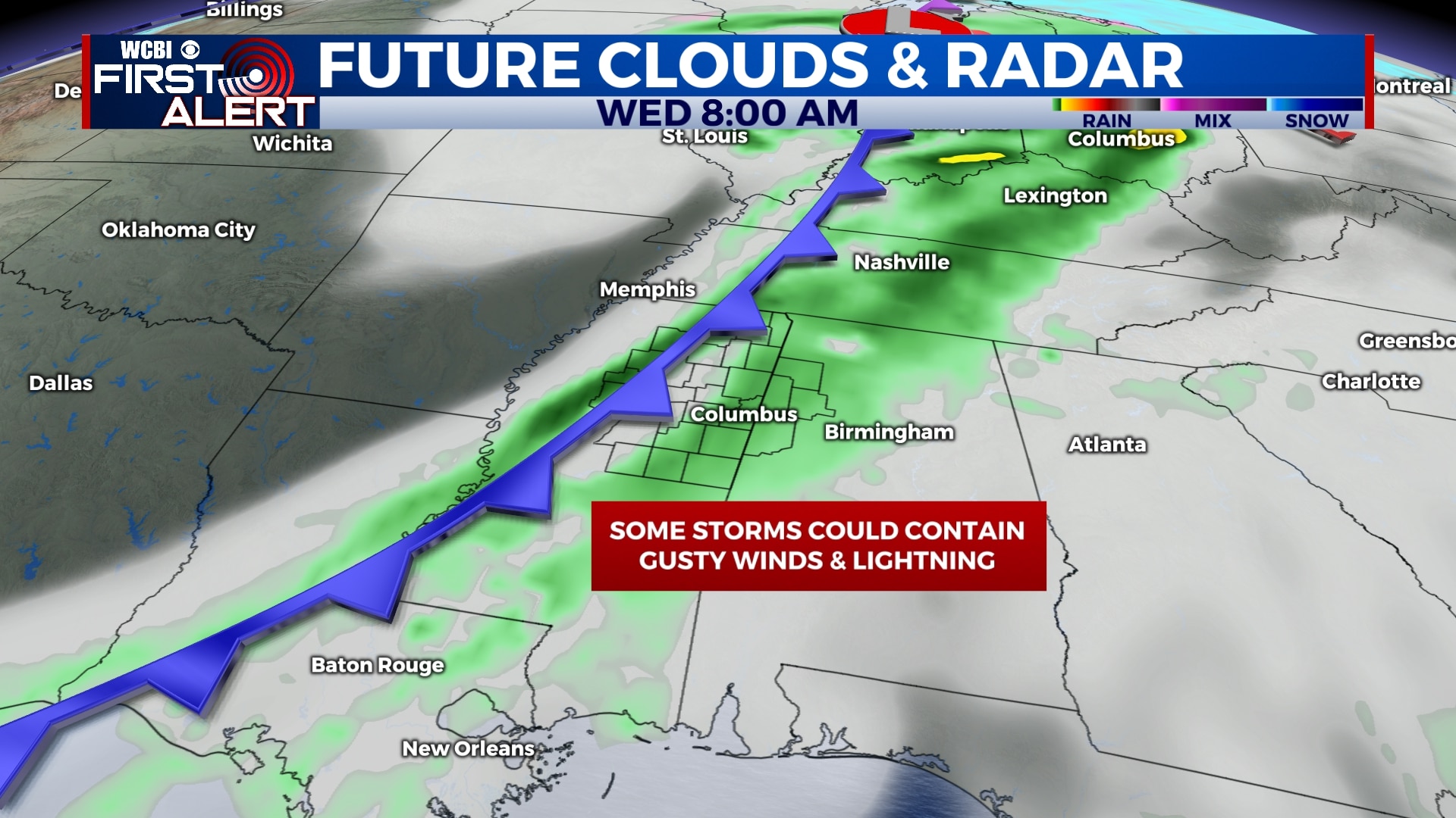
WEDNESDAY: Rain and storms will begin to move into the area early Wednesday morning and will persist into the afternoon and evening. A few storms could produce gusty winds and lightning, but no major severe weather is anticipated at this time. Highs will be in the upper 60s to near 70.
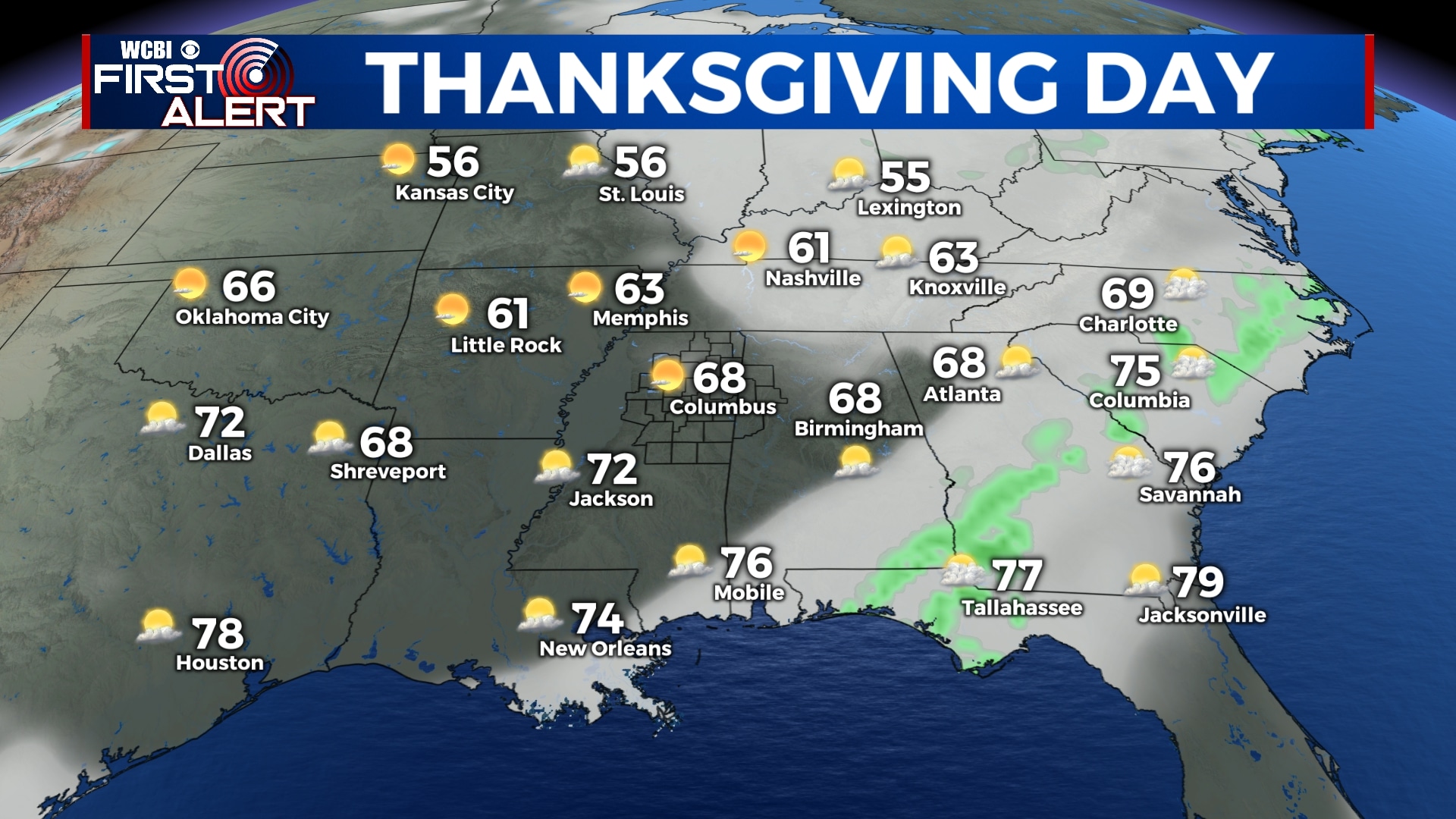
THURSDAY: Fortunately, it appears that Thanksgiving Day will be dry and partly cloudy. Highs will be in the mid 60s with lows in the mid 40s.
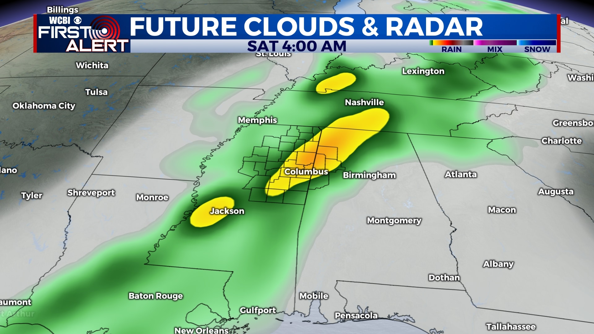
FRIDAY-SUNDAY: Yet another storm system will approach on Friday, bringing some rain and perhaps a little thunder late Friday evening. It appears that chances for showers and storms will persist through much of the day Saturday and perhaps even into early Sunday. The forecast will become a bit more clear as we get closer to the end of the week, but for now, plan for a rainy weekend. Highs will be in the mid 60s to near 70 on Friday and Saturday, with temperatures remaining in the 50s for Sunday.
Follow WCBI Weather on Facebook, Twitter, and Instagram
Follow Meteorologist Trevor Birchett on Facebook and Twitter


Leave a Reply