Severe potential Friday, sultry next week
COLUMBUS – SUMMARY: Some potential for severe storms Friday bring the threat for strong winds and the outside chance for a tornado. Most of this potential lies in the southwestern corner of our viewing area. Well above average temperatures await us beyond Friday, with highs in the mid to upper 90s by Monday.
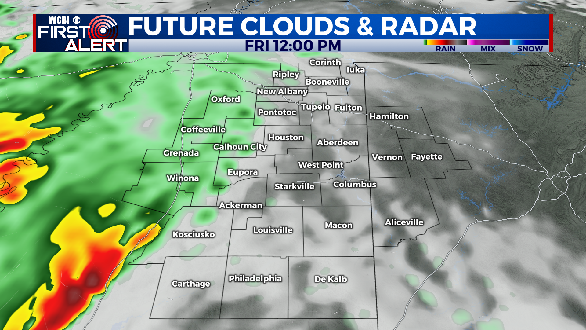
FRIDAY: The majority of impacts from storms Friday will be concentrated in our southwestern counties. Timing at the moment looks to be between noon and 4pm, with primary impacts consisting of mostly damaging winds, although the odd hail storm or tornado cannot be ruled out. We will continue to update you on the situation as it evolves. Highs reach into the mid 80s while lows touch the upper 60s.
THURSDAY: Highs Saturday remain similar to those on Friday, touching the mid to upper 80s. Lows take a bit of an increase, reaching into the 70s. Mostly clear skies prevail with the chance for the stray shower or thunderstorm.
REST OF THE WEEK: Sunday marks the beginning of our above average temperature adventure, as highs rocket into the low 90s. The heating trend slows somewhat afterwards, but reaching into the mid to upper 90s by Monday next week. Highs thereafter remain in the mid to low 90s through Thursday. Overnight lows also warm, although not as dramatically, into the mid to upper 70s by overnight Monday. No major rain chances after Friday contribute to the hot and dry trend on tap for next week.