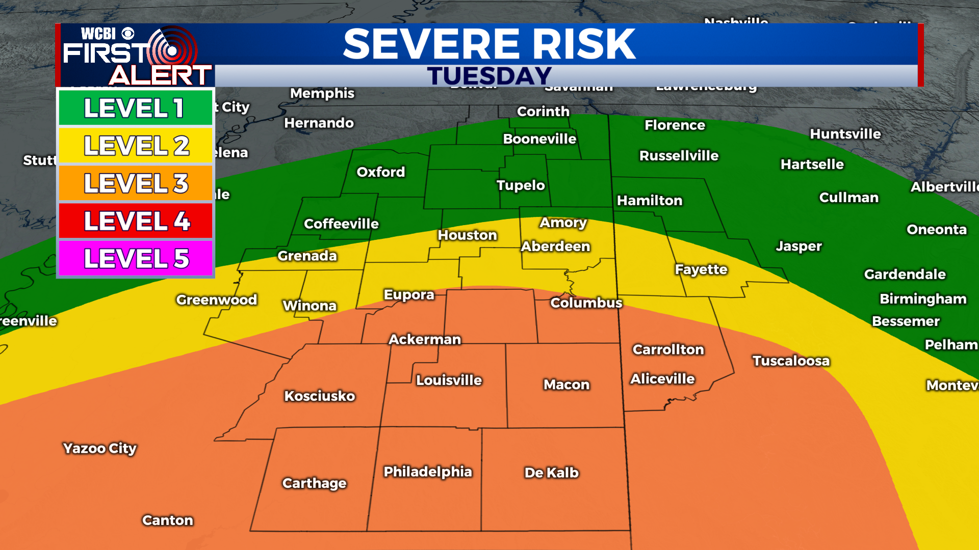
Severe storm potential Tuesday marks ramp-up of severe weather season
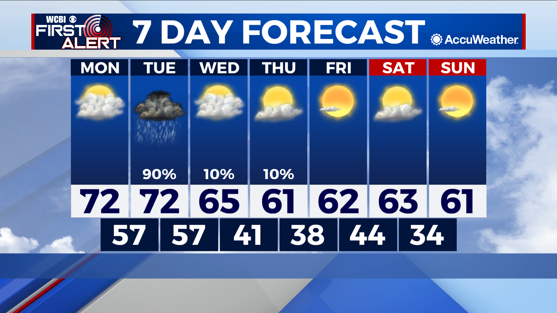
COLUMBUS – SUMMARY: A cold front Tuesday brings not only cooler temperatures to the region, but also a significant chance for severe weather defined by tornadoes. Highs remain in the 70s early before the front Tuesday knocks afternoon temperatures down into the 60s for the remainder of the week. Lows Hover in the upper 50s before dropping down into the 40s and high 30s after the Tuesday front.
MONDAY: Monday remains the most comfortable day of the week, with afternoon highs touching the low 70s with lows in the upper 50s overnight. Extensive cloud cover makes its way into the region during the day but no rain is expected.
TUESDAY: The setup for severe weather Tuesday looks dicey for much of south central Mississippi, with some of the threat extending to the southern counties of our viewing area. Damaging winds and hail will be an ever-present threat, but the primary risk factor Tuesday will be the possibly for a few tornadoes. Timing for the severe threat is confined at the moment to the afternoon and evening hours Tuesday, but could change as models get a better lock on the setup. We will continue to update you on the severe situation as the threat evolves. In terms of conditions outside, highs will top out in the low 70s, with lows bottoming out in the upper 50s. Mostly cloudy to overcast skies will dominate the area during the day.
REST OF THE WEEK: Tuesdays cold front brings a roughly 10 degree change in the highs, as afternoon temperatures struggle to get much higher than the mid 60s throughout the rest of the week. Lows likewise will follow a similar pattern, and remain in the low 40s to upper 30s. Tuesday’s severe event comprises the primary rain chance of the week, as the rest of the week will be relatively dry.